Colomby SityTrail > Touren > Outdoor > France > Normandie > Manche > Colomby SityTrail > Touren > Outdoor > France > Normandie > Manche > Colomby Colomby Alexia Lepoittevin Benutzer 3D © OpenStreetMap contributors Länge 10,9 km Maximale Höhe 36 m Positive Höhendifferenz 88 m Km-Effort 12 km Min. Höhe 11 m Negative Höhendifferenz 89 m Boucle Ja Erstellungsdatum : 2023-08-05 13:07:34.0 Letzte Änderung : 2023-08-05 15:21:40.11 (0 Nachricht) Kostenlosegpshiking-Anwendung SityTrail IGN / Geografische Institute SityTrail World Die Welt öffnet sich für Sie Über SityTrail 
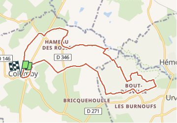
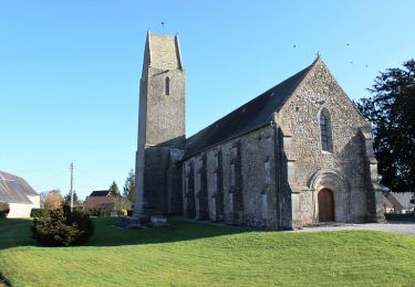
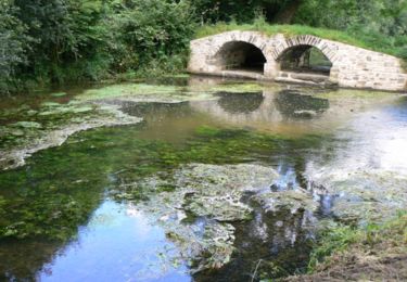
Tour von 10,9 km verfügbar auf Normandie, Manche, Colomby. Diese Tour wird von Alexia Lepoittevin vorgeschlagen. Legenden | Mehr Details (PDF) Höhenprofil Legenden > 15% 15% - 10% 10% - 5% Wohnung 5% - 10% 10% - 15% 15% - 30% > 30% Ort Land: France Region : Normandie Abteilung/Provinz : Manche Kommune : Colomby Standort: Unknown Gehen Sie:(Dec) 49.455556 / -1.49502 Gehen Sie:(UTM) 609069 ; 5479188 (30U) N. Kommentare Bitte melden Sie sich an, um einen Kommentar oder eine Bewertung zu hinterlassen Touren in der Umgebung PatRando Hémevez Wandern Medium Hémevez, Normandie, Manche, France 12,4 km | 13,7 km-effort 2h 31min Ja xcreator ueville Wandern Medium Urville, Normandie, Manche, France 9,2 km | 10,3 km-effort 1h 59min Nein tracegps Rando de Yvetot-Bocage 2013 Mountainbike Medium Yvetot-Bocage, Normandie, Manche, France 42 km | 47 km-effort 2h 45min Ja tracegps La Sortosvillaise 2013 - Sortosville Mountainbike Medium Sortosville, Normandie, Manche, France 27 km | 30 km-effort 2h 0min Ja tracegps Le Cul de fer - Colomby Wandern Medium (2) Colomby, Normandie, Manche, France 11 km | 12,2 km-effort 3h 30min Ja saw1983 quad rando Motor Medium Lieusaint, Normandie, Manche, France 27 km | 29 km-effort 1h 0min Ja mouchelpierre hemevez Wandern Sehr leicht Hémevez, Normandie, Manche, France 9,4 km | 10,4 km-effort 2h 18min Ja