Tour  Rognac - 
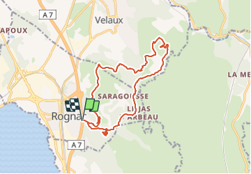
De Rognac vers le Collet Redon - Photo
 Nathy8913
Nathy8913

Benutzer

© OpenStreetMap contributors
Länge
Länge
17 km
Maximale Höhe
Maximale Höhe
223 m
Positive Höhendifferenz
438 m
Km-Effort
Km-Effort  
23 km
Min. Höhe
Min. Höhe
56 m
Negative Höhendifferenz
439 m
Boucle
Boucle
Ja
Erstellungsdatum :
2023-11-24 13:27:06.509
Letzte Änderung :
2023-11-24 13:27:33.288

(0 Nachricht)


Scannen Sie diesen QR-Code, um die Tour in der SityTrail-Anwendung zu öffnen

Kostenlosegpshiking-Anwendung

Logo SityTrail SityTrail

IGN / Geografische Institute

SityTrail aus dem App Store herunterladen SityTrail von Google Play herunterladen

Logo SityTrail SityTrail Plus

Die Welt öffnet sich für Sie

SityTrail aus dem App Store herunterladen SityTrail von Google Play herunterladen SityTrail auf Huawei AppGallery herunterladen

Über SityTrail

Tour von 17 km verfügbar auf Provence-Alpes-Côte d'Azur, Bouches-du-Rhône, Rognac. Diese Tour wird von Nathy8913 vorgeschlagen.

Höhenprofil

POIs

POI Rognac - Stationnement cote 54 - Photo
Nathy8913
POI Rognac - Château du Castellas - Photo
Nathy8913
POI Rognac - Croisement en Y - Photo
Nathy8913
POI Velaux - Croisement en X - Photo
Nathy8913
POI Velaux - Stèle  - Photo
Nathy8913
VELAUX 
POI Velaux - Fourche - Photo
Nathy8913
VELAUX 
POI Velaux - Sentier à droite - Photo
Nathy8913
POI Velaux - Flèche Bleue - Photo
Nathy8913
POI Velaux - Croisement en X - Photo
Nathy8913
POI Velaux - Croisement en Y - Photo
Nathy8913
POI Velaux - Croisement en Y - Photo
Nathy8913
POI Velaux - Cote 216 - Photo
Nathy8913
VELAUX 
POI Rognac - Raccourci à gauche - Photo
Nathy8913
POI Vitrolles - Cote 200 - Photo
Nathy8913
VITROLLES 
POI Rognac - Croisement en Y - Photo
Nathy8913
POI Rognac - Stationnement cote 54 - Photo
Nathy8913

Ort

Land:
France
Region :
Provence-Alpes-Côte d'Azur
Abteilung/Provinz :
Bouches-du-Rhône
Kommune :
Rognac
Standort:
Unknown
Gehen Sie:(UTM)
681238 ; 4817174 (31T) N.


Schließen
Meine Abonnements