![](/images/other/stat-length.png)
![Tour Wandern Libin - REDU (Lesse) - Photo](https://media.geolcdn.com/t/1900/400/ext.pjpeg?maxdim=2&url=https%3A%2F%2Fservices.sitytrail.com%2FGeolivesWS%2FDownloadMedia.ashx%3FTrailID%3D461731%26Media%3Dfix__20150820155101.jpg)
REDU (Lesse)
GerardBouche
Benutzer
![Länge](/images/other/stat-length.png)
Länge
11,9 km
![Maximale Höhe](https://static1.geolcdn.com/siteimages/upload/files/1508320355ic_sort_altitude_max_24dp.png)
Maximale Höhe
382 m
![Positive Höhendifferenz](https://static1.geolcdn.com/siteimages/upload/files/1508320355ic_sort_den_pos_24dp.png)
Positive Höhendifferenz
268 m
![Km-Effort](/images/other/stat-length.png)
Km-Effort
15,5 km
![Min. Höhe](https://static1.geolcdn.com/siteimages/upload/files/1508320355ic_sort_altitude_min_24dp.png)
Min. Höhe
250 m
![Negative Höhendifferenz](https://static1.geolcdn.com/siteimages/upload/files/1508320355ic_sort_den_neg_24dp.png)
Negative Höhendifferenz
270 m
![Boucle](https://static1.geolcdn.com/siteimages/upload/files/16400158638029165_repeat_loop_refresh_sync_direction_icon.png)
Boucle
Ja
Erstellungsdatum :
2015-09-23 00:00:00.0
Letzte Änderung :
2015-09-23 00:00:00.0
![Wandern](https://static1.geolcdn.com/sitytour/trail-icons/101.png)
3h21
Schwierigkeit : Einfach
![Scannen Sie diesen QR-Code, um die Tour in der SityTrail-Anwendung zu öffnen](https://capi.geolives.com/qq0zvz2zws4bq2lad0pu/sitytour/trails/461731/qr.png?size=200)
Kostenlosegpshiking-Anwendung
Über SityTrail
Tour Wandern von 11,9 km verfügbar auf Wallonien, Luxemburg, Libin. Diese Tour wird von GerardBouche vorgeschlagen.
Beschreibung
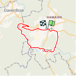
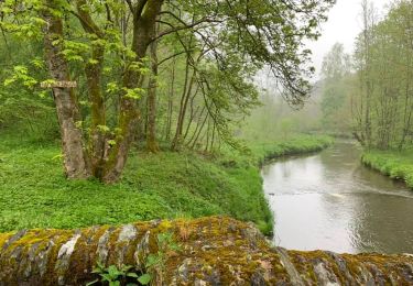
Très belle balade au départ du P à proximité de l'église par la rue de Daverdisse, la "Virée du Rot"et la superbe vallée de la Lesse vers la "Roche aux Chevaux et le petit village de LESSE.
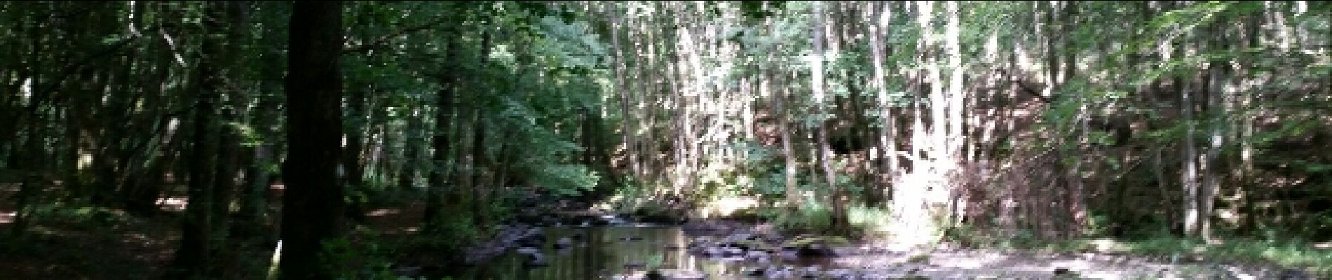
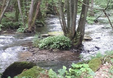
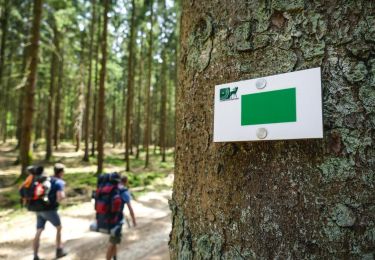
Ort
Land:
Belgium
Region :
Wallonien
Abteilung/Provinz :
Luxemburg
Kommune :
Libin
Standort:
Redu
Gehen Sie:(Dec)
Gehen Sie:(UTM)
654602 ; 5541661 (31U) N.
Kommentare
Touren in der Umgebung
![Tour Wandern Paliseul - RB-Lu-10_Maissin - Photo](https://media.geolcdn.com/t/375/260/ext.jpg?maxdim=2&url=https%3A%2F%2Fservices.sitytrail.com%2FGeolivesWS%2FDownloadMedia.ashx%3FTrailID%3D315513%26Media%3D52f53adc-4763-4371-9efe-70f027b21c91.jpg)
![Wandern Wandern](https://static1.geolcdn.com/sitytour/trail-icons/101.png)
RB-Lu-10_Maissin
Wandern
Schwierig
(7)
Paliseul,
Wallonien,
Luxemburg,
Belgium
![](/images/other/stat-length.png)
25 km | 32 km-effort
6h 38min
![](https://static1.geolcdn.com/siteimages/upload/files/16400158638029165_repeat_loop_refresh_sync_direction_icon.png)
Ja
![Tour Wandern Libin - Lesse - Promenade de la Lesse (LI06) - Photo](https://media.geolcdn.com/t/375/260/ext.jpg?maxdim=2&url=https%3A%2F%2Fmedia.geolcdn.com%2Ff%2F27528ace-a0b8-4107-8825-6100f3450bfd.jpg)
![Wandern Wandern](https://static1.geolcdn.com/sitytour/trail-icons/101.png)
Lesse - Promenade de la Lesse (LI06)
Wandern
Medium
(6)
Libin,
Wallonien,
Luxemburg,
Belgium
![](/images/other/stat-length.png)
8,6 km | 11,3 km-effort
2h 26min
![](https://static1.geolcdn.com/siteimages/upload/files/16400158638029165_repeat_loop_refresh_sync_direction_icon.png)
Ja
![Tour Wandern Libin - Du village de Redu au hameau de Lesse - Photo](https://media.geolcdn.com/t/375/260/ext.jpg?maxdim=2&url=https%3A%2F%2Fservices.sitytrail.com%2FGeolivesWS%2FDownloadMedia.ashx%3FTrailID%3D449318%26Media%3D3daffb28-a541-4d0a-b434-13b6750e6d2d.JPG)
![Wandern Wandern](https://static1.geolcdn.com/sitytour/trail-icons/101.png)
Du village de Redu au hameau de Lesse
Wandern
Einfach
(3)
Libin,
Wallonien,
Luxemburg,
Belgium
![](/images/other/stat-length.png)
11,3 km | 14,9 km-effort
3h 13min
![](https://static1.geolcdn.com/siteimages/upload/files/16400158638029165_repeat_loop_refresh_sync_direction_icon.png)
Ja
![Tour Wandern Libin - Lesse - Entre Lesse et Lomme - Photo](https://media.geolcdn.com/t/375/260/ext.jpg?maxdim=2&url=https%3A%2F%2Fmedia.geolcdn.com%2Ff%2F29de6fa8-4c44-40a4-a5ee-a6e3f0f650e2.jpg)
![Wandern Wandern](https://static1.geolcdn.com/sitytour/trail-icons/101.png)
Lesse - Entre Lesse et Lomme
Wandern
Sehr leicht
(2)
Libin,
Wallonien,
Luxemburg,
Belgium
![](/images/other/stat-length.png)
78 km | 102 km-effort
20h 32min
![](https://static1.geolcdn.com/siteimages/upload/files/16400158638029165_repeat_loop_refresh_sync_direction_icon.png)
Ja
![Tour Wandern Libin - Redu - La Virée des Croix - Photo](https://media.geolcdn.com/t/375/260/ext.jpg?maxdim=2&url=https%3A%2F%2Fservices.sitytrail.com%2FGeolivesWS%2FDownloadMedia.ashx%3FTrailID%3D334581%26Media%3D577140e5-7a9b-4e16-8501-3973c972819c.JPG)
![Wandern Wandern](https://static1.geolcdn.com/sitytour/trail-icons/101.png)
Redu - La Virée des Croix
Wandern
Medium
(4)
Libin,
Wallonien,
Luxemburg,
Belgium
![](/images/other/stat-length.png)
6,1 km | 8,2 km-effort
1h 44min
![](https://static1.geolcdn.com/siteimages/upload/files/16400158638029165_repeat_loop_refresh_sync_direction_icon.png)
Ja
![Tour Wandern Paliseul - RB-LUX-10 - Raccourci 2 - Le long de deux rivières fougueuses : l’Our et la Lesse - Photo](https://media.geolcdn.com/t/375/260/ext.jpg?maxdim=2&url=https%3A%2F%2Fservices.sitytrail.com%2FGeolivesWS%2FDownloadMedia.ashx%3FTrailID%3D216782%26Media%3D52f53adc-4763-4371-9efe-70f027b21c91.jpg)
![Wandern Wandern](https://static1.geolcdn.com/sitytour/trail-icons/101.png)
RB-LUX-10 - Raccourci 2 - Le long de deux rivières fougueuses : l’Our et la L...
Wandern
Einfach
(2)
Paliseul,
Wallonien,
Luxemburg,
Belgium
![](/images/other/stat-length.png)
22 km | 29 km-effort
4h 6min
![](https://static1.geolcdn.com/siteimages/upload/files/16400158638029165_repeat_loop_refresh_sync_direction_icon.png)
Ja
![Tour Wandern Paliseul - RB-LUX-10 - Raccourci 1 - Le long de deux rivières fougueuses : l’Our et la Lesse - Photo](https://media.geolcdn.com/t/375/260/ext.jpg?maxdim=2&url=https%3A%2F%2Fservices.sitytrail.com%2FGeolivesWS%2FDownloadMedia.ashx%3FTrailID%3D179615%26Media%3D52f53adc-4763-4371-9efe-70f027b21c91.jpg)
![Wandern Wandern](https://static1.geolcdn.com/sitytour/trail-icons/101.png)
RB-LUX-10 - Raccourci 1 - Le long de deux rivières fougueuses : l’Our et la L...
Wandern
Medium
(2)
Paliseul,
Wallonien,
Luxemburg,
Belgium
![](/images/other/stat-length.png)
14,9 km | 19,4 km-effort
5h 59min
![](https://static1.geolcdn.com/siteimages/upload/files/16400158638029165_repeat_loop_refresh_sync_direction_icon.png)
Ja
![Tour Wandern Libin - Transinne - Les Voies d'Antan (LI12) - Photo](https://media.geolcdn.com/t/375/260/ext.jpg?maxdim=2&url=https%3A%2F%2Fmedia.geolcdn.com%2Ff%2F9c2533c3-01b6-4ea6-863f-eedbbedfdc39.jpg)
![Wandern Wandern](https://static1.geolcdn.com/sitytour/trail-icons/101.png)
Transinne - Les Voies d'Antan (LI12)
Wandern
Medium
(1)
Libin,
Wallonien,
Luxemburg,
Belgium
![](/images/other/stat-length.png)
10 km | 12,5 km-effort
2h 44min
![](https://static1.geolcdn.com/siteimages/upload/files/16400158638029165_repeat_loop_refresh_sync_direction_icon.png)
Ja
![Tour Wandern Libin - Villance - Promenade des Ponts (LI14) - Photo](https://media.geolcdn.com/t/375/260/ext.jpg?maxdim=2&url=https%3A%2F%2Fmedia.geolcdn.com%2Ff%2Ffe9fccf1-9bca-4e04-ac67-5acf6a5bba21.jpg)
![Wandern Wandern](https://static1.geolcdn.com/sitytour/trail-icons/101.png)
Villance - Promenade des Ponts (LI14)
Wandern
Einfach
(4)
Libin,
Wallonien,
Luxemburg,
Belgium
![](/images/other/stat-length.png)
8,1 km | 9,7 km-effort
2h 8min
![](https://static1.geolcdn.com/siteimages/upload/files/16400158638029165_repeat_loop_refresh_sync_direction_icon.png)
Ja