Tour Andere Aktivitäten Courcy - Basse Normandie - Ligne 417 - Coutances - Sottevast - Photo

Basse Normandie - Ligne 417 - Coutances - Sottevast

 mich54
mich54

Benutzer

© OpenStreetMap contributors
Länge
Länge
69 km
Maximale Höhe
Maximale Höhe
142 m
Positive Höhendifferenz
491 m
Km-Effort
Km-Effort  
75 km
Min. Höhe
Min. Höhe
4 m
Negative Höhendifferenz
553 m
Boucle
Boucle
Nein
Erstellungsdatum :
2017-01-25 00:00:00.0
Letzte Änderung :
2017-01-25 00:00:00.0

(0 Nachricht)

Andere Aktivitäten
Andere Aktivitäten
5m
Schwierigkeit : Unbekannt

Scannen Sie diesen QR-Code, um die Tour in der SityTrail-Anwendung zu öffnen

Kostenlosegpshiking-Anwendung

Logo SityTrail SityTrail

IGN / Geografische Institute

SityTrail aus dem App Store herunterladen SityTrail von Google Play herunterladen

Logo SityTrail SityTrail World

Die Welt öffnet sich für Sie

SityTrail aus dem App Store herunterladen SityTrail von Google Play herunterladen SityTrail auf Huawei AppGallery herunterladen

Über SityTrail

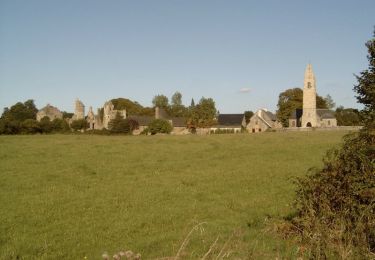
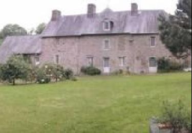
Tour Andere Aktivitäten von 69 km verfügbar auf Normandie, Manche, Courcy. Diese Tour wird von mich54 vorgeschlagen.

Beschreibung

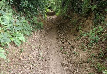
La ligne de Coutances à Sottevast est une ancienne ligne de chemin de fer française, se trouvant dans le département de la Manche. Elle reliait les localités de Sottevast et Coutances.La ligne est fermée entre septembre 1972 et le 24 janvier 1988. Elle est entièrement déclassée par le décret signé le 10 avril 19961. En 2000, l'ancienne plate-forme est vendue au Conseil général de la Manche qui la reconvertit en voie verte.(Source Wikipédia)

Höhenprofil

Ort

Land:
France
Region :
Normandie
Abteilung/Provinz :
Manche
Kommune :
Courcy
Standort:
Unknown
Gehen Sie:(Dec)
Gehen Sie:(UTM)
617480 ; 5435316 (30U) N.

Touren in der Umgebung

Tour Mountainbike Monthuchon - Autour de Feugères en VTT - Photo
Mountainbike
tracegps

Mountainbike

Schwierig
(1)
Monthuchon, Normandie, Manche, France
62 km | 73 km-effort
4h 30min
Ja
Tour Mountainbike Coutances - 1 pas, 2 pas pour Anaïs - Coutances - Photo
Mountainbike
tracegps

Mountainbike

Schwierig
Coutances, Normandie, Manche, France
39 km | 47 km-effort
2h 45min
Ja
Tour Wandern Coutances - Coutances - Photo
Wandern
Roulland

Wandern

Einfach
Coutances, Normandie, Manche, France
10,6 km | 13,1 km-effort
2h 3min
Ja
Tour Wandern Nicorps - Pédestre - Les trois vallées - Photo
Wandern
neoroll44

Wandern

Medium
Nicorps, Normandie, Manche, France
12,4 km | 15,3 km-effort
3h 30min
Ja
Tour Mountainbike Coutances - Rando des Petits Princes de Margot 2013 - Coutances - Photo
Mountainbike
tracegps

Mountainbike

Schwierig
Coutances, Normandie, Manche, France
42 km | 50 km-effort
2h 45min
Ja
Tour Mountainbike Coutances - Rando VTT à Coutance 2012 - Photo
Mountainbike
tracegps

Mountainbike

Schwierig
Coutances, Normandie, Manche, France
68 km | 80 km-effort
5h 0min
Ja
Tour Elektrofahrrad Nicorps - boucle Nicorps - Le Pont de la Roque - Photo
Elektrofahrrad
EricVIBERT

Elektrofahrrad

Medium
Nicorps, Normandie, Manche, France
15,9 km | 18,2 km-effort
1h 32min
Ja
Tour Mountainbike Savigny - VTT entre Soulles et Sauvagère II - Photo
Mountainbike
tracegps

Mountainbike

Schwierig
Savigny, Normandie, Manche, France
43 km | 53 km-effort
3h 0min
Ja
Tour Mountainbike Monthuchon - Autour de Coutances par le Mont Rainfer - Photo
Mountainbike
tracegps

Mountainbike

Schwierig
Monthuchon, Normandie, Manche, France
48 km | 59 km-effort
3h 30min
Ja


Schließen
Meine Abonnements