Tour Rennrad Veynes - C17 - Le Tour de la Montagne de l'Aup - Photo

C17 - Le Tour de la Montagne de l'Aup

Les Hautes Alpes à découvrir ! GUIDE+

© OpenStreetMap contributors
Länge
Länge
128 km
Maximale Höhe
Maximale Höhe
1279 m
Positive Höhendifferenz
2970 m
Km-Effort
Km-Effort  
168 km
Min. Höhe
Min. Höhe
615 m
Negative Höhendifferenz
2970 m
Boucle
Boucle
Ja
Erstellungsdatum :
2018-03-23 05:39:49.711
Letzte Änderung :
2019-05-13 13:19:29.727

(0 Nachricht)

Rennrad
Rennrad
9h18
Schwierigkeit : Sehr schwierig

Scannen Sie diesen QR-Code, um die Tour in der SityTrail-Anwendung zu öffnen

Kostenlosegpshiking-Anwendung

Logo SityTrail SityTrail

IGN / Geografische Institute

SityTrail aus dem App Store herunterladen SityTrail von Google Play herunterladen

Logo SityTrail SityTrail World

Die Welt öffnet sich für Sie

SityTrail aus dem App Store herunterladen SityTrail von Google Play herunterladen SityTrail auf Huawei AppGallery herunterladen

Über SityTrail

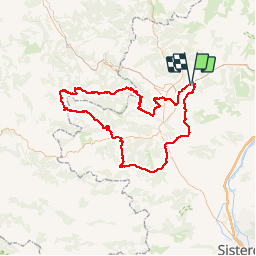
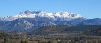
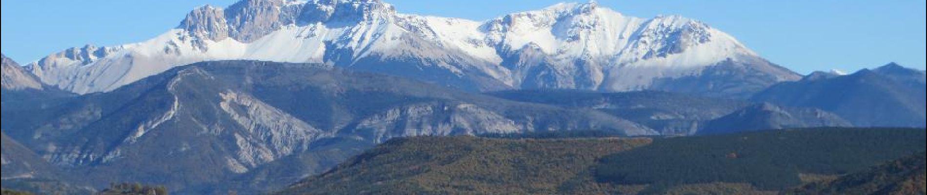
Tour Rennrad von 128 km verfügbar auf Provence-Alpes-Côte d'Azur, Hochalpen, Veynes. Diese Tour wird von Camping Les Rives du Lac vorgeschlagen.

Beschreibung

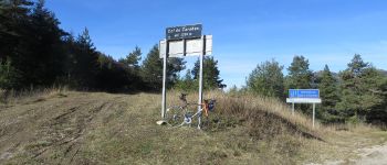
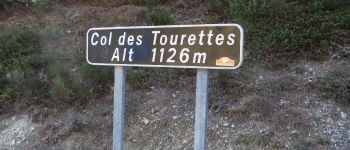
Col de Carabès, Tourettes pass ... You will remember these names !!

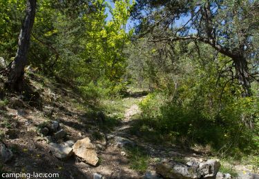
This hike is one of the wildest and we recommend it.

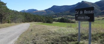
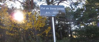
The first pass (Carabes) is the hardest. You then go down towards the Village of Valdrome. Be careful, the road is not very good. In Valdrôme, take the direction of Saint Dizier en Diois. Nice climb to the pass of Fays. It is then very rolling (downhill) to the village of Charces which has a beautiful little castle. False flat and long climb to reach the Tourettes pass. Short descent. You join the D994 and turn right towards Montjay. (You can reduce the distance by joining Serres directly from the village of L'Epine.) 3 km climb to reach the Col de Serre Larobe. Rise quite steep. Descent to Montjay then 15kms of dish to join the leisure base of the Germanette. Take direction Serres then 400m further to the right direction Savournon. After Savournon, the Col de la Croix will surely seem steep! The last 15 kms are fast.

Höhenprofil

Foto-Galerie

POIs

POI Sigottier - Vers Sigottier depuis Aspremont - Photo
CampingLesRivesduLac
POI La Bâtie-des-Fonds - Col de Carabès - Photo
CampingLesRivesduLac
LA BÂTIE-DES-FONDS 
POI Valdrôme - Col de Rossas - Photo
CampingLesRivesduLac
VALDRÔME 
POI Ribeyret - Vers le Col des Tourettes - Photo
CampingLesRivesduLac
POI L'Épine - Serre Larobe - Photo
CampingLesRivesduLac
L'ÉPINE 

Ort

Land:
France
Region :
Provence-Alpes-Côte d'Azur
Abteilung/Provinz :
Hochalpen
Kommune :
Veynes
Standort:
Unknown
Gehen Sie:(Dec)
Gehen Sie:(UTM)
722408 ; 4933341 (31T) N.

Touren in der Umgebung

Tour Wandern Le Saix - R08 La boucle des cascades jaunes - Photo
Wandern
GUIDE+

Wandern

Sehr leicht
(1)
Le Saix, Provence-Alpes-Côte d'Azur, Hochalpen, France
5,5 km | 10,3 km-effort
2h 10min
Ja
Tour Mountainbike Veynes - VTT29 - Rando famille - Photo
Mountainbike
GUIDE+

Mountainbike

Einfach
(1)
Veynes, Provence-Alpes-Côte d'Azur, Hochalpen, France
10,9 km | 13,6 km-effort
54min
Ja
Tour Mountainbike Veynes - VTT14 - Les crêtes de la Longeagne - Photo
Mountainbike
GUIDE+

Mountainbike

Sehr schwierig
(1)
Veynes, Provence-Alpes-Côte d'Azur, Hochalpen, France
39 km | 57 km-effort
3h 15min
Ja
Tour Mountainbike Veynes - VTT03 - Tous les Eygaux - Photo
Mountainbike
GUIDE+

Mountainbike

Medium
(2)
Veynes, Provence-Alpes-Côte d'Azur, Hochalpen, France
23 km | 31 km-effort
1h 31min
Ja
Tour Mountainbike Veynes - VTT02 - Aiguebelle - Photo
Mountainbike
GUIDE+

Mountainbike

Einfach
(2)
Veynes, Provence-Alpes-Côte d'Azur, Hochalpen, France
16,7 km | 21 km-effort
1h 23min
Ja
Tour Mountainbike Veynes - VTT01 - Les Eygaux - Photo
Mountainbike
GUIDE+

Mountainbike

Einfach
(3)
Veynes, Provence-Alpes-Côte d'Azur, Hochalpen, France
14,1 km | 19,2 km-effort
1h 13min
Ja
Tour Wandern Veynes - R10   Le tour des Eygaux - Photo
Wandern
GUIDE+

Wandern

Sehr leicht
(4)
Veynes, Provence-Alpes-Côte d'Azur, Hochalpen, France
7,8 km | 11,3 km-effort
2h 24min
Ja
Tour Wandern Veynes - R09   Le tour de Veynes - Photo
Wandern
GUIDE+

Wandern

Sehr leicht
(3)
Veynes, Provence-Alpes-Côte d'Azur, Hochalpen, France
9,5 km | 12,3 km-effort
2h 40min
Ja
Tour Wandern Le Saix - R07   le fai - Photo
Wandern
GUIDE+

Wandern

Einfach
(4)
Le Saix, Provence-Alpes-Côte d'Azur, Hochalpen, France
5,1 km | 8 km-effort
1h 42min
Ja


Schließen
Meine Abonnements