


10,1 km | 18,2 km-effort
Templeneiry: Scopri i migliori percorsi: 6 percorsi a piedi. Tutti questi percorsi, itinerari e attività outdoor sono disponibili nelle nostre app SityTrail per smartphone e tablet.
Marcia


•

Marcia
• OPEN MOORE LAND
Marcia
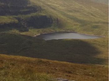
• 5 Lakes view on 6 Mountain peaks in the galtees
Marcia
• 5 Lakes view on 6 Mountain peaks in the galtees
Marcia
• OPEN MOORE LAND
Marcia
6 percorsi visualizzati su 6
Applicazione GPS da escursionismo GRATUITA
 SityTrail
IGN / Istituti geografici
SityTrail World
Il mondo è tuo