![](/images/other/stat-length.png)
![Percorso A piedi Bodman-Ludwigshafen - Wanderweg 29 Bodman - Liggeringen - Photo](https://media.geolcdn.com/t/1900/400/ext.pjpeg?maxdim=2&url=https%3A%2F%2Fmedia.geolcdn.com%2Ff%2Fe94d9e5e-a0cf-4cfc-a6de-220fa80e3fe6.jpeg)
Wanderweg 29 Bodman - Liggeringen
SityTrail - itinéraires balisés pédestres
Tous les sentiers balisés d’Europe PRO
![Lunghezza](/images/other/stat-length.png)
Lunghezza
3,9 km
![Altitudine massima](https://static1.geolcdn.com/siteimages/upload/files/1508320355ic_sort_altitude_max_24dp.png)
Altitudine massima
705 m
![Dislivello positivo](https://static1.geolcdn.com/siteimages/upload/files/1508320355ic_sort_den_pos_24dp.png)
Dislivello positivo
271 m
![Km-Effort](/images/other/stat-length.png)
Km-Effort
6,8 km
![Altitudine minima](https://static1.geolcdn.com/siteimages/upload/files/1508320355ic_sort_altitude_min_24dp.png)
Altitudine minima
433 m
![Dislivello negativo](https://static1.geolcdn.com/siteimages/upload/files/1508320355ic_sort_den_neg_24dp.png)
Dislivello negativo
53 m
![Boucle](https://static1.geolcdn.com/siteimages/upload/files/16400158638029165_repeat_loop_refresh_sync_direction_icon.png)
Boucle
No
Tag
Data di creazione :
2022-02-11 13:28:13.488
Ultima modifica :
2022-02-11 13:28:13.488
![A piedi](https://static1.geolcdn.com/sitytour/trail-icons/100.png)
1h32
Difficoltà : Facile
![Scannerizza questo codice QR per aprire il percorso nell'applicazione SityTrail](https://capi.geolives.com/qq0zvz2zws4bq2lad0pu/sitytour/trails/3090402/qr.png?size=200)
Applicazione GPS da escursionismo GRATUITA
Chi siamo
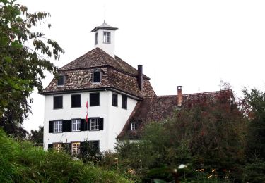
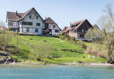
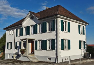
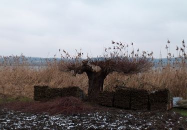
Percorso A piedi di 3,9 km da scoprire a Baden-Württemberg, Landkreis Konstanz, Bodman-Ludwigshafen. Questo percorso è proposto da SityTrail - itinéraires balisés pédestres.
Descrizione
Symbol: gelbe Zahl auf weißem Grund
Localizzazione
Paese:
Germany
Regione :
Baden-Württemberg
Dipartimento/Provincia :
Landkreis Konstanz
Comune :
Bodman-Ludwigshafen
Località :
Unknown
Partenza:(Dec)
Partenza:(UTM)
504373 ; 5292297 (32T) N.
Commenti
Percorsi nelle vicinanze
![Percorso A piedi Costanza - Planetenweg Nord - Photo](https://media.geolcdn.com/t/375/260/ext.jpg?maxdim=2&url=https%3A%2F%2Fmedia.geolcdn.com%2Ff%2F474a2e9d-35f8-46f1-8ecf-aef524e411c9.jpeg)
![A piedi A piedi](https://static1.geolcdn.com/sitytour/trail-icons/100.png)
Planetenweg Nord
A piedi
Facile
Costanza,
Baden-Württemberg,
Landkreis Konstanz,
Germany
![](/images/other/stat-length.png)
8,6 km | 10,1 km-effort
2h 18min
![](https://static1.geolcdn.com/siteimages/upload/files/16400158638029165_repeat_loop_refresh_sync_direction_icon.png)
No
![Percorso A piedi - Planetenweg Süd Kreuzlingen - Photo](https://media.geolcdn.com/t/375/260/ext.jpg?maxdim=2&url=https%3A%2F%2Fmedia.geolcdn.com%2Ff%2F474a2e9d-35f8-46f1-8ecf-aef524e411c9.jpeg)
![A piedi A piedi](https://static1.geolcdn.com/sitytour/trail-icons/100.png)
Planetenweg Süd Kreuzlingen
A piedi
Facile
,
Turgovia,
Bezirk Kreuzlingen,
Switzerland
![](/images/other/stat-length.png)
5,1 km | 6 km-effort
1h 21min
![](https://static1.geolcdn.com/siteimages/upload/files/16400158638029165_repeat_loop_refresh_sync_direction_icon.png)
No
![Percorso A piedi Stein am Rhein - Uferrundweg Stein am Rhein - Photo](https://media.geolcdn.com/t/375/260/ext.jpg?maxdim=2&url=https%3A%2F%2Fmedia.geolcdn.com%2Ff%2Fe513e5c3-8da9-4e7e-82ec-d18cb65fa8f7.jpeg)
![A piedi A piedi](https://static1.geolcdn.com/sitytour/trail-icons/100.png)
Uferrundweg Stein am Rhein
A piedi
Facile
Stein am Rhein,
Sciaffusa,
Sconosciuto,
Switzerland
![](/images/other/stat-length.png)
6,5 km | 7,6 km-effort
1h 44min
![](https://static1.geolcdn.com/siteimages/upload/files/16400158638029165_repeat_loop_refresh_sync_direction_icon.png)
Sì
![Percorso A piedi Kemmental - Bommer Weier - Langrickenbach - Photo](https://media.geolcdn.com/t/375/260/ext.jpg?maxdim=2&url=https%3A%2F%2Fmedia.geolcdn.com%2Ff%2F1add05c5-527f-4d2e-a886-fbf5549a160f.jpeg)
![A piedi A piedi](https://static1.geolcdn.com/sitytour/trail-icons/100.png)
Bommer Weier - Langrickenbach
A piedi
Facile
Kemmental,
Turgovia,
Bezirk Kreuzlingen,
Switzerland
![](/images/other/stat-length.png)
6,6 km | 7,7 km-effort
1h 45min
![](https://static1.geolcdn.com/siteimages/upload/files/16400158638029165_repeat_loop_refresh_sync_direction_icon.png)
No
![Percorso A piedi Bermatingen - Rundweg A1 - Photo](https://media.geolcdn.com/t/375/260/ext.jpg?maxdim=2&url=https%3A%2F%2Fmedia.geolcdn.com%2Ff%2F63b741f5-a6e3-4fe4-893a-bff6ecd72008.jpeg)
![A piedi A piedi](https://static1.geolcdn.com/sitytour/trail-icons/100.png)
Rundweg A1
A piedi
Facile
Bermatingen,
Baden-Württemberg,
Bodenseekreis,
Germany
![](/images/other/stat-length.png)
6,1 km | 6,8 km-effort
1h 32min
![](https://static1.geolcdn.com/siteimages/upload/files/16400158638029165_repeat_loop_refresh_sync_direction_icon.png)
Sì
![Percorso A piedi Bermatingen - Rundweg A2 - Photo](https://media.geolcdn.com/t/375/260/ext.jpg?maxdim=2&url=https%3A%2F%2Fmedia.geolcdn.com%2Ff%2F8a0d5958-3e75-4846-b1d2-fd2cae4fa568.jpeg)
![A piedi A piedi](https://static1.geolcdn.com/sitytour/trail-icons/100.png)
Rundweg A2
A piedi
Facile
Bermatingen,
Baden-Württemberg,
Bodenseekreis,
Germany
![](/images/other/stat-length.png)
8,8 km | 10,6 km-effort
2h 25min
![](https://static1.geolcdn.com/siteimages/upload/files/16400158638029165_repeat_loop_refresh_sync_direction_icon.png)
Sì
![Percorso A piedi Bermatingen - Rundweg B6 - Photo](https://media.geolcdn.com/t/375/260/ext.jpg?maxdim=2&url=https%3A%2F%2Fmedia.geolcdn.com%2Ff%2Fae4c1c91-559e-4646-8685-f780ec046570.jpeg)
![A piedi A piedi](https://static1.geolcdn.com/sitytour/trail-icons/100.png)
Rundweg B6
A piedi
Facile
Bermatingen,
Baden-Württemberg,
Bodenseekreis,
Germany
![](/images/other/stat-length.png)
10,7 km | 12,6 km-effort
2h 51min
![](https://static1.geolcdn.com/siteimages/upload/files/16400158638029165_repeat_loop_refresh_sync_direction_icon.png)
Sì
![Percorso A piedi Aach - Hegauer Kegelspiel: Aacher Geißbock - Photo](https://media.geolcdn.com/t/375/260/ext.jpg?maxdim=2&url=https%3A%2F%2Fmedia.geolcdn.com%2Ff%2F8e664d38-f061-4038-b5e7-f7c28cb31e1a.jpeg)
![A piedi A piedi](https://static1.geolcdn.com/sitytour/trail-icons/100.png)
Hegauer Kegelspiel: Aacher Geißbock
A piedi
Facile
Aach,
Baden-Württemberg,
Landkreis Konstanz,
Germany
![](/images/other/stat-length.png)
13,7 km | 18,5 km-effort
4h 11min
![](https://static1.geolcdn.com/siteimages/upload/files/16400158638029165_repeat_loop_refresh_sync_direction_icon.png)
Sì
![Percorso A piedi Reichenau - Inselrundweg Reichenau - Photo](https://media.geolcdn.com/t/375/260/ext.jpg?maxdim=2&url=https%3A%2F%2Fmedia.geolcdn.com%2Ff%2Fa596df38-bc5b-4f40-98df-d3032fb97201.jpeg)
![A piedi A piedi](https://static1.geolcdn.com/sitytour/trail-icons/100.png)
Inselrundweg Reichenau
A piedi
Facile
Reichenau,
Baden-Württemberg,
Landkreis Konstanz,
Germany
![](/images/other/stat-length.png)
11,7 km | 12,8 km-effort
2h 54min
![](https://static1.geolcdn.com/siteimages/upload/files/16400158638029165_repeat_loop_refresh_sync_direction_icon.png)
Sì