


Nebelhorn

Geert H.
Utente
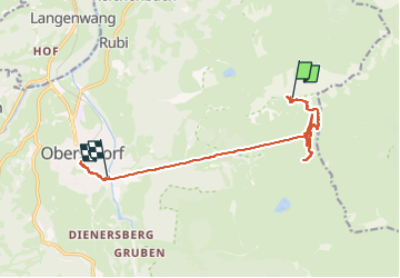

Lunghezza
12,6 km

Altitudine massima
2210 m

Dislivello positivo
217 m
Km-Effort
20 km

Altitudine minima
812 m

Dislivello negativo
1586 m
Boucle
No
Data di creazione :
2024-06-18 10:43:26.572
Ultima modifica :
2024-06-22 07:46:24.39
2h18
Difficoltà : Medio

Applicazione GPS da escursionismo GRATUITA
 SityTrail
IGN / Istituti geografici
SityTrail Plus
Il mondo è tuo
Chi siamo
Percorso Marcia di 12,6 km da scoprire a Baviera, Landkreis Oberallgäu, Oberstdorf. Questo percorso è proposto da Geert H..
Descrizione
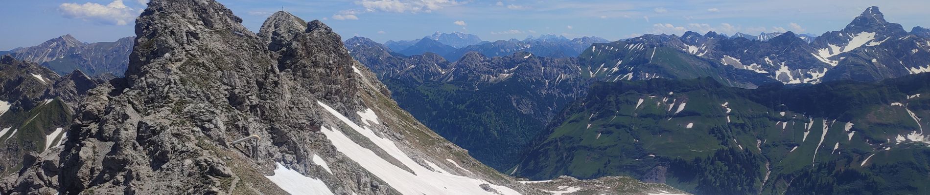
Went up to the top of the Nebelhorn by cable car and came back on foot to the Höfatsblick mountain station. Walke around and back down to Oberstdorf to see a little bit of the town.
Foto


Localizzazione
Paese:
Germany
Regione :
Baviera
Dipartimento/Provincia :
Landkreis Oberallgäu
Comune :
Oberstdorf
Località :
Unknown
Partenza:(Dec)
Partenza:(UTM)
601282 ; 5252933 (32T) N.
Commenti