


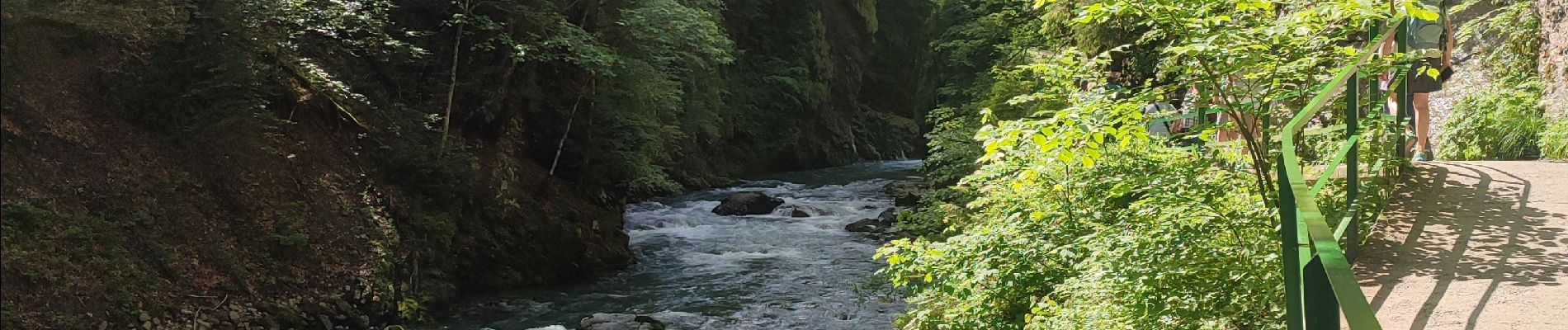
Breitachklamm

Geert H.
Utente


1h29
Difficoltà : Medio

Applicazione GPS da escursionismo GRATUITA
 SityTrail
IGN / Istituti geografici
SityTrail Plus
Il mondo è tuo
Chi siamo
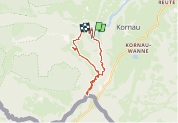
Percorso Marcia di 6,5 km da scoprire a Baviera, Landkreis Oberallgäu, Oberstdorf. Questo percorso è proposto da Geert H..
Descrizione
The Breitachklamm is a gorge created by the river Breitach
It is one of the deepest gorges of the Bavarian Alps and the deepest rocky gorge of Central Europe. Every year around 300.000 visitors walk the 2.5 km long path through the gorge.
Parking: € 4
Entrance fee: € 7,50 (2024)
Foto


25 foto in totale. Fai clic su una foto per visualizzarle tutte nella galleria.
Localizzazione
Commenti