


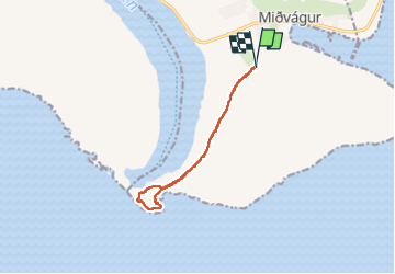
Leitisvatn Lake- Bøssdalafossur waterfall

Geert H.
Utente


1h47
Difficoltà : Medio

Applicazione GPS da escursionismo GRATUITA
 SityTrail
IGN / Istituti geografici
SityTrail Plus
Il mondo è tuo
Chi siamo
Percorso Marcia di 7,1 km da scoprire a Vága sýsla, Sconosciuto, Miðvágur. Questo percorso è proposto da Geert H..
Descrizione
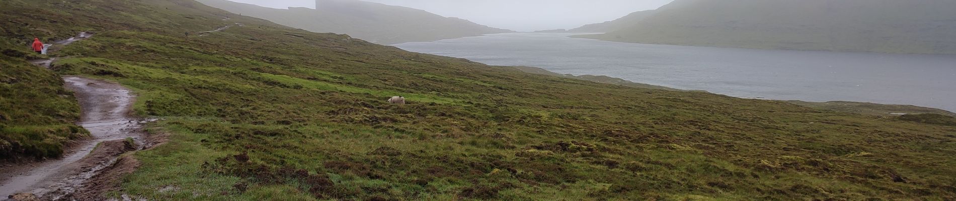
Could be nice if you see something, I didn't because of fog and hard winds. But the entrance fee is too high in this case.
You will hike along the lake Leitisvatn also known as Sørvágsvatn on your way to Traelanipan.
It feels like standing on the very edge of the world when you feel the wind and you witness the beautiful sight that attracts visitors to this remote location. Trælanípa is untouched nature at its best.
The hike to Trælanipa is easy. However, with a risk of fog and taking into account the vertical cliff way above the ocean.
Foto


Localizzazione
Commenti