


4.4 km | 12.8 km-effort
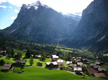
Grindelwald: Discover the best trails: 19 hiking trails and 1 bike and mountain-bike routes. All these trails, routes and outdoor activities are available in our SityTrail applications for smartphones and tablets.
On foot


• Abzweigung Gleckstein - Glecksteinhütte Symbol: weiss-rot-weiss
On foot
• Unterlauchbühl - Bort Symbol: Gelber Rhombus
On foot
• Symbol: weiss-rot-weiss
On foot
• Symbol: weiss-rot-weiss
On foot
• Trail created by Berner Wanderwege. Holewang - fixme Symbol: gelbe Raute
On foot
• Scheidegg / Oberläger - Wildgärst
On foot
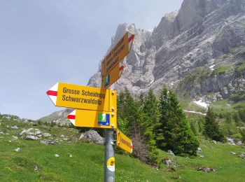
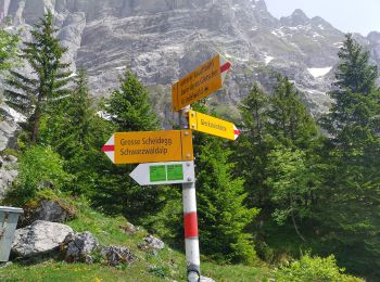
• Grosse Scheidegg - Scheidegg / Oberläger
On foot
• Grosse Scheidegg - Schreckfeld
On foot
• First - Grosse Scheidegg (Höhenweg 2400)
Walking

Other activity
•
Other activity
•
Other activity
•
Other activity
•

Walking

Mountain bike
•
On foot
Walking
Walking
• 3 Holiday walk
Walking
• Holiday 2
20 trails displayed on 35
FREE GPS app for hiking
 SityTrail
IGN / Geographical institutes
SityTrail World
The world is yours!