


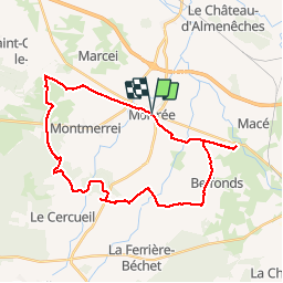

14.4 km | 15.8 km-effort


User


FREE GPS app for hiking
 SityTrail
IGN / Geographical institutes
SityTrail World
The world is yours!
Trail Mountain bike of 31 km to be discovered at Normandy, Orne, Mortrée. This trail is proposed by tracegps.
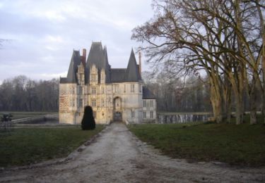
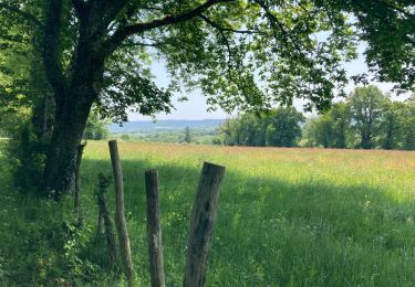
Circuit bocager. La seule partie dans les bois se situe aux alentours de Saint Hilaire du Gérard. Passage à côté du dolmen de la Pierre Tournoire. Sur le chemin du retour vers Mortrée, on aperçoit au loin le clocher de la cathédrale de Sées. Passage à côté du château d'Ô. Circuit sans difficultés. Une petite erreur d'aiguillage a un peu rallongé la sauce de cette balade qui théoriquement fait 27km.
Walking

Walking

Mountain bike
Mountain bike

Mountain bike
Walking
Running
Très bon circuit. Pour une reprise et réglage du vélo. Parcours varié, vraiment idéal en hiver. Mis le pied à terre après la pierre tournoire. Ruisseau dans le chemin et les pierres sont extrêmement glissantes. Mes pneus neufs n'accrochent pas encore assez. Je n'ai fait que les 24 kms sur les 27 prévus, la nuit arrive encore vite en cette saison, mais vraiment très beau parcours sans grande difficulté, c'est bien. Merci au créateur de la cache Guillaume 61.