Trail Walking Droisy - MONTAGNE DES PRINCES: Départ de Droisy / Passage sud sous les falaises - Photo

MONTAGNE DES PRINCES: Départ de Droisy / Passage sud sous les falaises

© OpenStreetMap contributors
Length
Length
11.5 km
Max alt
Max alt
935 m
Uphill gradient
Uphill gradient
563 m
Km-Effort
Km-Effort  
19 km
Min alt
Min alt
630 m
Downhill gradient
Downhill gradient
565 m
Boucle
Boucle
Yes
Creation date :
2019-06-01 08:26:45.579
Updated on :
2019-06-03 19:00:54.961

(1 Reviews)

Walking
Walking
3h45
Difficulty : Medium

Scan this QR Code to open this trail in the SityTrail application

FREE GPS app for hiking

Logo SityTrail SityTrail

IGN / Geographical institutes

Download SityTrail from the App Store Download SityTrail from Google Play

Logo SityTrail SityTrail World

The world is yours!

Download SityTrail from the App Store Download SityTrail from Google Play Download SityTrail on Huawei AppGallery

About

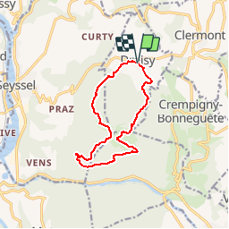
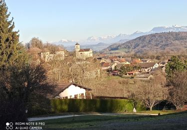
Trail Walking of 11.5 km to be discovered at Auvergne-Rhône-Alpes, Upper Savoy, Droisy. This trail is proposed by djeepee74.

Description

BOUCLE
On peut se garer autour de l'église de Droisy ou bien sur le parking situé juste avant le cimetière.
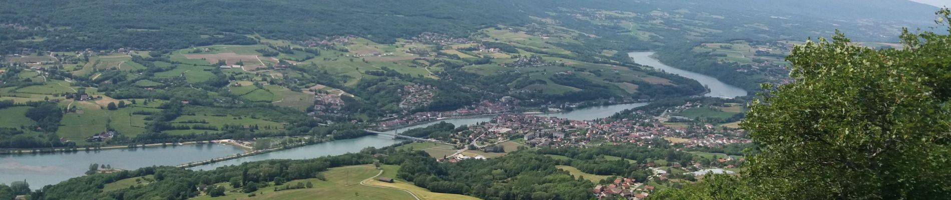
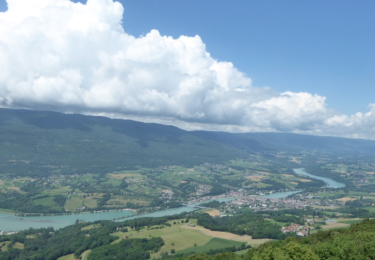
La partie sud du parcours se fait, non pas par le belvédère, mais sous les falaises...Pour y accéder, le sentier descend très raide, puis, plus bas, se sépare en deux... Prenez le premier à droite (de toute façon, ils finissent par se rejoindre)... Par contre, pour remonter, après la traversée, ne ratez pas (130 m. après le point de vue) le sentier encaissé montant très raide sur votre droite... une marque jaune figure sur le premier arbre de gauche de cette montée !

Elevation profile

Photos

Positioning

Country:
France
Region :
Auvergne-Rhône-Alpes
Department/Province :
Upper Savoy
Municipality :
Droisy
Location:
Unknown
Start:(UTM)
723398 ; 5094185 (31T) N.

Comments

Please log in to post a review or rate the element


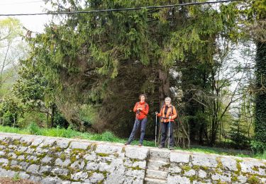
Super randonnée, merci Jean-Pierre !


Trails nearby

Trail Walking Vallières-sur-Fier - VAL_DE_FIER_BALCONS - Photo
Walking
GUIDE
HERRY

Walking

Very easy
(1)
Vallières-sur-Fier, Auvergne-Rhône-Alpes, Upper Savoy, France
8.4 km | 15.1 km-effort
2h 49min
Yes
Trail Walking Seyssel - 14-03-2022 Seyssel - La Montagne des Princes  - Photo
Walking
GUIDE
Kargil

Walking

Medium
Seyssel, Auvergne-Rhône-Alpes, Upper Savoy, France
24 km | 35 km-effort
5h 57min
Yes
Trail Walking Motz - MOTZ SERRIERES: BORDS DU RHONE - Photo
Walking
djeepee74

Walking

Difficult
Motz, Auvergne-Rhône-Alpes, Savoy, France
25 km | 30 km-effort
6h 43min
Yes
Trail Walking Seyssel - balade - Photo
Walking
patricemouton

Walking

Very easy
Seyssel, Auvergne-Rhône-Alpes, Upper Savoy, France
4 km | 6 km-effort
1h 20min
Yes
Trail Nordic walking Vallières-sur-Fier - Val de Fier - Croix saint-André - Photo
Nordic walking
woody85

Nordic walking

Difficult
Vallières-sur-Fier, Auvergne-Rhône-Alpes, Upper Savoy, France
5.6 km | 10.4 km-effort
1h 21min
Yes
Trail Walking Seyssel - Sur les Pas des Huguenots - Seyssel  - Frangy - Photo
Walking
tracegps

Walking

Difficult
Seyssel, Auvergne-Rhône-Alpes, Upper Savoy, France
15.4 km | 21 km-effort
5h 0min
No
Trail Walking Motz - Sentier Ornithologique du Fier - Photo
Walking
Ladyclairdelune74

Walking

Easy
Motz, Auvergne-Rhône-Alpes, Savoy, France
3 km | 3.2 km-effort
43min
Yes
Trail Walking Clermont - Clermont château - Photo
Walking
Manuel Vergara

Walking

Very easy
Clermont, Auvergne-Rhône-Alpes, Upper Savoy, France
6.4 km | 8.1 km-effort
1h 42min
No
Trail Walking Droisy - Montagne des princes  - Photo
Walking
Michel_Martin

Walking

Easy
Droisy, Auvergne-Rhône-Alpes, Upper Savoy, France
10.8 km | 17 km-effort
3h 30min
Yes


Close
My subscriptions