Trail Walking Plestin-les-Grèves - Embouchure du Douron - Plestin Les Grèves - Photo

Embouchure du Douron - Plestin Les Grèves

 tracegps
tracegps

User

© OpenStreetMap contributors
Length
Length
10.7 km
Max alt
Max alt
61 m
Uphill gradient
Uphill gradient
163 m
Km-Effort
Km-Effort  
12.9 km
Min alt
Min alt
0 m
Downhill gradient
Downhill gradient
162 m
Boucle
Boucle
Yes
Creation date :
2014-12-10 00:00:00.0
Updated on :
2014-12-10 00:00:00.0

(0 Reviews)

Walking
Walking
3h00
Difficulty : Medium

Scan this QR Code to open this trail in the SityTrail application

FREE GPS app for hiking

Logo SityTrail SityTrail

IGN / Geographical institutes

Download SityTrail from the App Store Download SityTrail from Google Play

Logo SityTrail SityTrail World

The world is yours!

Download SityTrail from the App Store Download SityTrail from Google Play Download SityTrail on Huawei AppGallery

About

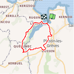
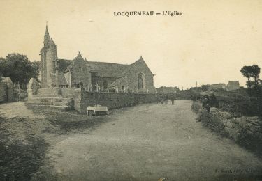
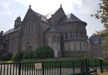
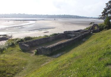
Trail Walking of 10.7 km to be discovered at Brittany, Côtes-d'Armor, Plestin-les-Grèves. This trail is proposed by tracegps.

Description

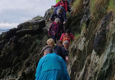
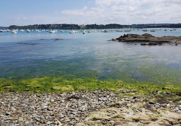
Partir de Toul An Hery (Plestin Les Grèves) puis traverser le pont sur le Douron qui marque la limite entre le Finistère et les Côtes d'Armor. Suivre le GRP Tour du Pays de Morlaix le long de la rivière. A Pont Menou, abandonner le GRP, traverser le bourg, franchir la rivière et ensuite direction Plestin par des chemins de terre (pas de balisage). Retrouver le GR 34D qui vous ramène au point de départ.

Elevation profile

Photos

Positioning

Country:
France
Region :
Brittany
Department/Province :
Côtes-d'Armor
Municipality :
Plestin-les-Grèves
Location:
Unknown
Start:(UTM)
453071 ; 5391023 (30U) N.

Trails nearby

Trail Mountain bike Plestin-les-Grèves - Circuit des chapelles, coté terre - Plestin-les-Grèves - Photo
Mountain bike
tracegps

Mountain bike

Medium
(1)
Plestin-les-Grèves, Brittany, Côtes-d'Armor, France
17.1 km | 20 km-effort
2h 0min
Yes
Trail Walking Saint-Michel-en-Grève - Saint-Michel-en-Grève - GR34 le Grand Rocher - 12km 300m 4h05 - 2023 09 13 - Photo
Walking
GUIDE
Orcal37

Walking

Difficult
Saint-Michel-en-Grève, Brittany, Côtes-d'Armor, France
12.1 km | 16 km-effort
4h 5min
Yes
Trail sport Locquirec - Locquirec aire camping car - Photo
sport
papylou7

sport

Very easy
Locquirec, Brittany, Finistère, France
10.5 km | 12.7 km-effort
Unknown
Yes
Trail Walking Guimaëc - Gr34 Poul Rodou à Venizella - Photo
Walking
Corto2023

Walking

Easy
Guimaëc, Brittany, Finistère, France
3.3 km | 4.3 km-effort
55min
No
Trail On foot Trédrez-Locquémeau - Circuit des Falaises de Trédrez - Photo
On foot
GUIDE+

On foot

Easy
Trédrez-Locquémeau, Brittany, Côtes-d'Armor, France
11.2 km | 14.1 km-effort
3h 11min
Yes
Trail Walking Plestin-les-Grèves - Locquirec 07-06-19 - Photo
Walking
nolsim

Walking

Medium
Plestin-les-Grèves, Brittany, Côtes-d'Armor, France
12.4 km | 14.7 km-effort
3h 38min
No
Trail Walking Locquirec - lokirec - Photo
Walking

Walking

Very easy
Locquirec, Brittany, Finistère, France
4.6 km | 5.7 km-effort
1h 12min
Yes
Trail Walking Plestin-les-Grèves - Plestin les grèves - Photo
Walking
Marie-Claire-mcp

Walking

Medium
Plestin-les-Grèves, Brittany, Côtes-d'Armor, France
11.9 km | 14.7 km-effort
3h 10min
Yes
Trail Walking Plestin-les-Grèves - De Plestin Les Grèves à Saint Efflam - Photo
Walking
tracegps

Walking

Medium
(1)
Plestin-les-Grèves, Brittany, Côtes-d'Armor, France
10.7 km | 13.4 km-effort
4h 0min
Yes


Close
My subscriptions