Point d'intérêt Chastre - L'Orne - Photo

L'Orne

Description

L'Orne prend sa source à Corroy-le-Château(Gembloux). Elle traverse les villages de Cortil, Noirmont, Chastre, Blanmont, Mont-Saint-Guibert et Beaurieux sur un parcours de 18 km. Elle se jette dans la Thyle, à hauteur du château de Court-Saint-Etienne.
Son affluent principal est le Nil qui prend sa source à Walhain et se jette ici dans l'Orne au terme d'un parcours de 15 km en zone très agricole.

Photos

L'Orne est à découvir dans les randonnées suivantes...
Randonnée Marche Chastre - Promenade de l'Orne, Blanmont - Photo
Marche
Chastre1450

Marche

Très facile
(1)
Chastre, Wallonie, Brabant wallon, Belgique
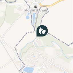
7,1 km | 8,3 km-effort
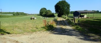
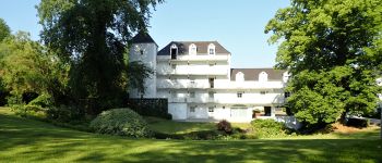
1h 49min
Oui
 Chastre1450
Chastre1450

Utilisateur

© OpenStreetMap contributors

Localisation

Pays :
Belgique
Région :
Wallonie
Département/Province :
Brabant wallon
Commune :
Chastre
Localité :
Chastre-Villeroux-Blanmont
Date de création :
2018-04-10 16:37:31.742
Dernière modification
2018-04-10 16:37:31.742

(0 Avis)

Lacs - étendues d'eau

Points d'intérêt à proximité

Point d'intérêt Chastre - Ancienne carrière - Photo
Chastre1450
Point d'intérêt Chastre - Vue nord Rue Moulin Al Poudre - Photo
Randos Ouvertes
Point d'intérêt Mont-Saint-Guibert - L'Orne - Photo
calofrancis
MONT-SAINT-GUIBERT 
Point d'intérêt Chastre - Vues du Moulin Al Poudre - Photo
Randos Ouvertes
Point d'intérêt Walhain - Moulin d'Alvaux - Photo
Chastre1450
Point d'intérêt Mont-Saint-Guibert - Mont-Saint-Guibert - Photo
Desrumaux
MONT-SAINT-GUIBERT 
Point d'intérêt Mont-Saint-Guibert - Vue sud-ouest à travers le tunnel sous la ligne 161 - Photo
Randos Ouvertes
Point d'intérêt Mont-Saint-Guibert - Moulin al Poudre - Photo
Chastre1450
MONT-SAINT-GUIBERT 


Fermer
Mes abonnements