Tocht Stappen Orsières - TMB 08 - Relais d'Arpette -> Trient - Photo

TMB 08 - Relais d'Arpette -> Trient

 uru2010
uru2010

Gebruiker

© OpenStreetMap contributors
Lengte
Lengte
17 km
Max. hoogte
Max. hoogte
2053 m
Positief hoogteverschil
765 m
Km-Effort
Km-Effort  
28 km
Min. hoogte
Min. hoogte
1280 m
Negatief hoogteverschil
1117 m
Boucle
Boucle
Neen
Datum van aanmaak :
2021-06-30 06:15:02.149
Laatste wijziging :
2022-05-08 14:53:35.86

(0 Bericht)

Stappen
Stappen
6h39
Moeilijkheid : Moeilijk

Scan deze QR-code om de tocht te openen in de SityTrail-applicatie

Gratisgps-wandelapplicatie

Logo SityTrail SityTrail

IGN / Geografische instituten

SityTrail uit de App Store downloaden SityTrail uit Google Play downloaden

Logo SityTrail SityTrail World

De wereld gaat voor u open

SityTrail uit de App Store downloaden SityTrail uit Google Play downloaden SityTrail op Huawei AppGallery downloaden

Over ons

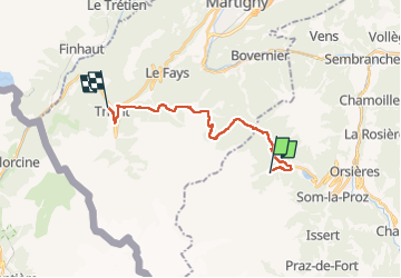
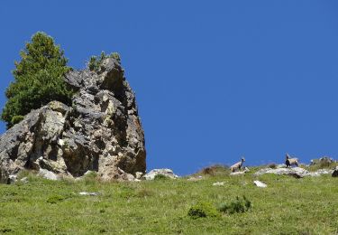
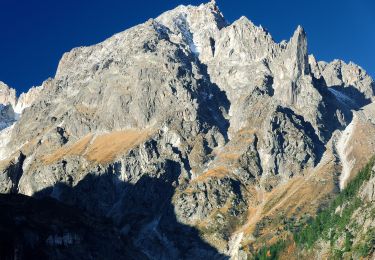
Tocht Stappen van 17 km beschikbaar op Valais/Wallis, Entremont, Orsières. Deze tocht wordt voorgesteld door uru2010.

Beschrijving

Départ : Relais d'Arpette, Arpette.
Arrivée : Hôtel de la Grande Ourse, 30 Le Betty, Trient. Tél :  41 27 722 17 54.

Randonnée faite le 30/6/2021.
Durée suivant le guide : 6h25. Ma durée réelle : 6h40.

Hoogteprofiel

Foto's

Plaatsbepaling

Land:
Switzerland
Regio :
Valais/Wallis
Departement/Provincie :
Entremont
Gemeente :
Orsières
Locatie:
Unknown
Vertrek:(UTM)
352424 ; 5099119 (32T) N.

Wandeltochten in de omgeving

Tocht Te voet Orsières - Chemins pédestre de montagne, commune d'Orsières - Photo
Te voet
PRO

Te voet

Gemakkelijk
Orsières, Valais/Wallis, Entremont, Switzerland
5,6 km | 8,8 km-effort
1h 59min
Neen
Tocht Te voet Orsières - sentier du Devin - Photo
Te voet
PRO

Te voet

Gemakkelijk
Orsières, Valais/Wallis, Entremont, Switzerland
3,9 km | 6,7 km-effort
1h 31min
Ja
Tocht Te voet Orsières - Chemins pédestre, commune d'Orsières - Photo
Te voet
PRO

Te voet

Gemakkelijk
Orsières, Valais/Wallis, Entremont, Switzerland
5,4 km | 14,1 km-effort
3h 12min
Neen
Tocht Te voet Bovernier - Chemins pédestre de montagne, région Entremont - Photo
Te voet
PRO

Te voet

Medium
Bovernier, Valais/Wallis, Martigny, Switzerland
6,9 km | 22 km-effort
4h 54min
Neen
Tocht Te voet Orsières - Raccard du blé - Photo
Te voet
PRO

Te voet

Gemakkelijk
Orsières, Valais/Wallis, Entremont, Switzerland
7,9 km | 13,7 km-effort
3h 6min
Ja
Tocht Sneeuwschoenen Orsières - Champex Lac - La Breya - Champex Lac - Photo
Sneeuwschoenen
jpksenicz

Sneeuwschoenen

Medium
Orsières, Valais/Wallis, Entremont, Switzerland
8,8 km | 18,2 km-effort
3h 1min
Ja
Tocht Stappen Orsières - CMX ZRMT Étape 2 Champex Cabane de Mille  - Photo
Stappen
jeff2

Stappen

Medium
Orsières, Valais/Wallis, Entremont, Switzerland
17,9 km | 38 km-effort
7h 15min
Neen
Tocht Stappen Orsières - TMB day 5 - Photo
Stappen
elixpomatia

Stappen

Medium
Orsières, Valais/Wallis, Entremont, Switzerland
16,7 km | 28 km-effort
6h 15min
Neen
Tocht Sneeuwschoenen Orsières - Champex Lac - Belvédère - Champex Lac - Photo
Sneeuwschoenen
jpksenicz

Sneeuwschoenen

Medium
Orsières, Valais/Wallis, Entremont, Switzerland
8,4 km | 13,6 km-effort
2h 52min
Ja


Sluiten
Mijn abonnementen