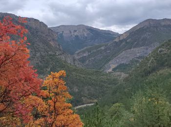
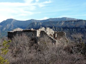
Chaudon-Norante, Alpes-de-Haute-Provence: Die besten Touren, Trails, Trecks und Wanderungen

4 kommentare

Chaudon-Norante : Entdecken Sie die besten Touren : 23 zu Fuß, 2 mit dem Fahrrad oder Mountainbike und 1 auf dem Pferderücken. Alle diese Touren, Trails, Routen und Outdoor-Aktivitäten sind in unseren SityTrail-Apps für Smartphones und Tablets verfügbar.


Die besten Spuren (26)

Tour Wandern Chaudon-Norante - ENTRAGES la Clappe départ ancienne carrière Gozzi - Photo
Wandern 12.771
Km

Wandern

Medium
(1)
Chaudon-Norante, Provence-Alpes-Côte d'Azur, Alpes-de-Haute-Provence, France
12,8 km | 19,9 km-effort
4h 7min
534 m
537 m
Ja
RobinMicheline

• Belle randonnée de 5 h de marché plein de sentiers ombragés de l eau de partout très agréable à refaire 280 mns 13 ...
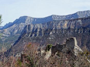
Tour Wandern Chaudon-Norante - Ruines hameau Creisset par Passerelle Asse - Photo
Wandern 8.799
Km

Wandern

Einfach
Chaudon-Norante, Provence-Alpes-Côte d'Azur, Alpes-de-Haute-Provence, France
8,8 km | 15,2 km-effort
4h 14min
575 m
192 m
Nein
GrouGary

Tour Wandern Chaudon-Norante - Hameau de Creisset - Photo
Wandern 9.455
Km

Wandern

Sehr leicht
(1)
Chaudon-Norante, Provence-Alpes-Côte d'Azur, Alpes-de-Haute-Provence, France
9,5 km | 15,6 km-effort
3h 39min
464 m
461 m
Ja
Nicomontagnes

Tour Pferd Chaudon-Norante - La Voie Impériale (Etape 3 : Chaudon-Norante (La Clappe) - Digne-les-Bains) - Photo
Pferd 14.038
Km

Pferd

Schwierig
(1)
Chaudon-Norante, Provence-Alpes-Côte d'Azur, Alpes-de-Haute-Provence, France
14 km | 21 km-effort
3h 45min
428 m
866 m
Nein
tracegps

Tour Wandern Chaudon-Norante - La Voie Impériale (Etape 3 : Chaudon-Norante (La Clappe) - Digne-les-Bains) - Photo
Wandern 14.038
Km

Wandern

Schwierig
Chaudon-Norante, Provence-Alpes-Côte d'Azur, Alpes-de-Haute-Provence, France
14 km | 21 km-effort
4h 30min
428 m
866 m
Nein
tracegps

Tour Mountainbike Chaudon-Norante - Grande Traversée des PréAlpes à VTT : Col de Pierre Basse - La Bâtie Neuve (Maison forestière ruinée) - Photo
Mountainbike 15.092
Km

Mountainbike

Medium
Chaudon-Norante, Provence-Alpes-Côte d'Azur, Alpes-de-Haute-Provence, France
15,1 km | 20 km-effort
3h 0min
410 m
372 m
Nein
tracegps

Tour Wandern Chaudon-Norante - Le poil valbonnette - Photo
Wandern 24.033
Km

Wandern

Medium
Chaudon-Norante, Provence-Alpes-Côte d'Azur, Alpes-de-Haute-Provence, France
24 km | 38 km-effort
8h 56min
1040 m
1037 m
Ja
Danielba

Tour Zu Fuß Chaudon-Norante - Château plus Haut - Photo
Zu Fuß 9.473
Km
PRO

Zu Fuß

Einfach
Chaudon-Norante, Provence-Alpes-Côte d'Azur, Alpes-de-Haute-Provence, France
9,5 km | 13,7 km-effort
3h 6min
314 m
314 m
Ja
SityTrail - itinéraires balisés pédestres

• Trail created by Département des Alpes-de-Haute-Provence. Website: https://www.rando-alpes-haute-provence.fr/rando...
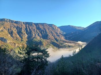
Tour Wandern Chaudon-Norante - BEYNES .  chapelle S Étienne,  Creisset o l  - Photo
Wandern 13.096
Km

Wandern

Medium
(1)
Chaudon-Norante, Provence-Alpes-Côte d'Azur, Alpes-de-Haute-Provence, France
13,1 km | 22 km-effort
6h 28min
635 m
632 m
Ja
RobinMicheline

Tour Wandern Chaudon-Norante - Village abandonné de Creisset - Photo
Wandern 11.717
Km

Wandern

Medium
Chaudon-Norante, Provence-Alpes-Côte d'Azur, Alpes-de-Haute-Provence, France
11,7 km | 19,4 km-effort
4h 57min
572 m
575 m
Ja
domi06

Tour Wandern Chaudon-Norante - Chateau du haut-Chaudon - Photo
Wandern 13.226
Km

Wandern

Sehr schwierig
Chaudon-Norante, Provence-Alpes-Côte d'Azur, Alpes-de-Haute-Provence, France
13,2 km | 21 km-effort
4h 40min
551 m
555 m
Ja
Geruen

Tour Wandern Chaudon-Norante - les dourbettes au col de pierre basse  - Photo
Wandern 10.176
Km

Wandern

Schwierig
Chaudon-Norante, Provence-Alpes-Côte d'Azur, Alpes-de-Haute-Provence, France
10,2 km | 14,7 km-effort
3h 20min
342 m
339 m
Ja
ejacky

Tour Wandern Chaudon-Norante - des Dourbettes au col de pierre basse  - Photo
Wandern 5.68
Km

Wandern

Medium
Chaudon-Norante, Provence-Alpes-Côte d'Azur, Alpes-de-Haute-Provence, France
5,7 km | 8,3 km-effort
1h 53min
197 m
195 m
Ja
ejacky

Tour Zu Fuß Chaudon-Norante - boucle de Chabrieres à Creisset 8.4 km et 450m déniv - Photo
Zu Fuß 8.436
Km

Zu Fuß

Medium
Chaudon-Norante, Provence-Alpes-Côte d'Azur, Alpes-de-Haute-Provence, France
8,4 km | 14,4 km-effort
4h 0min
449 m
449 m
Ja
eaea7charles

Tour Wandern Chaudon-Norante - Rando709 - Photo
Wandern 20.911
Km

Wandern

Schwierig
Chaudon-Norante, Provence-Alpes-Côte d'Azur, Alpes-de-Haute-Provence, France
21 km | 35 km-effort
5h 11min
1071 m
1072 m
Ja
Escondido

Tour Wandern Chaudon-Norante - BEYNES    creisset haut et bas villard  o l s  - Photo
Wandern 12.613
Km

Wandern

Medium
Chaudon-Norante, Provence-Alpes-Côte d'Azur, Alpes-de-Haute-Provence, France
12,6 km | 20 km-effort
7h 50min
569 m
571 m
Ja
RobinMicheline

Tour Wandern Chaudon-Norante - Le Haut Villar  - Photo
Wandern 11.287
Km

Wandern

Medium
Chaudon-Norante, Provence-Alpes-Côte d'Azur, Alpes-de-Haute-Provence, France
11,3 km | 20 km-effort
3h 31min
658 m
658 m
Ja
PITOUSSAINT

Tour Wandern Chaudon-Norante - Creisset - Chapelle St-Etienne - Photo
Wandern 15.221
Km

Wandern

Medium
Chaudon-Norante, Provence-Alpes-Côte d'Azur, Alpes-de-Haute-Provence, France
15,2 km | 25 km-effort
4h 50min
716 m
715 m
Ja
Clo0413

Tour Wandern Chaudon-Norante -  circuit haut Villars cresset - Photo
Wandern 9.951
Km

Wandern

Einfach
Chaudon-Norante, Provence-Alpes-Côte d'Azur, Alpes-de-Haute-Provence, France
10 km | 16,3 km-effort
3h 41min
475 m
471 m
Ja
gerin

Tour Wandern Chaudon-Norante - CREISSET - Photo
Wandern 15.415
Km

Wandern

Schwierig
Chaudon-Norante, Provence-Alpes-Côte d'Azur, Alpes-de-Haute-Provence, France
15,4 km | 25 km-effort
4h 26min
688 m
681 m
Ja
RobinMicheline

20 Angezeigte Touren bei 26

Kostenlosegpshiking-Anwendung

Logo SityTrail SityTrail

IGN / Geografische Institute

SityTrail aus dem App Store herunterladen SityTrail von Google Play herunterladen

Logo SityTrail SityTrail World

Die Welt öffnet sich für Sie

SityTrail aus dem App Store herunterladen SityTrail von Google Play herunterladen SityTrail auf Huawei AppGallery herunterladen

Aktivitäten

Schließen
Meine Abonnements