Startseite
World
NEW
Premium
Speichern Sie
Touren
Artikel
Hilfe - Unterstützung
Français
English
Nederlands
Español
Italiano
Deutsch
Verbindung
Startseite
World
Premium
Speichern Sie
Touren
Artikel
Hilfe - Unterstützung
SityTrail
>
POIs
>
GC16MXR
SityTrail
>
POIs
>
GC16MXR
GC16MXR
Beschreibung
Une p?tite mousse by vilcanota
Foto-Galerie
Erkunden Sie GC16MXR mit den folgenden Touren...
tracegps
Le Fort de la Batterie
Wandern
Medium
Marthod, Auvergne-Rhone-Alpen, Savoyen, France
6,5 km | 13,3 km-effort
2h 30min
Ja
tracegps
Benutzer
©
OpenStreetMap
contributors
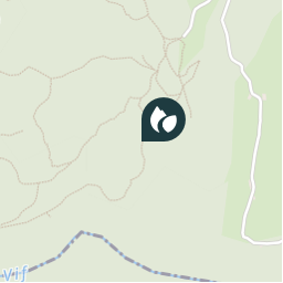
Ort
Land:
France
Region :
Auvergne-Rhone-Alpen
Abteilung/Provinz :
Savoyen
Kommune :
Saint-Christophe
Standort:
Unknown
Ort
45.44255 / 5.79285
Erstellungsdatum :
2018-04-09 12:19:17.702
Letzte Änderung
2018-04-09 12:19:17.702
(0 Nachricht)
Kommentare
Bitte melden Sie sich an, um einen Kommentar oder eine Bewertung zu hinterlassen
POI's in der Nähe
tracegps
GC16MXR
SAINT-CHRISTOPHE
tracegps
GC16MXR
SAINT-CHRISTOPHE
tracegps
GC16MXR
SAINT-CHRISTOPHE
tracegps
GC16MXR
SAINT-CHRISTOPHE
tracegps
GC16MXR
SAINT-CHRISTOPHE
tracegps
GC16MXR
SAINT-CHRISTOPHE
tracegps
GC16MXR
SAINT-CHRISTOPHE
tracegps
GC16MXR
SAINT-CHRISTOPHE
Schließen
Meine Abonnements