Startseite
World
NEW
Premium
Speichern Sie
Touren
Artikel
Hilfe - Unterstützung
Français
English
Nederlands
Español
Italiano
Deutsch
Verbindung
Startseite
World
Premium
Speichern Sie
Touren
Artikel
Hilfe - Unterstützung
SityTrail
>
POIs
>
GC18X5G
SityTrail
>
POIs
>
GC18X5G
GC18X5G
Beschreibung
Cache des Châtellans by cybert
Foto-Galerie
Erkunden Sie GC18X5G mit den folgenden Touren...
tracegps
Le Fort de la Batterie
Wandern
Medium
Marthod, Auvergne-Rhone-Alpen, Savoyen, France
6,5 km | 13,3 km-effort
2h 30min
Ja
tracegps
Benutzer
©
OpenStreetMap
contributors
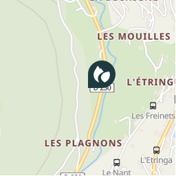
Ort
Land:
France
Region :
Auvergne-Rhone-Alpen
Abteilung/Provinz :
Hochsavoyen
Kommune :
Châtel
Standort:
Unknown
Ort
46.265 / 6.833667
Erstellungsdatum :
2018-04-09 12:18:42.854
Letzte Änderung
2018-04-09 12:18:42.854
(0 Nachricht)
Kommentare
Bitte melden Sie sich an, um einen Kommentar oder eine Bewertung zu hinterlassen
POI's in der Nähe
tracegps
GC18X5G
CHÂTEL
tracegps
GC18X5G
CHÂTEL
tracegps
GC18X5G
CHÂTEL
tracegps
GC18X5G
CHÂTEL
tracegps
GC18X5G
CHÂTEL
tracegps
GC18X5G
CHÂTEL
tracegps
GC18X5G
CHÂTEL
tracegps
GC18X5G
CHÂTEL
Schließen
Meine Abonnements