Startseite
World
NEW
Premium
Speichern Sie
Touren
Artikel
Hilfe - Unterstützung
Français
English
Nederlands
Español
Italiano
Deutsch
Verbindung
Startseite
World
Premium
Speichern Sie
Touren
Artikel
Hilfe - Unterstützung
SityTrail
>
POIs
>
GCJKK3
SityTrail
>
POIs
>
GCJKK3
GCJKK3
Beschreibung
Col Du Mont Cenis by waynerpra
Foto-Galerie
Erkunden Sie GCJKK3 mit den folgenden Touren...
tracegps
Sentiers des Pointières
Wandern
Medium
Queige, Auvergne-Rhone-Alpen, Savoyen, France
6,8 km | 11,3 km-effort
3h 30min
Ja
tracegps
Benutzer
©
OpenStreetMap
contributors
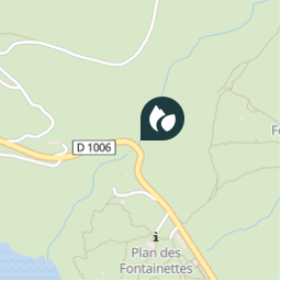
Ort
Land:
France
Region :
Auvergne-Rhone-Alpen
Abteilung/Provinz :
Savoyen
Kommune :
Val-Cenis
Standort:
Lanslebourg-Mont-Cenis
Ort
45.24345 / 6.94925
Erstellungsdatum :
2018-04-09 12:17:27.214
Letzte Änderung
2018-04-09 12:17:27.214
(0 Nachricht)
Kommentare
Bitte melden Sie sich an, um einen Kommentar oder eine Bewertung zu hinterlassen
POI's in der Nähe
tracegps
GCJKK3
VAL-CENIS
tracegps
GCJKK3
VAL-CENIS
tracegps
GCJKK3
VAL-CENIS
tracegps
GCJKK3
VAL-CENIS
tracegps
GCJKK3
VAL-CENIS
tracegps
GCJKK3
VAL-CENIS
tracegps
GCJKK3
VAL-CENIS
tracegps
GCJKK3
VAL-CENIS
Schließen
Meine Abonnements