Startseite
World
NEW
Premium
Speichern Sie
Touren
Artikel
Hilfe - Unterstützung
Français
English
Nederlands
Español
Italiano
Deutsch
Verbindung
Startseite
World
Premium
Speichern Sie
Touren
Artikel
Hilfe - Unterstützung
SityTrail
>
POIs
>
GCXZTA
SityTrail
>
POIs
>
GCXZTA
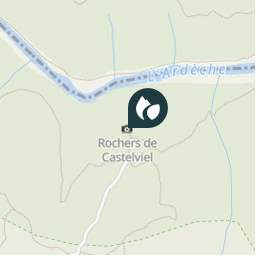
GCXZTA
Beschreibung
Rochers de Castelviel by buckf
Foto-Galerie
Erkunden Sie GCXZTA mit den folgenden Touren...
tracegps
Sentiers des Pointières
Wandern
Medium
Queige, Auvergne-Rhone-Alpen, Savoyen, France
6,8 km | 11,3 km-effort
3h 30min
Ja
tracegps
Benutzer
©
OpenStreetMap
contributors
Ort
Land:
France
Region :
Okzitanien
Abteilung/Provinz :
Gard
Kommune :
Aiguèze
Standort:
Unknown
Ort
44.3216 / 4.5348
Erstellungsdatum :
2018-04-09 12:18:09.794
Letzte Änderung
2018-04-09 12:18:09.794
(0 Nachricht)
Kommentare
Bitte melden Sie sich an, um einen Kommentar oder eine Bewertung zu hinterlassen
POI's in der Nähe
tracegps
GCXZTA
AIGUÈZE
tracegps
GCXZTA
AIGUÈZE
tracegps
GCXZTA
AIGUÈZE
tracegps
GCXZTA
AIGUÈZE
kephas
Point 6
BIDON
kephas
Point 5
BIDON
tracegps
GCWW7W
BIDON
tracegps
GCWW7W
BIDON
Schließen
Meine Abonnements