Startseite
World
NEW
Premium
Speichern Sie
Touren
Artikel
Hilfe - Unterstützung
Français
English
Nederlands
Español
Italiano
Deutsch
Verbindung
Startseite
World
Premium
Speichern Sie
Touren
Artikel
Hilfe - Unterstützung
SityTrail
>
POIs
>
GCYQVQ
SityTrail
>
POIs
>
GCYQVQ
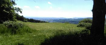
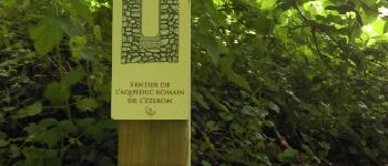
GCYQVQ
Beschreibung
Col de Malval by Rockley, Trad
Foto-Galerie
Erkunden Sie GCYQVQ mit den folgenden Touren...
tracegps
Sentiers des Pointières
Wandern
Medium
Queige, Auvergne-Rhone-Alpen, Savoyen, France
6,8 km | 11,3 km-effort
3h 30min
Ja
tracegps
Benutzer
©
OpenStreetMap
contributors
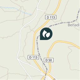
Ort
Land:
France
Region :
Auvergne-Rhone-Alpen
Abteilung/Provinz :
Rhône
Kommune :
Vaugneray
Standort:
Vaugneray
Ort
45.751067 / 4.610667
Erstellungsdatum :
2018-04-09 12:18:17.334
Letzte Änderung
2018-04-09 12:18:17.334
(0 Nachricht)
Kommentare
Bitte melden Sie sich an, um einen Kommentar oder eine Bewertung zu hinterlassen
POI's in der Nähe
tracegps
GCYQVQ
VAUGNERAY
tracegps
GCYQVQ
VAUGNERAY
tracegps
GCYQVQ
VAUGNERAY
tracegps
GCYQVQ
VAUGNERAY
tracegps
GCYQVQ
VAUGNERAY
Trotte-menu
vuePoint 4
POLLIONNAY
Trotte-menu
Vue
POLLIONNAY
Trotte-menu
sentier aqueduc romain terr...
VAUGNERAY
Schließen
Meine Abonnements