Startseite
World
NEW
Premium
Speichern Sie
Touren
Artikel
Hilfe - Unterstützung
Français
English
Nederlands
Español
Italiano
Deutsch
Verbindung
Startseite
World
Premium
Speichern Sie
Touren
Artikel
Hilfe - Unterstützung
SityTrail
>
POIs
>
GC145BK
SityTrail
>
POIs
>
GC145BK
GC145BK
Beschreibung
Le chevelu de la Daronne by ra
Foto-Galerie
Erkunden Sie GC145BK mit den folgenden Touren...
tracegps
Crêt Coquet
Wandern
Medium
(3)
Hautecour, Auvergne-Rhone-Alpen, Savoyen, France
6,5 km | 9,6 km-effort
3h 30min
Ja
tracegps
Benutzer
©
OpenStreetMap
contributors
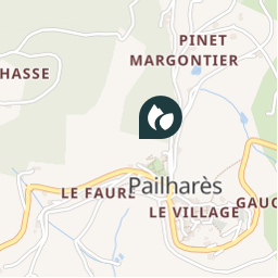
Ort
Land:
France
Region :
Auvergne-Rhone-Alpen
Abteilung/Provinz :
Ardèche
Kommune :
Pailharès
Standort:
Unknown
Ort
45.0799 / 4.564333
Erstellungsdatum :
2018-04-09 12:18:54.666
Letzte Änderung
2018-04-09 12:18:54.666
(0 Nachricht)
Kommentare
Bitte melden Sie sich an, um einen Kommentar oder eine Bewertung zu hinterlassen
POI's in der Nähe
tracegps
GC145BK
PAILHARÈS
tracegps
GC145BK
PAILHARÈS
tracegps
GC145BK
PAILHARÈS
tracegps
GC145BK
PAILHARÈS
tracegps
GC145BK
PAILHARÈS
bosses21
Col du Marchand - 903 m
PAILHARÈS
tracegps
GC13ZY9
SAINT-FÉLICIEN
tracegps
GC13ZY9
SAINT-FÉLICIEN
Schließen
Meine Abonnements