Startseite
World
NEW
Premium
Speichern Sie
Touren
Artikel
Hilfe - Unterstützung
Français
English
Nederlands
Español
Italiano
Deutsch
Verbindung
Startseite
World
Premium
Speichern Sie
Touren
Artikel
Hilfe - Unterstützung
SityTrail
>
POIs
>
GCZXH4
SityTrail
>
POIs
>
GCZXH4
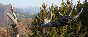
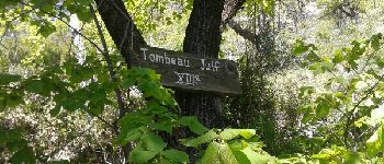
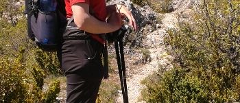
GCZXH4
Beschreibung
Balcon Serrois by Mire-Mich, T
Foto-Galerie
Erkunden Sie GCZXH4 mit den folgenden Touren...
tracegps
Lac-Bleu depuis Méribel-Altiport
Wandern
Schwierig
(1)
Les Allues, Auvergne-Rhone-Alpen, Savoyen, France
10 km | 18,1 km-effort
4h 30min
Ja
tracegps
Benutzer
©
OpenStreetMap
contributors
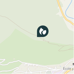
Ort
Land:
France
Region :
Provence-Alpes-Côte d'Azur
Abteilung/Provinz :
Hochalpen
Kommune :
Serres
Standort:
Unknown
Ort
44.431 / 5.70715
Erstellungsdatum :
2018-04-09 12:17:02.575
Letzte Änderung
2018-04-09 12:17:02.575
(0 Nachricht)
Kommentare
Bitte melden Sie sich an, um einen Kommentar oder eine Bewertung zu hinterlassen
POI's in der Nähe
tracegps
GCZXH4
SERRES
tracegps
GCZXH4
SERRES
tracegps
GCZXH4
SERRES
tracegps
GCZXH4
SERRES
CampingLesRivesduLac
Montée à la crête de Serre
SERRES
margotte
Point 6
SERRES
margotte
Point 7
SERRES
margotte
Point 10
SERRES
Schließen
Meine Abonnements