


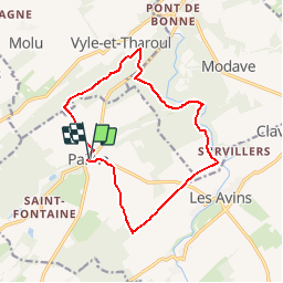


17,1 km | 21 km-effort

Benutzer


Kostenlosegpshiking-Anwendung
 SityTrail
IGN / Geografische Institute
SityTrail World
Die Welt öffnet sich für Sie
Tour Wandern von 12,6 km verfügbar auf Wallonien, Lüttich, Clavier. Diese Tour wird von tourcondroz vorgeschlagen.
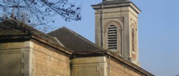
Au départ de l'église de Pailhe, cette promenade de 12,5 km propose de beaux chemins boisés notamment dans la réserve naturelle du château de Modave ainsi que dans le Bois Guillaume.


Wandern

Wandern

Wandern

Wandern

Wandern

Wandern

Wandern

Wandern
Wandern
niet zo bijzonder. boeretractorspoormodderploeteren.
Zeer mooi afwisselend en rustig traject
super