![](/images/other/stat-length.png)
![Tour Zu Fuß Verl - Verler Kirchwege - Photo](https://media.geolcdn.com/t/1900/400/ext.pjpeg?maxdim=2&url=https%3A%2F%2Fmedia.geolcdn.com%2Ff%2F02c298a3-0840-4bbf-b00a-bca5e99cf1fb.jpeg)
Verler Kirchwege
SityTrail - itinéraires balisés pédestres
Tous les sentiers balisés d’Europe PRO
![Länge](/images/other/stat-length.png)
Länge
7,1 km
![Maximale Höhe](https://static1.geolcdn.com/siteimages/upload/files/1508320355ic_sort_altitude_max_24dp.png)
Maximale Höhe
99 m
![Positive Höhendifferenz](https://static1.geolcdn.com/siteimages/upload/files/1508320355ic_sort_den_pos_24dp.png)
Positive Höhendifferenz
39 m
![Km-Effort](/images/other/stat-length.png)
Km-Effort
7,6 km
![Min. Höhe](https://static1.geolcdn.com/siteimages/upload/files/1508320355ic_sort_altitude_min_24dp.png)
Min. Höhe
86 m
![Negative Höhendifferenz](https://static1.geolcdn.com/siteimages/upload/files/1508320355ic_sort_den_neg_24dp.png)
Negative Höhendifferenz
30 m
![Boucle](https://static1.geolcdn.com/siteimages/upload/files/16400158638029165_repeat_loop_refresh_sync_direction_icon.png)
Boucle
Nein
Kennzeichnung
Erstellungsdatum :
2022-02-11 17:34:53.351
Letzte Änderung :
2022-02-11 17:34:53.351
![Zu Fuß](https://static1.geolcdn.com/sitytour/trail-icons/100.png)
1h44
Schwierigkeit : Einfach
![Scannen Sie diesen QR-Code, um die Tour in der SityTrail-Anwendung zu öffnen](https://capi.geolives.com/qq0zvz2zws4bq2lad0pu/sitytour/trails/3098180/qr.png?size=200)
Kostenlosegpshiking-Anwendung
Über SityTrail
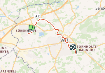
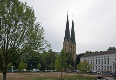
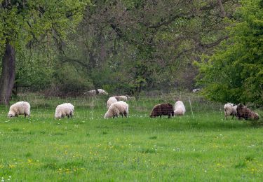
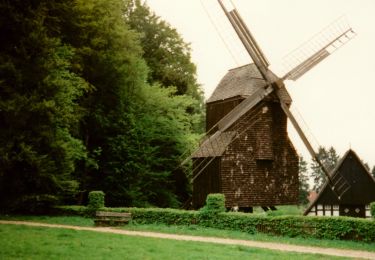
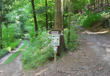
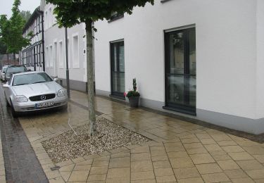
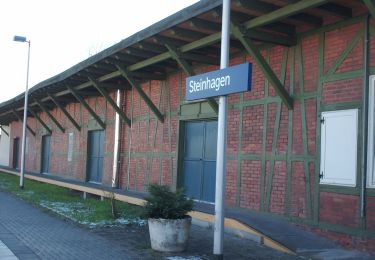
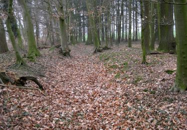
Tour Zu Fuß von 7,1 km verfügbar auf Nordrhein-Westfalen, Kreis Gütersloh, Verl. Diese Tour wird von SityTrail - itinéraires balisés pédestres vorgeschlagen.
Beschreibung
Trail created by Kolpingsfamilien im Pastoralverbund Verl.
Ort
Land:
Germany
Region :
Nordrhein-Westfalen
Abteilung/Provinz :
Kreis Gütersloh
Kommune :
Verl
Standort:
Unknown
Gehen Sie:(Dec)
Gehen Sie:(UTM)
463276 ; 5748640 (32U) N.
Kommentare
Touren in der Umgebung
![Tour Zu Fuß Oerlinghausen - Holzweg - Photo](https://media.geolcdn.com/t/375/260/ext.jpg?maxdim=2&url=https%3A%2F%2Fmedia.geolcdn.com%2Ff%2F46fb7f62-dac9-4c53-bef4-31692828a068.jpeg)
![Zu Fuß Zu Fuß](https://static1.geolcdn.com/sitytour/trail-icons/100.png)
Holzweg
Zu Fuß
Einfach
Oerlinghausen,
Nordrhein-Westfalen,
Kreis Lippe,
Germany
![](/images/other/stat-length.png)
8,1 km | 10 km-effort
2h 16min
![](https://static1.geolcdn.com/siteimages/upload/files/16400158638029165_repeat_loop_refresh_sync_direction_icon.png)
Nein
![Tour Zu Fuß Schloß Holte-Stukenbrock - Romantisches Furlbachtal - Photo](https://media.geolcdn.com/t/375/260/ext.jpg?maxdim=2&url=https%3A%2F%2Fmedia.geolcdn.com%2Ff%2F3b4c90b3-ac39-47a8-a47a-b37ecca07826.jpeg)
![Zu Fuß Zu Fuß](https://static1.geolcdn.com/sitytour/trail-icons/100.png)
Romantisches Furlbachtal
Zu Fuß
Einfach
Schloß Holte-Stukenbrock,
Nordrhein-Westfalen,
Kreis Gütersloh,
Germany
![](/images/other/stat-length.png)
5,8 km | 6,4 km-effort
1h 27min
![](https://static1.geolcdn.com/siteimages/upload/files/16400158638029165_repeat_loop_refresh_sync_direction_icon.png)
Nein
![Tour Zu Fuß Unbekannt - Stadtrundgang - Photo](https://media.geolcdn.com/t/375/260/ext.jpg?maxdim=2&url=https%3A%2F%2Fmedia.geolcdn.com%2Ff%2F57497daa-a1c0-474e-bc4c-e77271ef28a9.jpeg)
![Zu Fuß Zu Fuß](https://static1.geolcdn.com/sitytour/trail-icons/100.png)
Stadtrundgang
Zu Fuß
Einfach
Unbekannt,
Nordrhein-Westfalen,
Bielefeld,
Germany
![](/images/other/stat-length.png)
3,7 km | 4,5 km-effort
1h 1min
![](https://static1.geolcdn.com/siteimages/upload/files/16400158638029165_repeat_loop_refresh_sync_direction_icon.png)
Ja
![Tour Zu Fuß Unbekannt - Weser-Lutter-Weg - Photo](https://media.geolcdn.com/t/375/260/ext.jpg?maxdim=2&url=https%3A%2F%2Fmedia.geolcdn.com%2Ff%2Fc90dd43f-6f1d-498e-9eb5-c59a5139c94e.jpeg)
![Zu Fuß Zu Fuß](https://static1.geolcdn.com/sitytour/trail-icons/100.png)
Weser-Lutter-Weg
Zu Fuß
Einfach
Unbekannt,
Nordrhein-Westfalen,
Bielefeld,
Germany
![](/images/other/stat-length.png)
11 km | 11,9 km-effort
2h 42min
![](https://static1.geolcdn.com/siteimages/upload/files/16400158638029165_repeat_loop_refresh_sync_direction_icon.png)
Nein
![Tour Zu Fuß Unbekannt - Von Burg zu Berg - Photo](https://media.geolcdn.com/t/375/260/ext.jpg?maxdim=2&url=https%3A%2F%2Fmedia.geolcdn.com%2Ff%2Ffb5868bb-e2ef-464c-940e-562613eca188.jpeg)
![Zu Fuß Zu Fuß](https://static1.geolcdn.com/sitytour/trail-icons/100.png)
Von Burg zu Berg
Zu Fuß
Einfach
Unbekannt,
Nordrhein-Westfalen,
Bielefeld,
Germany
![](/images/other/stat-length.png)
4,4 km | 5,8 km-effort
1h 19min
![](https://static1.geolcdn.com/siteimages/upload/files/16400158638029165_repeat_loop_refresh_sync_direction_icon.png)
Nein
![Tour Zu Fuß Unbekannt - Bergmannsweg - Photo](https://media.geolcdn.com/t/375/260/ext.jpg?maxdim=2&url=https%3A%2F%2Fmedia.geolcdn.com%2Ff%2Fd06aa6f9-fca4-42a2-b4e5-976d5b7f506b.jpeg)
![Zu Fuß Zu Fuß](https://static1.geolcdn.com/sitytour/trail-icons/100.png)
Bergmannsweg
Zu Fuß
Einfach
Unbekannt,
Nordrhein-Westfalen,
Bielefeld,
Germany
![](/images/other/stat-length.png)
5 km | 7,2 km-effort
1h 38min
![](https://static1.geolcdn.com/siteimages/upload/files/16400158638029165_repeat_loop_refresh_sync_direction_icon.png)
Ja
![Tour Zu Fuß Oelde - Pflaumenwanderweg - Photo](https://media.geolcdn.com/t/375/260/ext.jpg?maxdim=2&url=https%3A%2F%2Fmedia.geolcdn.com%2Ff%2F45d54f1e-a9d3-4af2-8066-e3eeb72c2dd9.jpeg)
![Zu Fuß Zu Fuß](https://static1.geolcdn.com/sitytour/trail-icons/100.png)
Pflaumenwanderweg
Zu Fuß
Einfach
Oelde,
Nordrhein-Westfalen,
Kreis Warendorf,
Germany
![](/images/other/stat-length.png)
10,5 km | 12,4 km-effort
2h 48min
![](https://static1.geolcdn.com/siteimages/upload/files/16400158638029165_repeat_loop_refresh_sync_direction_icon.png)
Ja
![Tour Zu Fuß Steinhagen - östlicher Zugangsweg Hermannshöhen - Steinhagen - Photo](https://media.geolcdn.com/t/375/260/ext.jpg?maxdim=2&url=https%3A%2F%2Fupload.wikimedia.org%2Fwikipedia%2Fcommons%2Fthumb%2F9%2F94%2FBahnhof_Steinhagen.jpg%2F2000px-Bahnhof_Steinhagen.jpg)
![Zu Fuß Zu Fuß](https://static1.geolcdn.com/sitytour/trail-icons/100.png)
östlicher Zugangsweg Hermannshöhen - Steinhagen
Zu Fuß
Einfach
Steinhagen,
Nordrhein-Westfalen,
Kreis Gütersloh,
Germany
![](/images/other/stat-length.png)
3,1 km | 4,4 km-effort
1h 0min
![](https://static1.geolcdn.com/siteimages/upload/files/16400158638029165_repeat_loop_refresh_sync_direction_icon.png)
Nein
![Tour Zu Fuß Halle (Westf.) - Burgenweg - Photo](https://media.geolcdn.com/t/375/260/ext.jpg?maxdim=2&url=https%3A%2F%2Fmedia.geolcdn.com%2Ff%2F0f55565d-282c-4fe8-8d26-75442427b1fd.jpeg)
![Zu Fuß Zu Fuß](https://static1.geolcdn.com/sitytour/trail-icons/100.png)
Burgenweg
Zu Fuß
Einfach
Halle (Westf.),
Nordrhein-Westfalen,
Kreis Gütersloh,
Germany
![](/images/other/stat-length.png)
4,1 km | 4,5 km-effort
1h 1min
![](https://static1.geolcdn.com/siteimages/upload/files/16400158638029165_repeat_loop_refresh_sync_direction_icon.png)
Nein