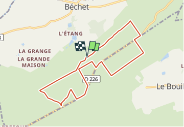
10 km | 12,9 km-effort
Chêne Bossu (Hiver) 8.5 km
neitag61
Benutzer
Länge
8,4 km
Maximale Höhe
403 m
Positive Höhendifferenz
221 m
Km-Effort
11,4 km
Min. Höhe
271 m
Negative Höhendifferenz
221 m
Boucle
Ja
Erstellungsdatum :
2022-03-30 08:30:34.671
Letzte Änderung :
2022-03-30 08:31:37.807
2h35
Schwierigkeit : Medium
Kostenlosegpshiking-Anwendung
Über SityTrail
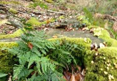
Tour Wandern von 8,4 km verfügbar auf Normandie, Orne, La Ferrière-Béchet. Diese Tour wird von neitag61 vorgeschlagen.
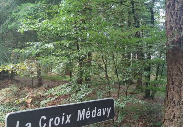
Ort
Land:
France
Region :
Normandie
Abteilung/Provinz :
Orne
Kommune :
La Ferrière-Béchet
Standort:
Unknown
Gehen Sie:(Dec)
Gehen Sie:(UTM)
284191 ; 5383539 (31U) N.
Kommentare
Touren in der Umgebung
La Forêt d'Ecouves
Zu Fuß
Einfach
La Ferrière-Béchet,
Normandie,
Orne,
France
8,1 km | 10,4 km-effort
2h 21min
Nein
Alençon : La Forêt d'Écouves
Wandern
Medium
Le Bouillon,
Normandie,
Orne,
France
13,5 km | 17,5 km-effort
3h 30min
Ja
Le Cercueil
Wandern
Einfach
Le Cercueil,
Normandie,
Orne,
France
12,3 km | 15,1 km-effort
3h 14min
Ja
St Hilaire la Gerard
Wandern
Schwierig
Mortrée,
Normandie,
Orne,
France
11,3 km | 13,2 km-effort
2h 31min
Ja
point culminant de la Normandie
Wandern
Einfach
Le Bouillon,
Normandie,
Orne,
France
4,2 km | 5,1 km-effort
57min
Ja
2019-11 Ecouves VduP
Auto
Saint-Gervais-du-Perron,
Normandie,
Orne,
France
27 km | 33 km-effort
3h 13min
Nein
2019-10-23 Ecouves V du P
Auto
Le Bouillon,
Normandie,
Orne,
France
42 km | 53 km-effort
4h 41min
Ja
Forêt d'Écouves 121019
Wandern
Einfach
(1)
Le Bouillon,
Normandie,
Orne,
France
12,7 km | 15,3 km-effort
5h 22min
Nein