


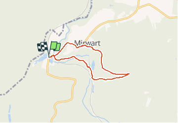


9,6 km | 11,9 km-effort
Randonnées de la Grande Forêt de Saint-Hubert GUIDE+


Kostenlosegpshiking-Anwendung
 SityTrail
IGN / Geografische Institute
SityTrail World
Die Welt öffnet sich für Sie
Tour Wandern von 5,1 km verfügbar auf Wallonien, Luxemburg, Saint-Hubert. Diese Tour wird von La Grande Forêt de Saint-Hubert vorgeschlagen.
C'est une des quatre promenades du domaine provincial de Mirwart.
En partant de la pisciculture, vous passez sous le pont de chemin de fer, puis, en prenant tout de suite sur la droite, vous vous engagez dans une promenade sous le signe du patrimoine historique. Elle commence derrière le Vieux Moulin et longe le bief qui déroutait vers la roue l'eau de la Lomme.
Extrait de la carte de promenade « Au Pays de Saint-Hubert » (30 balades pédestres, 6 circuits VTT – carte topographique 1/25.000) disponible au Royal Syndicat d’Initiative de Saint-Hubert au prix de 8€.
Royal Syndicat d’Initiative de Saint-Hubert
Place du Marché, n°15
B-6870 SAINT-HUBERT
Tél.: 32 (0)61 61 30 10
Fax: 32 (0)61 61 54 44
rsi@saint-hubert-tourisme.be
www.rsi-sainthubert.be
facebook.com/rsisainthubert
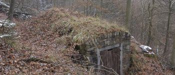
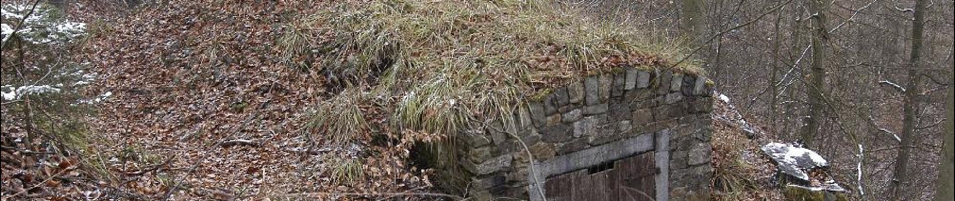
 - Photo 1")
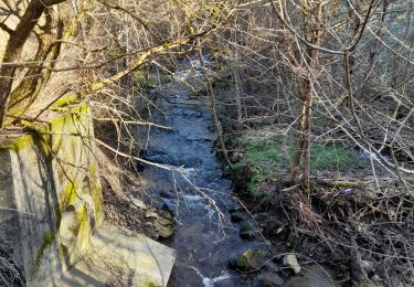
 - Photo 2")

Wandern

Wandern

Wandern
Wandern

Wandern

Wandern

Wandern

Wandern

Zu Fuß
Très belle balade. Bien fléché...