


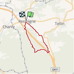


26 km | 33 km-effort
Randonnées de la Grande Forêt de Saint-Hubert GUIDE+


Kostenlosegpshiking-Anwendung
 SityTrail
IGN / Geografische Institute
SityTrail World
Die Welt öffnet sich für Sie
Tour Wandern von 8,2 km verfügbar auf Wallonien, Luxemburg, Tellin. Diese Tour wird von La Grande Forêt de Saint-Hubert vorgeschlagen.
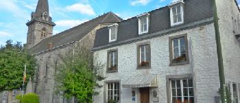
The heritage built in the village of Resteigne deserves to be discussed. In this characteristic village, most of the building used local materials: limestone. This walk will also make you discover the Ry de Glaumont depression from different angles, through a forest route.
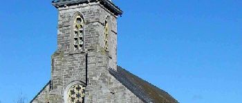
The Resteigne church is a neo-Gothic limestone building built between 1868 and 1871. The adjoining rectory is a classical style house, also built of limestone, dating from 1760. Shortly after leaving the village, you reach the first site Of the Ardenne slope (Dry-les-Miens). This mid-grassy, ??semi-aborous medium grows on calcareous soil. There are some remarkable floral species, such as the small rhinant and the meadow luce. In the wet prairie area grow meadowsweed, yellow iris, aquatic mint and swamp populage.
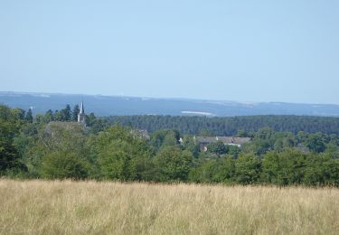
In the localities of Tien and Bossu Oak, the deciduous trees give way to the Scots pine up to the summit of the coast, which is 375 m high. This promontory offers a beautiful clearance on the bottom of the valley of the stream of Glaumont and on the surrounding landscape. The importance of the forest massif provides shelter for large game (wild boars, deer and deer).
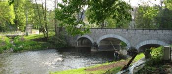
An aulnaie-ash tree runs along the stream, sparing both sides an old wet meadow heavily grazed by large game. Several remarkable species line the Ry de Glaumont. You will see in particular the European lycope, the water pepper, the eagle fern, the spaced sack and the plantain of water. From La Cras'nîre, where the fox makes frequent appearances, at Fosse Hawette, you walk parallel to the Promenade des étangs (see description).
A dirt road runs alongside old hedges of blackthorns and rosehips.
Between the bristles and the Spienchamp the slope contains small pimprenelles, knauties and St. John's wort, while the grassy environment presents a specific vegetation of fragrant blossom and hairy hawk. The presence of the badger has been reported here. A meadow on the right at the end of the route welcomes flowering plants such as primroses, vines, ranunculus and fescues.


Wandern

Wandern

Wandern

Wandern

Wandern

Wandern

Wandern

Wandern

Wandern