![](/images/other/stat-length.png)
Wandeling- P6
Maison du Tourisme Explore Meuse
Vivez Explore Meuse GUIDE+
![Länge](/images/other/stat-length.png)
Länge
7,8 km
![Maximale Höhe](https://static1.geolcdn.com/siteimages/upload/files/1508320355ic_sort_altitude_max_24dp.png)
Maximale Höhe
304 m
![Positive Höhendifferenz](https://static1.geolcdn.com/siteimages/upload/files/1508320355ic_sort_den_pos_24dp.png)
Positive Höhendifferenz
118 m
![Km-Effort](/images/other/stat-length.png)
Km-Effort
9,3 km
![Min. Höhe](https://static1.geolcdn.com/siteimages/upload/files/1508320355ic_sort_altitude_min_24dp.png)
Min. Höhe
240 m
![Negative Höhendifferenz](https://static1.geolcdn.com/siteimages/upload/files/1508320355ic_sort_den_neg_24dp.png)
Negative Höhendifferenz
118 m
![Boucle](https://static1.geolcdn.com/siteimages/upload/files/16400158638029165_repeat_loop_refresh_sync_direction_icon.png)
Boucle
Ja
Erstellungsdatum :
2017-07-11 00:00:00.0
Letzte Änderung :
2017-07-11 00:00:00.0
![Wandern](https://static1.geolcdn.com/sitytour/trail-icons/101.png)
2h01
Schwierigkeit : Sehr leicht
![Scannen Sie diesen QR-Code, um die Tour in der SityTrail-Anwendung zu öffnen](https://capi.geolives.com/qq0zvz2zws4bq2lad0pu/sitytour/trails/364225/qr.png?size=200)
Kostenlosegpshiking-Anwendung
Über SityTrail
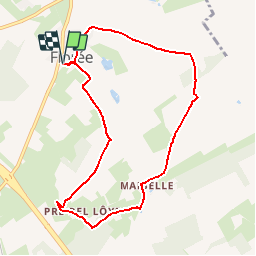
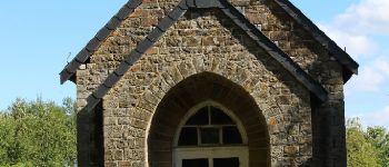
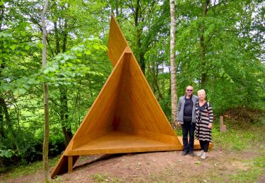
Tour Wandern von 7,8 km verfügbar auf Wallonien, Namur, Assesse. Diese Tour wird von Maison du Tourisme Explore Meuse vorgeschlagen.
Beschreibung
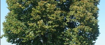
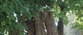
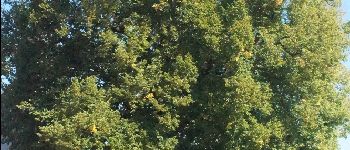
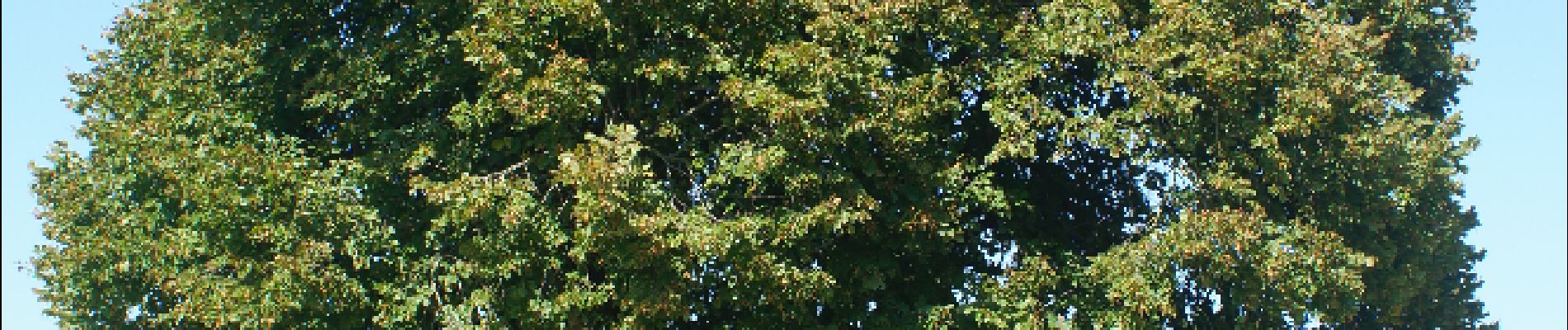
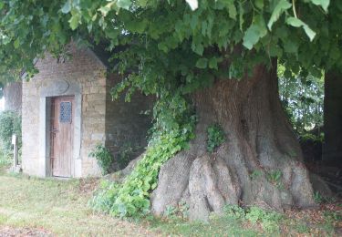
Deze voetganger lus biedt de gelegenheid tot de ontdekking van Florée en zijn gehucht Maibelle, waar een eeuwenoude linde troont.
POIs
Ort
Land:
Belgium
Region :
Wallonien
Abteilung/Provinz :
Namur
Kommune :
Assesse
Standort:
Florée
Gehen Sie:(Dec)
Gehen Sie:(UTM)
647140 ; 5582076 (31U) N.
Kommentare
Touren in der Umgebung
![Tour Wandern Gesves - Sentiers d'Art : Boucle 8 - Gesves - Photo](https://media.geolcdn.com/t/375/260/ext.jpg?maxdim=2&url=https%3A%2F%2Fmedia.geolcdn.com%2Ff%2Faedf2348-d572-49a0-860a-b0031e864a79.JPG)
![Wandern Wandern](https://static1.geolcdn.com/sitytour/trail-icons/101.png)
Sentiers d'Art : Boucle 8 - Gesves
Wandern
Schwierig
(5)
Gesves,
Wallonien,
Namur,
Belgium
![](/images/other/stat-length.png)
12,6 km | 15,6 km-effort
3h 24min
![](https://static1.geolcdn.com/siteimages/upload/files/16400158638029165_repeat_loop_refresh_sync_direction_icon.png)
Ja
![Tour Wandern Gesves - GESVES- Le Pré D'Amite- N°07- Bois - Photo](https://media.geolcdn.com/t/375/260/ext.jpg?maxdim=2&url=https%3A%2F%2Fservices.sitytrail.com%2FGeolivesWS%2FDownloadMedia.ashx%3FTrailID%3D121401%26Media%3D56c27e3a-fec1-4804-be43-ac45373f04b7.jpg)
![Wandern Wandern](https://static1.geolcdn.com/sitytour/trail-icons/101.png)
GESVES- Le Pré D'Amite- N°07- Bois
Wandern
Schwierig
(13)
Gesves,
Wallonien,
Namur,
Belgium
![](/images/other/stat-length.png)
9,4 km | 12,5 km-effort
2h 41min
![](https://static1.geolcdn.com/siteimages/upload/files/16400158638029165_repeat_loop_refresh_sync_direction_icon.png)
Ja
![Tour Wandern Hamois - HAMOIS- Schaltin- Promenade du Bois du Bocq au Colombier - Photo](https://media.geolcdn.com/t/375/260/ext.jpg?maxdim=2&url=https%3A%2F%2Fservices.sitytrail.com%2FGeolivesWS%2FDownloadMedia.ashx%3FTrailID%3D250699%26Media%3Df5fa6a8e-df6b-4e51-95e3-c58e93d30411.jpg)
![Wandern Wandern](https://static1.geolcdn.com/sitytour/trail-icons/101.png)
HAMOIS- Schaltin- Promenade du Bois du Bocq au Colombier
Wandern
Sehr leicht
(6)
Hamois,
Wallonien,
Namur,
Belgium
![](/images/other/stat-length.png)
4,9 km | 5,8 km-effort
1h 15min
![](https://static1.geolcdn.com/siteimages/upload/files/16400158638029165_repeat_loop_refresh_sync_direction_icon.png)
Ja
![Tour Wandern Gesves - SENTIERS D'ART - Grande randonnée - Assesse, Ciney, Gesves, Hamois, Havelange, Ohey et Somme-Leuze - Photo](https://media.geolcdn.com/t/375/260/ext.jpg?maxdim=2&url=https%3A%2F%2Fmedia.geolcdn.com%2Ff%2F8904bd1d-fa8f-461e-ac3c-033a3d63b7b9.JPG)
![Wandern Wandern](https://static1.geolcdn.com/sitytour/trail-icons/101.png)
SENTIERS D'ART - Grande randonnée - Assesse, Ciney, Gesves, Hamois, Havelange...
Wandern
Sehr schwierig
(1)
Gesves,
Wallonien,
Namur,
Belgium
![](/images/other/stat-length.png)
155 km | 193 km-effort
43h 50min
![](https://static1.geolcdn.com/siteimages/upload/files/16400158638029165_repeat_loop_refresh_sync_direction_icon.png)
Ja
![Tour Zu Fuß Hamois - Sentiers d'Art : Boucle 4 Hamois - Schaltin - Photo](https://media.geolcdn.com/t/375/260/ext.jpg?maxdim=2&url=https%3A%2F%2Fmedia.geolcdn.com%2Ff%2F2c7c2e61-e4de-40f0-ab0a-7cb107473369.jpg)
![Zu Fuß Zu Fuß](https://static1.geolcdn.com/sitytour/trail-icons/100.png)
Sentiers d'Art : Boucle 4 Hamois - Schaltin
Zu Fuß
Einfach
(1)
Hamois,
Wallonien,
Namur,
Belgium
![](/images/other/stat-length.png)
13,2 km | 16,3 km-effort
3h 42min
![](https://static1.geolcdn.com/siteimages/upload/files/16400158638029165_repeat_loop_refresh_sync_direction_icon.png)
Ja
![Tour Mountainbike Assesse - Assesse - Wandeling MTB 1 - Photo](https://media.geolcdn.com/t/375/260/ext.jpg?maxdim=2&url=https%3A%2F%2Fservices.sitytrail.com%2FGeolivesWS%2FDownloadMedia.ashx%3FTrailID%3D373170%26Media%3D666ca5d1-88d5-4a8f-b724-161452e3ea3a.JPG)
![Mountainbike Mountainbike](https://static1.geolcdn.com/sitytour/trail-icons/202.png)
Assesse - Wandeling MTB 1
Mountainbike
Medium
(1)
Assesse,
Wallonien,
Namur,
Belgium
![](/images/other/stat-length.png)
27 km | 32 km-effort
2h 7min
![](https://static1.geolcdn.com/siteimages/upload/files/16400158638029165_repeat_loop_refresh_sync_direction_icon.png)
Ja
![Tour Wandern Assesse - Wandeling door Sorinne-la-Longue - Photo](https://media.geolcdn.com/t/375/260/ext.jpg?maxdim=2&url=https%3A%2F%2Fservices.sitytrail.com%2FGeolivesWS%2FDownloadMedia.ashx%3FTrailID%3D369875%26Media%3D666ca5d1-88d5-4a8f-b724-161452e3ea3a.JPG)
![Wandern Wandern](https://static1.geolcdn.com/sitytour/trail-icons/101.png)
Wandeling door Sorinne-la-Longue
Wandern
Einfach
(4)
Assesse,
Wallonien,
Namur,
Belgium
![](/images/other/stat-length.png)
3,3 km | 4,1 km-effort
53min
![](https://static1.geolcdn.com/siteimages/upload/files/16400158638029165_repeat_loop_refresh_sync_direction_icon.png)
Ja
![Tour Wandern Assesse - Wandeling P - Photo](https://media.geolcdn.com/t/375/260/ext.jpg?maxdim=2&url=https%3A%2F%2Fservices.sitytrail.com%2FGeolivesWS%2FDownloadMedia.ashx%3FTrailID%3D364266%26Media%3D139ee766-0dcd-4b76-8caa-502e5e27d825.JPG)
![Wandern Wandern](https://static1.geolcdn.com/sitytour/trail-icons/101.png)
Wandeling P
Wandern
Einfach
(1)
Assesse,
Wallonien,
Namur,
Belgium
![](/images/other/stat-length.png)
9,9 km | 12,1 km-effort
2h 36min
![](https://static1.geolcdn.com/siteimages/upload/files/16400158638029165_repeat_loop_refresh_sync_direction_icon.png)
Ja
![Tour Wandern Assesse - Wandeling P4 - Photo](https://media.geolcdn.com/t/375/260/ext.jpg?maxdim=2&url=https%3A%2F%2Fservices.sitytrail.com%2FGeolivesWS%2FDownloadMedia.ashx%3FTrailID%3D364224%26Media%3D553ccc0e-2fd0-4416-91d4-3016321aead7.JPG)
![Wandern Wandern](https://static1.geolcdn.com/sitytour/trail-icons/101.png)
Wandeling P4
Wandern
Einfach
(2)
Assesse,
Wallonien,
Namur,
Belgium
![](/images/other/stat-length.png)
4,5 km | 5,4 km-effort
1h 10min
![](https://static1.geolcdn.com/siteimages/upload/files/16400158638029165_repeat_loop_refresh_sync_direction_icon.png)
Ja