Tour Wandern Orcières - Roc Diolon par le col de Fressinieres 11/08/23 - Photo

Roc Diolon par le col de Fressinieres 11/08/23

 R@ph
R@ph

Benutzer GUIDE

© OpenStreetMap contributors
Länge
Länge
16,3 km
Maximale Höhe
Maximale Höhe
3044 m
Positive Höhendifferenz
1207 m
Km-Effort
Km-Effort  
32 km
Min. Höhe
Min. Höhe
1867 m
Negative Höhendifferenz
1206 m
Boucle
Boucle
Ja
Erstellungsdatum :
2023-08-11 16:51:11.501
Letzte Änderung :
2023-08-13 19:13:09.332

(0 Nachricht)

Wandern
Wandern
7h21
Schwierigkeit : Sehr schwierig

Scannen Sie diesen QR-Code, um die Tour in der SityTrail-Anwendung zu öffnen

Kostenlosegpshiking-Anwendung

Logo SityTrail SityTrail

IGN / Geografische Institute

SityTrail aus dem App Store herunterladen SityTrail von Google Play herunterladen

Logo SityTrail SityTrail World

Die Welt öffnet sich für Sie

SityTrail aus dem App Store herunterladen SityTrail von Google Play herunterladen SityTrail auf Huawei AppGallery herunterladen

Über SityTrail

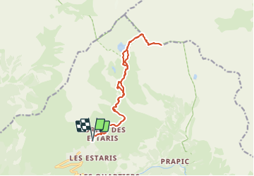
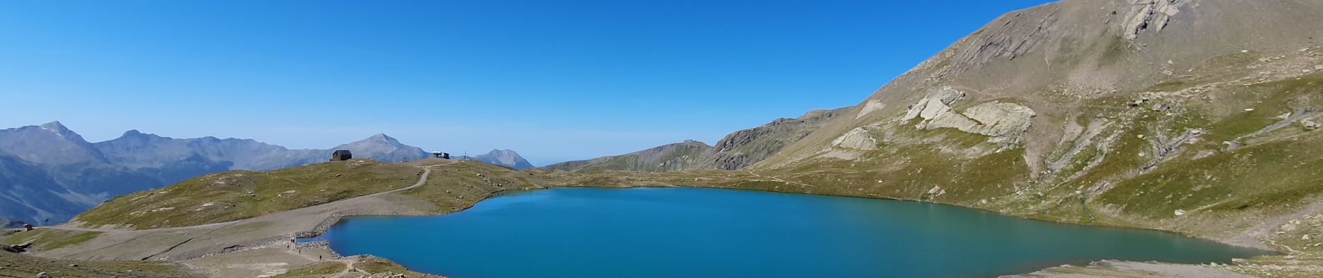
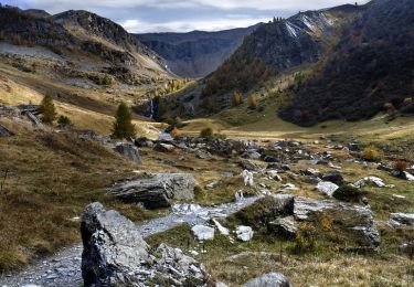
Tour Wandern von 16,3 km verfügbar auf Provence-Alpes-Côte d'Azur, Hochalpen, Orcières. Diese Tour wird von R@ph vorgeschlagen.

Beschreibung

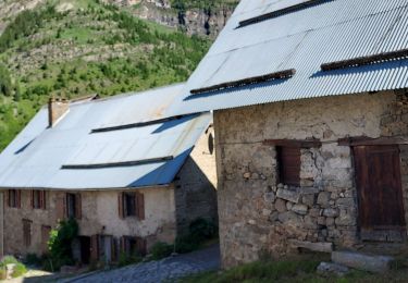
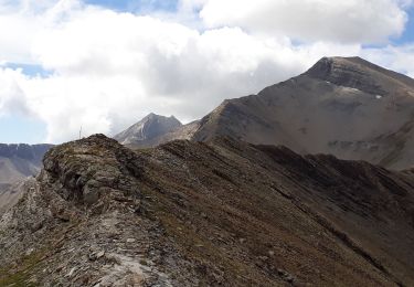
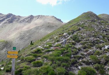
Au départ de la station de Merlette, une randonnée qui passe par les Lacs, Jujal, Sirènes, Jumeaux et grand Estaris, ensuite direction le col de Freissinières puis montée jusqu'au Roc Diolon à 3071 m.
Il s'agit d'une très belle randonnée, sans difficulté technique qui offre au sommet un panorama à 360° magnifique.

Höhenprofil

Foto-Galerie

Ort

Land:
France
Region :
Provence-Alpes-Côte d'Azur
Abteilung/Provinz :
Hochalpen
Kommune :
Orcières
Standort:
Unknown
Gehen Sie:(UTM)
288443 ; 4953104 (32T) N.

Touren in der Umgebung

Tour Wandern Orcières - Le Forest des marches - Photo
Wandern
GUIDE
nadinebondoux

Wandern

Einfach
(2)
Orcières, Provence-Alpes-Côte d'Azur, Hochalpen, France
6,3 km | 9,9 km-effort
1h 42min
Ja
Tour Wandern Orcières - R45   Marmottes a Prapic - Photo
Wandern
GUIDE+

Wandern

Medium
(2)
Orcières, Provence-Alpes-Côte d'Azur, Hochalpen, France
9 km | 14 km-effort
2h 57min
Ja
Tour Wandern Orcières - Orcieres (Hautes Alpes) - Photo
Wandern
ISATR

Wandern

Sehr schwierig
(1)
Orcières, Provence-Alpes-Côte d'Azur, Hochalpen, France
12 km | 19,4 km-effort
4h 24min
Ja
Tour Wandern Orcières - Col des Tourettes - Croix Lorraine 08/09/18 - Photo
Wandern
GUIDE
R@ph

Wandern

Schwierig
Orcières, Provence-Alpes-Côte d'Azur, Hochalpen, France
21 km | 37 km-effort
5h 30min
Ja
Tour Wandern Orcières - Col de Rouannette 22/07/18 - Photo
Wandern
GUIDE
R@ph

Wandern

Medium
Orcières, Provence-Alpes-Côte d'Azur, Hochalpen, France
9,3 km | 20 km-effort
3h 56min
Ja
Tour Wandern Orcières - Prapic Basset Cabane de la Barre - Photo
Wandern
Orage

Wandern

Medium
(1)
Orcières, Provence-Alpes-Côte d'Azur, Hochalpen, France
17,6 km | 30 km-effort
6h 10min
Ja
Tour Wandern Orcières - 08072013 - Photo
Wandern
mikaelerouzic

Wandern

Medium
(1)
Orcières, Provence-Alpes-Côte d'Azur, Hochalpen, France
10,5 km | 17,9 km-effort
2h 36min
Ja
Tour Wandern Orcières - Merlette Les Lacs - Photo
Wandern
frederique.marti@laposte.net

Wandern

Einfach
(1)
Orcières, Provence-Alpes-Côte d'Azur, Hochalpen, France
18,4 km | 32 km-effort
4h 39min
Ja
Tour Schneeschuhwandern Orcières - La recula 31.12.12 - Photo
Schneeschuhwandern
Orage

Schneeschuhwandern

Medium
(3)
Orcières, Provence-Alpes-Côte d'Azur, Hochalpen, France
11,1 km | 25 km-effort
4h 40min
Ja


Schließen
Meine Abonnements