![](/images/other/stat-length.png)
![Tour Wandern Chaumont-Gistoux - #221007 - Vieusart, Bois de Villers, Chêne Copette et Château*** - Photo](https://media.geolcdn.com/t/1900/400/ext.pjpeg?maxdim=2&url=https%3A%2F%2Fmedia.geolcdn.com%2Ff%2F6d28ea8a-ad8c-4c2b-9333-6d3cb55478c2.jpg)
#221007 - Vieusart, Bois de Villers, Chêne Copette et Château***
Randos Ouvertes
Benutzer
![Länge](/images/other/stat-length.png)
Länge
7,7 km
![Maximale Höhe](https://static1.geolcdn.com/siteimages/upload/files/1508320355ic_sort_altitude_max_24dp.png)
Maximale Höhe
142 m
![Positive Höhendifferenz](https://static1.geolcdn.com/siteimages/upload/files/1508320355ic_sort_den_pos_24dp.png)
Positive Höhendifferenz
128 m
![Km-Effort](/images/other/stat-length.png)
Km-Effort
9,4 km
![Min. Höhe](https://static1.geolcdn.com/siteimages/upload/files/1508320355ic_sort_altitude_min_24dp.png)
Min. Höhe
90 m
![Negative Höhendifferenz](https://static1.geolcdn.com/siteimages/upload/files/1508320355ic_sort_den_neg_24dp.png)
Negative Höhendifferenz
126 m
![Boucle](https://static1.geolcdn.com/siteimages/upload/files/16400158638029165_repeat_loop_refresh_sync_direction_icon.png)
Boucle
Ja
Erstellungsdatum :
2024-04-01 14:15:33.016
Letzte Änderung :
2024-04-20 14:12:37.243
![Wandern](https://static1.geolcdn.com/sitytour/trail-icons/101.png)
2h08
Schwierigkeit : Medium
![Scannen Sie diesen QR-Code, um die Tour in der SityTrail-Anwendung zu öffnen](https://capi.geolives.com/qq0zvz2zws4bq2lad0pu/sitytour/trails/4000938/qr.png?size=200)
Kostenlosegpshiking-Anwendung
Über SityTrail
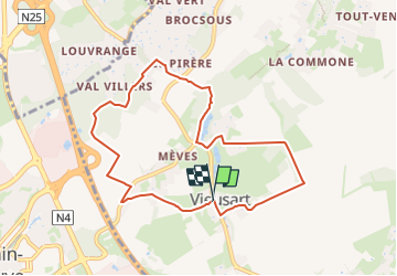
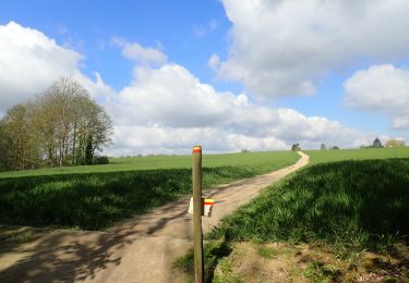
Tour Wandern von 7,7 km verfügbar auf Wallonien, Wallonisch-Brabant, Chaumont-Gistoux. Diese Tour wird von Randos Ouvertes vorgeschlagen.
Beschreibung
Dernière mise à jour : 01/04/2024 Vers km 4,4 sentier 55 dans le bois de Vieusart passage par ravin trop difficile. Remplacé par sentier 45.
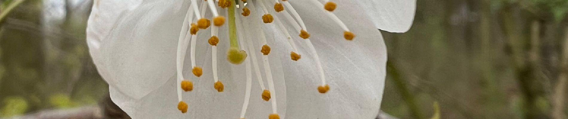
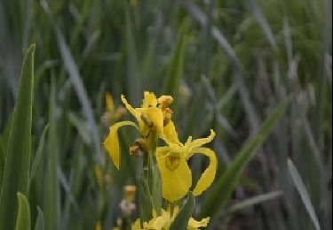
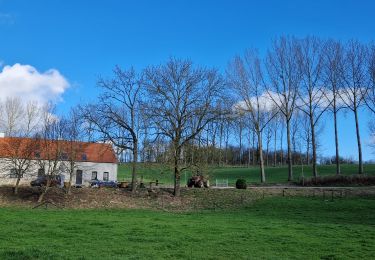
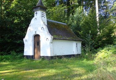
Crédits photos : Sophie Vermote et Corinne van Aubel.
Ort
Land:
Belgium
Region :
Wallonien
Abteilung/Provinz :
Wallonisch-Brabant
Kommune :
Chaumont-Gistoux
Standort:
Unknown
Gehen Sie:(Dec)
Gehen Sie:(UTM)
616444 ; 5614922 (31U) N.
Kommentare
Touren in der Umgebung
![Tour Wandern Ottignies-Louvain-la-Neuve - Nuit du scoutisme - Louvain-la-Neuve - Photo](https://media.geolcdn.com/t/375/260/ext.jpg?maxdim=2&url=https%3A%2F%2Fmedia.geolcdn.com%2Ff%2Fa66232ef-7471-42b4-b6aa-97b05d528647.jpg)
![Wandern Wandern](https://static1.geolcdn.com/sitytour/trail-icons/101.png)
Nuit du scoutisme - Louvain-la-Neuve
Wandern
Medium
(16)
Ottignies-Louvain-la-Neuve,
Wallonien,
Wallonisch-Brabant,
Belgium
![](/images/other/stat-length.png)
5,7 km | 6,7 km-effort
1h 27min
![](https://static1.geolcdn.com/siteimages/upload/files/16400158638029165_repeat_loop_refresh_sync_direction_icon.png)
Ja
![Tour Wandern Chaumont-Gistoux - De Dion-le Mont à Dion-le Val par la vallée du Pisselet - Photo](https://media.geolcdn.com/t/375/260/ext.jpg?maxdim=2&url=https%3A%2F%2Fstatic1.geolcdn.com%2Fsiteimages%2Fupload%2Ffiles%2F1553511878bg_sport_marche.png)
![Wandern Wandern](https://static1.geolcdn.com/sitytour/trail-icons/101.png)
De Dion-le Mont à Dion-le Val par la vallée du Pisselet
Wandern
Sehr leicht
(8)
Chaumont-Gistoux,
Wallonien,
Wallonisch-Brabant,
Belgium
![](/images/other/stat-length.png)
8,6 km | 10,3 km-effort
2h 0min
![](https://static1.geolcdn.com/siteimages/upload/files/16400158638029165_repeat_loop_refresh_sync_direction_icon.png)
Ja
![Tour Wandern Mont-Saint-Guibert - Balade à Mont-Saint-Guibert - Photo](https://media.geolcdn.com/t/375/260/ext.jpg?maxdim=2&url=https%3A%2F%2Fservices.sitytrail.com%2FGeolivesWS%2FDownloadMedia.ashx%3FTrailID%3D942864%26Media%3D4a857fe0-cf43-4eb8-b563-62b2b90d4fc2.jpg)
![Wandern Wandern](https://static1.geolcdn.com/sitytour/trail-icons/101.png)
Balade à Mont-Saint-Guibert
Wandern
Sehr leicht
(1)
Mont-Saint-Guibert,
Wallonien,
Wallonisch-Brabant,
Belgium
![](/images/other/stat-length.png)
8,4 km | 10,1 km-effort
2h 12min
![](https://static1.geolcdn.com/siteimages/upload/files/16400158638029165_repeat_loop_refresh_sync_direction_icon.png)
Ja
![Tour Wandern Ottignies-Louvain-la-Neuve - Balade dans le Bois de Lauzelle - Photo](https://media.geolcdn.com/t/375/260/ext.jpg?maxdim=2&url=https%3A%2F%2Fservices.sitytrail.com%2FGeolivesWS%2FDownloadMedia.ashx%3FTrailID%3D652718%26Media%3Dfe46824b-6e61-4100-b5d8-1f34a923c154.jpg)
![Wandern Wandern](https://static1.geolcdn.com/sitytour/trail-icons/101.png)
Balade dans le Bois de Lauzelle
Wandern
Sehr leicht
(1)
Ottignies-Louvain-la-Neuve,
Wallonien,
Wallonisch-Brabant,
Belgium
![](/images/other/stat-length.png)
6,3 km | 8,1 km-effort
1h 44min
![](https://static1.geolcdn.com/siteimages/upload/files/16400158638029165_repeat_loop_refresh_sync_direction_icon.png)
Ja
![Tour Wandern Ottignies-Louvain-la-Neuve - Lauzelle - Circuit Natura 2000, des sites qui valent le détour ! - Bw01 - Photo](https://media.geolcdn.com/t/375/260/ext.jpg?maxdim=2&url=https%3A%2F%2Fmedia.geolcdn.com%2Ff%2F648550f3-d9ef-4b6f-9933-939a57e593f5.JPG)
![Wandern Wandern](https://static1.geolcdn.com/sitytour/trail-icons/101.png)
Lauzelle - Circuit Natura 2000, des sites qui valent le détour ! - Bw01
Wandern
Einfach
(2)
Ottignies-Louvain-la-Neuve,
Wallonien,
Wallonisch-Brabant,
Belgium
![](/images/other/stat-length.png)
3,8 km | 4,8 km-effort
1h 26min
![](https://static1.geolcdn.com/siteimages/upload/files/16400158638029165_repeat_loop_refresh_sync_direction_icon.png)
Ja
![Tour Wandern Chaumont-Gistoux - #240301 - Ocquière - Photo](https://media.geolcdn.com/t/375/260/ext.jpg?maxdim=2&url=https%3A%2F%2Fmedia.geolcdn.com%2Ff%2F23a7770d-5e35-45ed-9cb6-b2850e27c8e4.JPG)
![Wandern Wandern](https://static1.geolcdn.com/sitytour/trail-icons/101.png)
#240301 - Ocquière
Wandern
Medium
(1)
Chaumont-Gistoux,
Wallonien,
Wallonisch-Brabant,
Belgium
![](/images/other/stat-length.png)
5,2 km | 6,2 km-effort
1h 24min
![](https://static1.geolcdn.com/siteimages/upload/files/16400158638029165_repeat_loop_refresh_sync_direction_icon.png)
Ja
![Tour Wandern Chaumont-Gistoux - #231016 - Corroy-Le-Grand et le Val d'Ocquière*** (inversé court) - Photo](https://media.geolcdn.com/t/375/260/ext.jpg?maxdim=2&url=https%3A%2F%2Fmedia.geolcdn.com%2Ff%2Fb650de28-d96e-49f2-85c2-d640aecfc352.jpg)
![Wandern Wandern](https://static1.geolcdn.com/sitytour/trail-icons/101.png)
#231016 - Corroy-Le-Grand et le Val d'Ocquière*** (inversé court)
Wandern
Medium
(2)
Chaumont-Gistoux,
Wallonien,
Wallonisch-Brabant,
Belgium
![](/images/other/stat-length.png)
6,2 km | 7,2 km-effort
1h 38min
![](https://static1.geolcdn.com/siteimages/upload/files/16400158638029165_repeat_loop_refresh_sync_direction_icon.png)
Ja
![Tour Wandern Chaumont-Gistoux - #210507 Dion-le-Mont, Pisselet et Louvranges - Photo](https://media.geolcdn.com/t/375/260/ext.jpg?maxdim=2&url=https%3A%2F%2Fmedia.geolcdn.com%2Ff%2Fd47a499a-2fb6-4522-b89e-f74658341ac6.JPG)
![Wandern Wandern](https://static1.geolcdn.com/sitytour/trail-icons/101.png)
#210507 Dion-le-Mont, Pisselet et Louvranges
Wandern
Medium
(1)
Chaumont-Gistoux,
Wallonien,
Wallonisch-Brabant,
Belgium
![](/images/other/stat-length.png)
6,5 km | 7,9 km-effort
2h 12min
![](https://static1.geolcdn.com/siteimages/upload/files/16400158638029165_repeat_loop_refresh_sync_direction_icon.png)
Ja
![Tour Zu Fuß Chaumont-Gistoux - #181126 - Bonlez, Bois et réserve naturelle de l'Étoile *** - Photo](https://media.geolcdn.com/t/375/260/ext.jpg?maxdim=2&url=https%3A%2F%2Fmedia.geolcdn.com%2Ff%2Fe6921239-6035-439e-aefa-1c0bf06b92ef.JPG)
![Zu Fuß Zu Fuß](https://static1.geolcdn.com/sitytour/trail-icons/100.png)
#181126 - Bonlez, Bois et réserve naturelle de l'Étoile ***
Zu Fuß
Einfach
(1)
Chaumont-Gistoux,
Wallonien,
Wallonisch-Brabant,
Belgium
![](/images/other/stat-length.png)
8,4 km | 10,6 km-effort
2h 10min
![](https://static1.geolcdn.com/siteimages/upload/files/16400158638029165_repeat_loop_refresh_sync_direction_icon.png)
Ja