Tour Wandern Villers-Cotterêts - en forêt de Retz_43_la laie des Pots_1 - Photo

en forêt de Retz_43_la laie des Pots_1

forêts de France

© OpenStreetMap contributors
Länge
Länge
24 km
Maximale Höhe
Maximale Höhe
240 m
Positive Höhendifferenz
432 m
Km-Effort
Km-Effort  
30 km
Min. Höhe
Min. Höhe
134 m
Negative Höhendifferenz
431 m
Boucle
Boucle
Ja
Erstellungsdatum :
2017-03-06 00:00:00.0
Letzte Änderung :
2020-11-08 11:58:26.528

(0 Nachricht)

Wandern
Wandern
8h02
Schwierigkeit : Sehr schwierig

Scannen Sie diesen QR-Code, um die Tour in der SityTrail-Anwendung zu öffnen

Kostenlosegpshiking-Anwendung

Logo SityTrail SityTrail

IGN / Geografische Institute

SityTrail aus dem App Store herunterladen SityTrail von Google Play herunterladen

Logo SityTrail SityTrail World

Die Welt öffnet sich für Sie

SityTrail aus dem App Store herunterladen SityTrail von Google Play herunterladen SityTrail auf Huawei AppGallery herunterladen

Über SityTrail

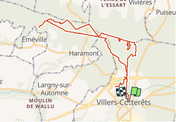
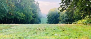
Tour Wandern von 24 km verfügbar auf Nordfrankreich, Aisne, Villers-Cotterêts. Diese Tour wird von en forêt de Retz vorgeschlagen.

Beschreibung

voir aussi:
http://foret-de-retz.over-blog.com/

03/2016

batterie pour iphone indispensable.

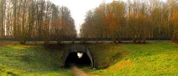
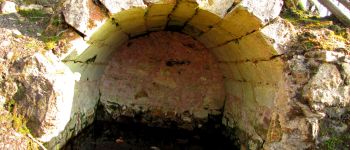
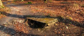
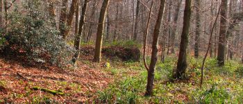
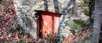
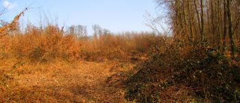
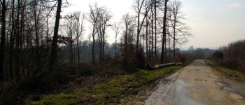
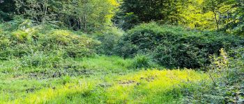
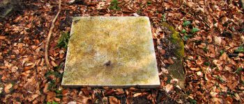
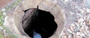
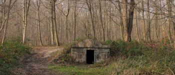
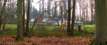
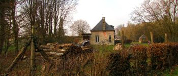
Objectif: relever les coordonnées GPS des regards à voûtes de la laie des Pots. Donc exploration ...

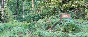
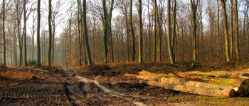
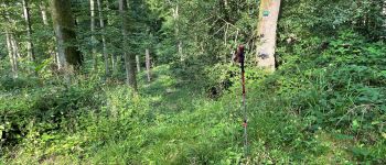
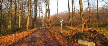
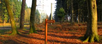
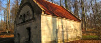
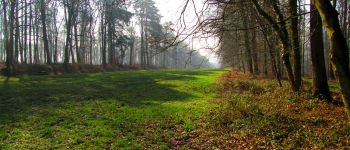
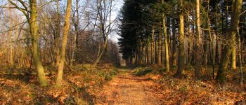
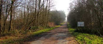
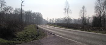
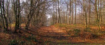
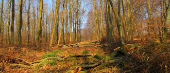
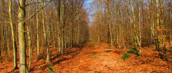
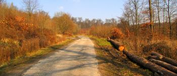
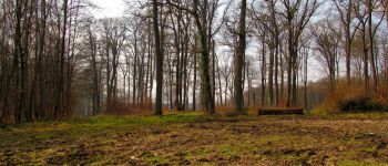
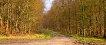
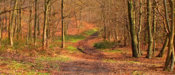
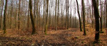
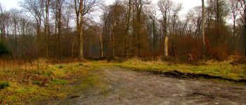
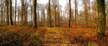
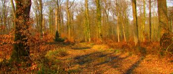
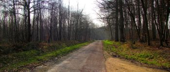
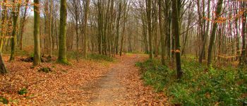
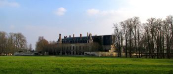
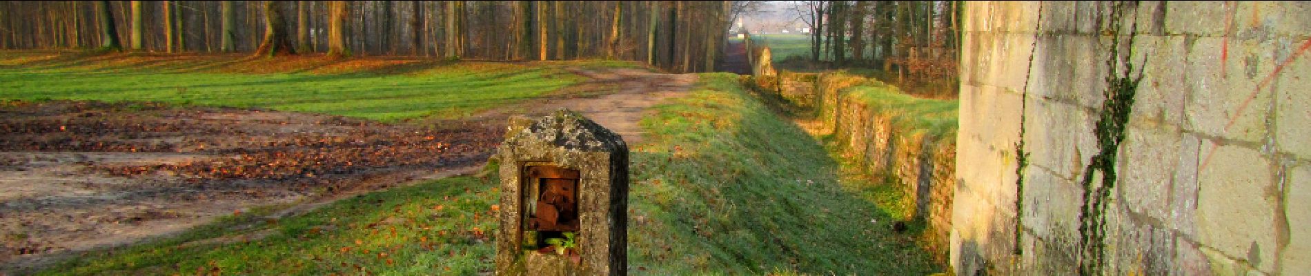
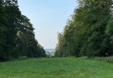
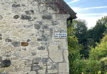
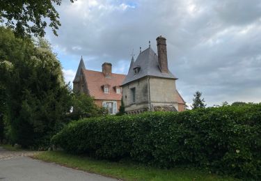
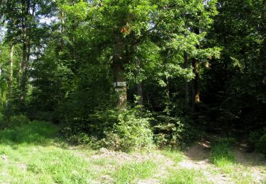
Au départ du Château de François 1er, suivre l'allée Royale, passer sous la N2 puis prendre à droite la route de Chavigny après le carrefour de Penthièvre et remonter vers la route du Faîte par la laie de Saint-Hubert. Exploration. Prendre à gauche (exploration) le chemin qui mène à l'Ermitage Saint-Hubert. Rejoindre l'allée Royale à droite et remonter vers la route du Faîte (exploration). Continuer sur la route du Faîte (exploration au carrefour de la Queue de Retz) jusqu'au carrefour des Quatre Gardes. Prendre à gauche la laie de l'Ancien Mur du Parc jusqu'au carrefour de la Brèche. Continuer à droite la laie de la Brèche jusqu'au carrefour de Vauquebert. Prendre à gauche la laie des Crapaudières jusqu'au carrefour "laie des Crapaudières-laie dite Route de la Croix Morel".  Prendre à droite la laie dite de la Croix Morel jusqu'à la Maison Forestière de la Croix Morel. Prendre à gauche la laie de Vauquebert puis exploration en limite des parcelles 341-342. Au carrefour d'Emeville, continuer à gauche sur la route de la Gare jusqu'au Réservoir. Revenir puis prendre à droite la laie du Petit Bois d'Haramont jusqu'à la D973. Continuer sur la laie des Pots jusqu'à l'allée Royale. Passer sous la N2. Prendre à droite le chemin pour voir les Maisons Forestières de la Pépinière et de la Faisanderie puis la nécropole 14-18. Revenir au Château de François 1er.

Höhenprofil

POIs

POI Villers-Cotterêts - Point 1 - Photo
JeanLucA4
VILLERS-COTTERÊTS 
POI Villers-Cotterêts - Point 2 - Photo
JeanLucA4
VILLERS-COTTERÊTS 
POI Villers-Cotterêts - Unnamed POI - Photo
JeanLucA4
VILLERS-COTTERÊTS 
POI Villers-Cotterêts - Unnamed POI - Photo
JeanLucA4
VILLERS-COTTERÊTS 
POI Villers-Cotterêts - Unnamed POI - Photo
JeanLucA4
VILLERS-COTTERÊTS 
POI Villers-Cotterêts - Point 6 - Photo
JeanLucA4
VILLERS-COTTERÊTS 
POI Villers-Cotterêts - Unnamed POI - Photo
JeanLucA4
VILLERS-COTTERÊTS 
POI Villers-Cotterêts - Point 8 - Photo
JeanLucA4
VILLERS-COTTERÊTS 
POI Villers-Cotterêts - Unnamed POI - Photo
JeanLucA4
VILLERS-COTTERÊTS 
POI Villers-Cotterêts - Point 10 - Photo
JeanLucA4
VILLERS-COTTERÊTS 
POI Villers-Cotterêts - Point 11 - Photo
JeanLucA4
VILLERS-COTTERÊTS 
POI Villers-Cotterêts - Point 12 - Photo
JeanLucA4
VILLERS-COTTERÊTS 
POI Villers-Cotterêts - Point 13 - Photo
JeanLucA4
VILLERS-COTTERÊTS 
POI Vivières - Point 14 - Photo
JeanLucA4
VIVIÈRES 
POI Vivières - Point 15 - Photo
JeanLucA4
VIVIÈRES 
POI Vivières - Point 16 - Photo
JeanLucA4
VIVIÈRES 
POI Vivières - Point 17 - Photo
JeanLucA4
VIVIÈRES 
POI Largny-sur-Automne - Point 18 - Photo
JeanLucA4
LARGNY-SUR-AUTOMNE 
POI Haramont - Point 19 - Photo
JeanLucA4
HARAMONT 
POI Haramont - Point 20 - Photo
JeanLucA4
HARAMONT 
POI Haramont - Point 21 - Photo
JeanLucA4
HARAMONT 
POI Haramont - Point 22 - Photo
JeanLucA4
HARAMONT 
POI Haramont - Point 23 - Photo
JeanLucA4
HARAMONT 
POI Haramont - Point 24 - Photo
JeanLucA4
HARAMONT 
POI Haramont - Point 26 - Photo
JeanLucA4
HARAMONT 
POI Haramont - Point 25 - Photo
JeanLucA4
HARAMONT 
POI Haramont - Point 27 - Photo
JeanLucA4
HARAMONT 
POI Haramont - Point 28 - Photo
JeanLucA4
HARAMONT 
POI Haramont - Point 29 - Photo
JeanLucA4
HARAMONT 
POI Haramont - Point 30 - Photo
JeanLucA4
HARAMONT 
POI Haramont - Unnamed POI - Photo
JeanLucA4
HARAMONT 
POI Haramont - Point 32 - Photo
JeanLucA4
HARAMONT 
POI Haramont - Point 33 - Photo
JeanLucA4
HARAMONT 
POI Haramont - Unnamed POI - Photo
JeanLucA4
HARAMONT 
POI Largny-sur-Automne - Point 35 - Photo
JeanLucA4
LARGNY-SUR-AUTOMNE 
POI Largny-sur-Automne - Point 36 - Photo
JeanLucA4
LARGNY-SUR-AUTOMNE 
POI Largny-sur-Automne - Point 37 - Photo
JeanLucA4
LARGNY-SUR-AUTOMNE 
POI Villers-Cotterêts - Point 38 - Photo
JeanLucA4
VILLERS-COTTERÊTS 
POI Villers-Cotterêts - Point 39 - Photo
JeanLucA4
VILLERS-COTTERÊTS 
POI Villers-Cotterêts - Point 40 - Photo
JeanLucA4
VILLERS-COTTERÊTS 
POI Villers-Cotterêts - Point 41 - Photo
JeanLucA4
VILLERS-COTTERÊTS 
POI Villers-Cotterêts - Point 42 - Photo
JeanLucA4
VILLERS-COTTERÊTS 
POI Villers-Cotterêts - Point 43 - Photo
JeanLucA4
VILLERS-COTTERÊTS 
POI Villers-Cotterêts - Point 44 - Photo
JeanLucA4
VILLERS-COTTERÊTS 
POI Villers-Cotterêts - Unnamed POI - Photo
JeanLucA4
VILLERS-COTTERÊTS 
POI Villers-Cotterêts - Point 46 - Photo
JeanLucA4
VILLERS-COTTERÊTS 
POI Villers-Cotterêts - Point 47 - Photo
JeanLucA4
VILLERS-COTTERÊTS 
POI Villers-Cotterêts - départ - Photo
JeanLucA4
VILLERS-COTTERÊTS 
POI Villers-Cotterêts - Arrivée - Photo
JeanLucA4
VILLERS-COTTERÊTS 

Ort

Land:
France
Region :
Nordfrankreich
Abteilung/Provinz :
Aisne
Kommune :
Villers-Cotterêts
Standort:
Unknown
Gehen Sie:(Dec)
Gehen Sie:(UTM)
506881 ; 5455793 (31U) N.

Touren in der Umgebung

Tour Wandern Fleury - en Forêt de Retz_92_05_2022_Rond d'Orléans_Chapeau des Cordeliers_la Laie des étangs de Longpont - Photo
Wandern

Wandern

Medium
Fleury, Nordfrankreich, Aisne, France
9,2 km | 10,9 km-effort
2h 46min
Ja
Tour Zu Fuß Puiseux-en-Retz - Route du Faîte - Photo
Zu Fuß
PRO

Zu Fuß

Einfach
Puiseux-en-Retz, Nordfrankreich, Aisne, France
5,8 km | 7,1 km-effort
1h 37min
Nein
Tour Wandern Largny-sur-Automne - en Forêt de Retz_90_09_2021_la Selve - Photo
Wandern

Wandern

Medium
Largny-sur-Automne, Nordfrankreich, Aisne, France
6,2 km | 7,8 km-effort
1h 52min
Ja
Tour Wandern Villers-Cotterêts - en Forêt de Retz_89_09_2021_les Ventes Racines et le Chablis des Bouleaux - Photo
Wandern

Wandern

Medium
Villers-Cotterêts, Nordfrankreich, Aisne, France
10,2 km | 12,1 km-effort
3h 14min
Ja
Tour Wandern Villers-Cotterêts - Domaine de Coyolles - Photo
Wandern
TURLUPIN2010

Wandern

Medium
Villers-Cotterêts, Nordfrankreich, Aisne, France
14,3 km | 16,3 km-effort
3h 0min
Ja
Tour Wandern Vivières - en Forêt de Retz_88_autour du Regard Saint-Hubert et du Rond de la Reine - Photo
Wandern

Wandern

Sehr schwierig
Vivières, Nordfrankreich, Aisne, France
12,3 km | 15,5 km-effort
4h 36min
Ja
Tour Wandern Villers-Cotterêts - en forêt de Retz_87_la Laie des Masures par la Route Chrétiennette - Photo
Wandern

Wandern

Sehr schwierig
Villers-Cotterêts, Nordfrankreich, Aisne, France
12 km | 15 km-effort
3h 57min
Ja
Tour Wandern Oigny-en-Valois - en forêt de Retz_86_les Laies de la Poudrerie et de la Fosse aux Demoiselles - Photo
Wandern

Wandern

Schwierig
Oigny-en-Valois, Nordfrankreich, Aisne, France
12,3 km | 15,1 km-effort
3h 44min
Ja
Tour Wandern Dampleux - en forêt de Retz_82_sur les Routes de la Bruyère aux Loups et de la Chrétiennette - Photo
Wandern

Wandern

Schwierig
Dampleux, Nordfrankreich, Aisne, France
17,5 km | 21 km-effort
5h 38min
Ja


Schließen
Meine Abonnements