![](/images/other/stat-length.png)
Balade à Resteigne
Desrumaux
Benutzer GUIDE
![Länge](/images/other/stat-length.png)
Länge
12,6 km
![Maximale Höhe](https://static1.geolcdn.com/siteimages/upload/files/1508320355ic_sort_altitude_max_24dp.png)
Maximale Höhe
288 m
![Positive Höhendifferenz](https://static1.geolcdn.com/siteimages/upload/files/1508320355ic_sort_den_pos_24dp.png)
Positive Höhendifferenz
273 m
![Km-Effort](/images/other/stat-length.png)
Km-Effort
16,2 km
![Min. Höhe](https://static1.geolcdn.com/siteimages/upload/files/1508320355ic_sort_altitude_min_24dp.png)
Min. Höhe
169 m
![Negative Höhendifferenz](https://static1.geolcdn.com/siteimages/upload/files/1508320355ic_sort_den_neg_24dp.png)
Negative Höhendifferenz
273 m
![Boucle](https://static1.geolcdn.com/siteimages/upload/files/16400158638029165_repeat_loop_refresh_sync_direction_icon.png)
Boucle
Ja
Erstellungsdatum :
2017-05-22 00:00:00.0
Letzte Änderung :
2017-05-22 00:00:00.0
![Wandern](https://static1.geolcdn.com/sitytour/trail-icons/101.png)
3h32
Schwierigkeit : Einfach
![Scannen Sie diesen QR-Code, um die Tour in der SityTrail-Anwendung zu öffnen](https://capi.geolives.com/qq0zvz2zws4bq2lad0pu/sitytour/trails/757564/qr.png?size=200)
Kostenlosegpshiking-Anwendung
Über SityTrail
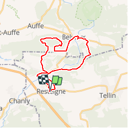
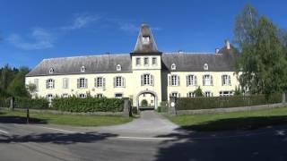
Tour Wandern von 12,6 km verfügbar auf Wallonien, Luxemburg, Tellin. Diese Tour wird von Desrumaux vorgeschlagen.
Beschreibung
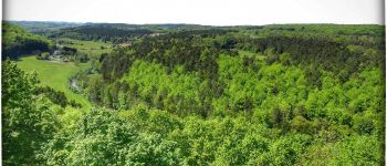
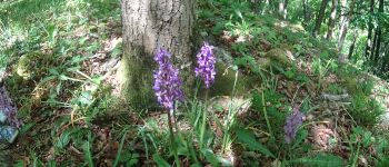
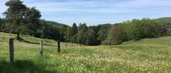
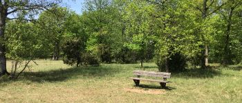
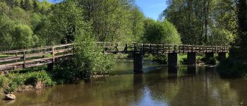
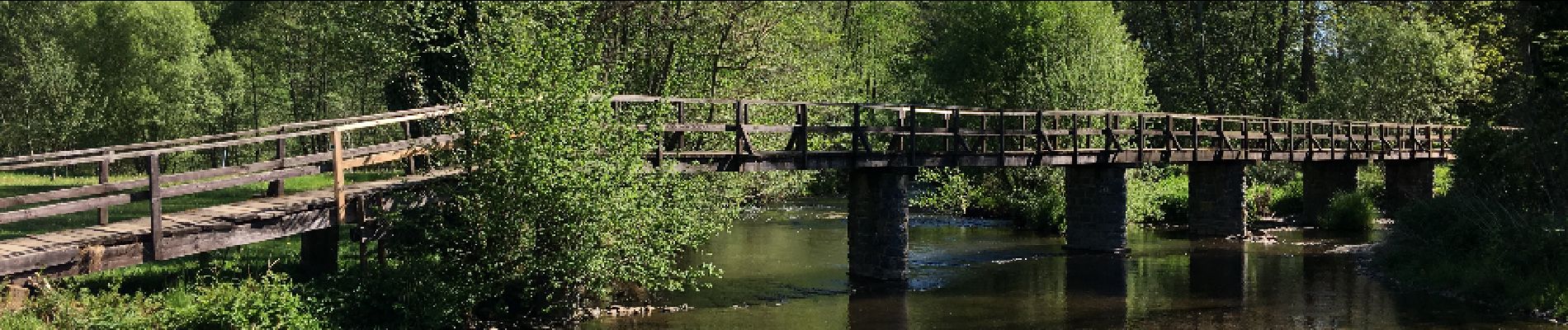
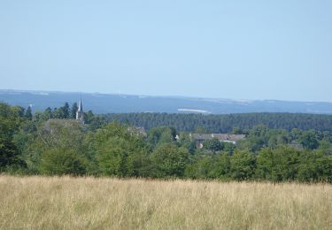
Balade dans la belle entité de Tellin dans la province du Luxembourg.
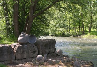
De Resteigne à Belvaux par la réserve naturelle Lesse et Lomme et le point de vue du Rocher qui pic. Départ: église de Resteigne
Ort
Land:
Belgium
Region :
Wallonien
Abteilung/Provinz :
Luxemburg
Kommune :
Tellin
Standort:
Resteigne
Gehen Sie:(Dec)
Gehen Sie:(UTM)
655766 ; 5550104 (31U) N.
Kommentare
Touren in der Umgebung
![Tour Wandern Wellin - RB-Lu-25_Wellin - Photo](https://media.geolcdn.com/t/375/260/ext.jpg?maxdim=2&url=https%3A%2F%2Fmedia.geolcdn.com%2Ff%2F6f55a51e-bf83-4bc1-a599-4dae86645acf.JPG)
![Wandern Wandern](https://static1.geolcdn.com/sitytour/trail-icons/101.png)
RB-Lu-25_Wellin
Wandern
Sehr leicht
(5)
Wellin,
Wallonien,
Luxemburg,
Belgium
![](/images/other/stat-length.png)
26 km | 33 km-effort
6h 46min
![](https://static1.geolcdn.com/siteimages/upload/files/16400158638029165_repeat_loop_refresh_sync_direction_icon.png)
Ja
![Tour Wandern Rochefort - Nature - The view from the Belvédère in Han-sur-Lesse - Photo](https://media.geolcdn.com/t/375/260/ext.jpg?maxdim=2&url=https%3A%2F%2Fservices.sitytrail.com%2FGeolivesWS%2FDownloadMedia.ashx%3FTrailID%3D193579%26Media%3D5797bc56-5327-4c2b-b581-d88d672bf775.jpg)
![Wandern Wandern](https://static1.geolcdn.com/sitytour/trail-icons/101.png)
Nature - The view from the Belvédère in Han-sur-Lesse
Wandern
Schwierig
(16)
Rochefort,
Wallonien,
Namur,
Belgium
![](/images/other/stat-length.png)
4,8 km | 6,3 km-effort
1h 20min
![](https://static1.geolcdn.com/siteimages/upload/files/16400158638029165_repeat_loop_refresh_sync_direction_icon.png)
Ja
![Tour Wandern Tellin - Tellin. Natura 2000, des sites qui valent le détour ! Lx 7 - Photo](https://media.geolcdn.com/t/375/260/ext.jpg?maxdim=2&url=https%3A%2F%2Fservices.sitytrail.com%2FGeolivesWS%2FDownloadMedia.ashx%3FTrailID%3D139723%26Media%3D4b6cd866-c01c-4092-b3ae-893d48db31d3.JPG)
![Wandern Wandern](https://static1.geolcdn.com/sitytour/trail-icons/101.png)
Tellin. Natura 2000, des sites qui valent le détour ! Lx 7
Wandern
Medium
(6)
Tellin,
Wallonien,
Luxemburg,
Belgium
![](/images/other/stat-length.png)
9,6 km | 11,9 km-effort
1h 30min
![](https://static1.geolcdn.com/siteimages/upload/files/16400158638029165_repeat_loop_refresh_sync_direction_icon.png)
Ja
![Tour Wandern Wellin - Wéry_Variante (WE 06) - Photo](https://media.geolcdn.com/t/375/260/ext.jpg?maxdim=2&url=https%3A%2F%2Fservices.sitytrail.com%2FGeolivesWS%2FDownloadMedia.ashx%3FTrailID%3D334441%26Media%3D69ef9e8a-0435-41bc-a5d3-d329c2516b48.JPG)
![Wandern Wandern](https://static1.geolcdn.com/sitytour/trail-icons/101.png)
Wéry_Variante (WE 06)
Wandern
Schwierig
(5)
Wellin,
Wallonien,
Luxemburg,
Belgium
![](/images/other/stat-length.png)
11,4 km | 15,5 km-effort
3h 30min
![](https://static1.geolcdn.com/siteimages/upload/files/16400158638029165_repeat_loop_refresh_sync_direction_icon.png)
Ja
![Tour Wandern Rochefort - RB-Na-07 Raccourci - Ronde au pays des grottes - Photo](https://media.geolcdn.com/t/375/260/ext.jpg?maxdim=2&url=https%3A%2F%2Fservices.sitytrail.com%2FGeolivesWS%2FDownloadMedia.ashx%3FTrailID%3D213757%26Media%3D27dc9085-0323-4669-9df4-56be0512bfe6.jpg)
![Wandern Wandern](https://static1.geolcdn.com/sitytour/trail-icons/101.png)
RB-Na-07 Raccourci - Ronde au pays des grottes
Wandern
Einfach
(9)
Rochefort,
Wallonien,
Namur,
Belgium
![](/images/other/stat-length.png)
18,4 km | 24 km-effort
4h 59min
![](https://static1.geolcdn.com/siteimages/upload/files/16400158638029165_repeat_loop_refresh_sync_direction_icon.png)
Ja
![Tour Wandern Rochefort - Nature : Belvaux -Les Rouges-Gorges (the robins) - Photo](https://media.geolcdn.com/t/375/260/ext.jpg?maxdim=2&url=https%3A%2F%2Fservices.sitytrail.com%2FGeolivesWS%2FDownloadMedia.ashx%3FTrailID%3D262701%26Media%3D8d8e8ae8-731b-4f5d-ad26-e3a028302c41.jpg)
![Wandern Wandern](https://static1.geolcdn.com/sitytour/trail-icons/101.png)
Nature : Belvaux -Les Rouges-Gorges (the robins)
Wandern
Einfach
(8)
Rochefort,
Wallonien,
Namur,
Belgium
![](/images/other/stat-length.png)
6,5 km | 8,4 km-effort
1h 20min
![](https://static1.geolcdn.com/siteimages/upload/files/16400158638029165_repeat_loop_refresh_sync_direction_icon.png)
Ja
![Tour Wandern Rochefort - Nature : Belvaux -Les Rouges-Gorges (the robins) - Photo](https://media.geolcdn.com/t/375/260/ext.jpg?maxdim=2&url=https%3A%2F%2Fservices.sitytrail.com%2FGeolivesWS%2FDownloadMedia.ashx%3FTrailID%3D183910%26Media%3D410abbc6-7c13-4109-b7d7-92f0aeb383e2.jpg)
![Wandern Wandern](https://static1.geolcdn.com/sitytour/trail-icons/101.png)
Nature : Belvaux -Les Rouges-Gorges (the robins)
Wandern
Einfach
(13)
Rochefort,
Wallonien,
Namur,
Belgium
![](/images/other/stat-length.png)
5,8 km | 7,6 km-effort
1h 20min
![](https://static1.geolcdn.com/siteimages/upload/files/16400158638029165_repeat_loop_refresh_sync_direction_icon.png)
Ja
![Tour Wandern Rochefort - Nature - A discovery trail through Han-sur-Lesse - Photo](https://media.geolcdn.com/t/375/260/ext.jpg?maxdim=2&url=https%3A%2F%2Fservices.sitytrail.com%2FGeolivesWS%2FDownloadMedia.ashx%3FTrailID%3D148989%26Media%3D3c202c2f-ee01-4903-bd25-24913ec8637b.jpg)
![Wandern Wandern](https://static1.geolcdn.com/sitytour/trail-icons/101.png)
Nature - A discovery trail through Han-sur-Lesse
Wandern
Sehr leicht
(15)
Rochefort,
Wallonien,
Namur,
Belgium
![](/images/other/stat-length.png)
4,8 km | 5,8 km-effort
1h 15min
![](https://static1.geolcdn.com/siteimages/upload/files/16400158638029165_repeat_loop_refresh_sync_direction_icon.png)
Ja
![Tour Wandern Rochefort - Nature : Belvaux -Les Rouges-Gorges (the robins) - Photo](https://media.geolcdn.com/t/375/260/ext.jpg?maxdim=2&url=https%3A%2F%2Fservices.sitytrail.com%2FGeolivesWS%2FDownloadMedia.ashx%3FTrailID%3D635109%26Media%3D8d8e8ae8-731b-4f5d-ad26-e3a028302c41.jpg)
![Wandern Wandern](https://static1.geolcdn.com/sitytour/trail-icons/101.png)
Nature : Belvaux -Les Rouges-Gorges (the robins)
Wandern
Einfach
(3)
Rochefort,
Wallonien,
Namur,
Belgium
![](/images/other/stat-length.png)
5,8 km | 7,6 km-effort
1h 20min
![](https://static1.geolcdn.com/siteimages/upload/files/16400158638029165_repeat_loop_refresh_sync_direction_icon.png)
Ja