Obervellach, Bezirk Spittal an der Drau : Les meilleures randonnées, itinéraires, parcours, balades et promenades

Obervellach : découvrez les meilleures randonnées : 4 pédestres. Tous ces circuits, parcours, itinéraires et activités en plein air sont disponibles dans nos applications SityTrail pour smartphones et tablettes.


Les meilleurs parcours (4)
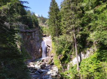
Randonnée Marche Obervellach - Groppensteinschlucht - Photo
Marche 4.555
Km

Marche

Facile
Obervellach, Carinthie, Bezirk Spittal an der Drau, Autriche
4,6 km | 7,8 km-effort
1h 42min
243 m
243 m
Oui
Arnaud Dejean

Randonnée Marche Obervellach - w-oostenrijk-rondwandeling-groppensteinschlucht - Photo
Marche 5.964
Km

Marche

Très facile
Obervellach, Carinthie, Bezirk Spittal an der Drau, Autriche
6 km | 10,7 km-effort
Inconnu
350 m
360 m
Oui
gpstracks

• More information on GPStracks.nl : http://www.gpstracks.nl

Randonnée Marche Obervellach - w-oostenrijk-rondje-obervellach - Photo
Marche 8.676
Km

Marche

Très facile
Obervellach, Carinthie, Bezirk Spittal an der Drau, Autriche
8,7 km | 12,4 km-effort
Inconnu
280 m
279 m
Oui
gpstracks

• More information on GPStracks.nl : http://www.gpstracks.nl

Randonnée Marche Obervellach - w-oostenrijk-burg-falkenstein - Photo
Marche 14.348
Km

Marche

Très facile
Obervellach, Carinthie, Bezirk Spittal an der Drau, Autriche
14,3 km | 22 km-effort
Inconnu
548 m
551 m
Oui
gpstracks

• More information on GPStracks.nl : http://www.gpstracks.nl

4 randonnées affichées sur 4

Application GPS de randonnée GRATUITE

Logo SityTrail SityTrail

IGN / Instituts géographiques

Télécharger SityTrail sur l'App Store Télécharger SityTrail sur Google Play

Logo SityTrail SityTrail World

Le monde est à vous

Télécharger SityTrail sur l'App Store Télécharger SityTrail sur Google Play Télécharger SityTrail sur Huawei AppGallery

Activités

Fermer
Mes abonnements