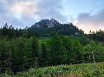
Schwangau, Landkreis Ostallgäu : Les meilleures randonnées, itinéraires, parcours, balades et promenades

Schwangau : découvrez les meilleures randonnées : 6 pédestres. Tous ces circuits, parcours, itinéraires et activités en plein air sont disponibles dans nos applications SityTrail pour smartphones et tablettes.


Les meilleurs parcours (6)

Randonnée A pied Schwangau - Alpsee-Rundweg - Photo
A pied 5.204
Km
PRO

A pied

Facile
Schwangau, Bavière, Landkreis Ostallgäu, Allemagne
5,2 km | 6,9 km-effort
1h 34min
129 m
130 m
Oui
SityTrail - itinéraires balisés pédestres

Randonnée A pied Schwangau - Naturpfad Ahornreitweg - Photo
A pied 5.777
Km
PRO

A pied

Facile
Schwangau, Bavière, Landkreis Ostallgäu, Allemagne
5,8 km | 12 km-effort
2h 44min
618 m
24 m
Non
SityTrail - itinéraires balisés pédestres

Randonnée Marche Schwangau - Tour de l'Alpsee - Photo
Marche 6.927
Km

Marche

Très facile
Schwangau, Bavière, Landkreis Ostallgäu, Allemagne
6,9 km | 9 km-effort
2h 7min
155 m
155 m
Oui
libertju

Randonnée Marche Schwangau - Autour du Neuschwanstein - Photo
Marche 11.336
Km

Marche

Facile
Schwangau, Bavière, Landkreis Ostallgäu, Allemagne
11,3 km | 17,4 km-effort
5h 0min
454 m
447 m
Oui
libertju

Randonnée Marche Schwangau - Neuschwanstein - Photo
Marche 15.922
Km

Marche

Très facile
Schwangau, Bavière, Landkreis Ostallgäu, Allemagne
15,9 km | 22 km-effort
7h 43min
440 m
435 m
Non
Papamoju

Randonnée Marche Schwangau - Neuschwanstein 16.1 - Photo
Marche 16.203
Km

Marche

Très facile
Schwangau, Bavière, Landkreis Ostallgäu, Allemagne
16,2 km | 23 km-effort
Inconnu
492 m
499 m
Oui
Papamoju

6 randonnées affichées sur 6

Application GPS de randonnée GRATUITE

Logo SityTrail SityTrail

IGN / Instituts géographiques

Télécharger SityTrail sur l'App Store Télécharger SityTrail sur Google Play

Logo SityTrail SityTrail World

Le monde est à vous

Télécharger SityTrail sur l'App Store Télécharger SityTrail sur Google Play Télécharger SityTrail sur Huawei AppGallery

Activités

Fermer
Mes abonnements