Le Haut-Soultzbach, Haut-Rhin : Les meilleures randonnées, itinéraires, parcours, balades et promenades

Le Haut-Soultzbach : découvrez les meilleures randonnées : 9 pédestres et 2 parcours équestres. Tous ces circuits, parcours, itinéraires et activités en plein air sont disponibles dans nos applications SityTrail pour smartphones et tablettes.


Les meilleurs parcours (12)

Randonnée Marche Le Haut-Soultzbach - Lac de la Seigneurie (10/01/2019) - Photo
Marche 16.295
Km

Marche

Facile
Le Haut-Soultzbach, Grand Est, Haut-Rhin, France
16,3 km | 19,5 km-effort
4h 24min
237 m
237 m
Oui
Richard68500

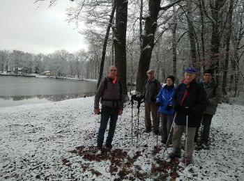
• Le lac de la Seigneurie vous le offre un paysage de grande qualité, entouré de forêts de sapins et de somptueuses hêt...

Randonnée Marche Le Haut-Soultzbach - compostelle - Photo
Marche 27.65
Km

Marche

Le Haut-Soultzbach, Grand Est, Haut-Rhin, France
28 km | 34 km-effort
9h 14min
448 m
462 m
Non
chantalwaltzer

• marche

Randonnée Marche Le Haut-Soultzbach - wei - Photo
Marche 10.179
Km

Marche

Difficile
Le Haut-Soultzbach, Grand Est, Haut-Rhin, France
10,2 km | 12,3 km-effort
2h 30min
156 m
157 m
Oui
gerando

Randonnée Marche Le Haut-Soultzbach - Sentheim - Lac de la Seigneurie (20/01/2022) - Photo
Marche 13.293
Km

Marche

Facile
Le Haut-Soultzbach, Grand Est, Haut-Rhin, France
13,3 km | 15,4 km-effort
3h 17min
159 m
157 m
Oui
Richard68500

• Randonnée facile avec peu de dénivelé

Randonnée Marche Le Haut-Soultzbach - Le haut soultzbach - Photo
Marche 8.415
Km

Marche

Facile
Le Haut-Soultzbach, Grand Est, Haut-Rhin, France
8,4 km | 10,7 km-effort
3h 9min
189 m
111 m
Non
jcguew

• facile

Randonnée Marche Le Haut-Soultzbach - le haut soultzbach - Photo
Marche 11.686
Km

Marche

Très facile
Le Haut-Soultzbach, Grand Est, Haut-Rhin, France
11,7 km | 14,4 km-effort
2h 53min
201 m
199 m
Oui
jcguew

• facile

Randonnée Marche Le Haut-Soultzbach - 23 02 07 VTM SOPPE LE HAUT - Photo
Marche 8.316
Km

Marche

Moyen
Le Haut-Soultzbach, Grand Est, Haut-Rhin, France
8,3 km | 10,4 km-effort
2h 20min
161 m
156 m
Oui
jmbilger

Randonnée Randonnée équestre Le Haut-Soultzbach - guewenheim tour notre dame des boulaux - Photo
Randonnée équestre 20.876
Km

Randonnée équestre

Très facile
Le Haut-Soultzbach, Grand Est, Haut-Rhin, France
21 km | 25 km-effort
2h 52min
309 m
347 m
Non
Sonia SCHNEIDER

Randonnée Randonnée équestre Le Haut-Soultzbach - tour guewenheim chapelle notre dame des bouleaux  - Photo
Randonnée équestre 18.884
Km

Randonnée équestre

Très facile
Le Haut-Soultzbach, Grand Est, Haut-Rhin, France
18,9 km | 23 km-effort
3h 36min
293 m
328 m
Non
lasteinmatt

Randonnée Marche Le Haut-Soultzbach - Randonnée Cvg Vauthiermont - Photo
Marche 15.059
Km

Marche

Facile
Le Haut-Soultzbach, Grand Est, Haut-Rhin, France
15,1 km | 18 km-effort
4h 26min
219 m
216 m
Oui
zheppi

Randonnée Marche Le Haut-Soultzbach - Seigneurie - Photo
Marche 12.233
Km

Marche

Moyen
Le Haut-Soultzbach, Grand Est, Haut-Rhin, France
12,2 km | 14,8 km-effort
3h 0min
190 m
188 m
Oui
gschwind

Randonnée Autre activité Le Haut-Soultzbach - Seigneurie  Gilles - Photo
Autre activité 2.109
Km

Autre activité

Très facile
Le Haut-Soultzbach, Grand Est, Haut-Rhin, France
2,1 km | 2,3 km-effort
40min
18 m
14 m
Non
gschwind

12 randonnées affichées sur 12

Application GPS de randonnée GRATUITE

Logo SityTrail SityTrail

IGN / Instituts géographiques

Télécharger SityTrail sur l'App Store Télécharger SityTrail sur Google Play

Logo SityTrail SityTrail World

Le monde est à vous

Télécharger SityTrail sur l'App Store Télécharger SityTrail sur Google Play Télécharger SityTrail sur Huawei AppGallery

Activités

Régions proches

Fermer
Mes abonnements