Wildenstein, Haut-Rhin : Les meilleures randonnées, itinéraires, parcours, balades et promenades

4 commentaires

Wildenstein : découvrez les meilleures randonnées : 60 pédestres et 4 à vélo ou VTT. Tous ces circuits, parcours, itinéraires et activités en plein air sont disponibles dans nos applications SityTrail pour smartphones et tablettes.


Les meilleurs parcours (67)

Randonnée Marche Wildenstein - 2022-02-20 Marche Kruth Grand Ventron - Photo
Marche 16.831
Km
GUIDE

Marche

Très difficile
(1)
Wildenstein, Grand Est, Haut-Rhin, France
16,8 km | 27 km-effort
4h 52min
771 m
771 m
Oui
holtzv

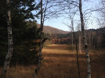
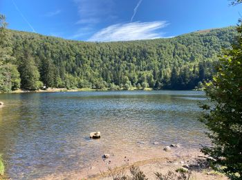
• En passant par la cascade Heindenbad, la cabane du Bockloch, le Bocklochkopf, le Grand Ventron, le refuge de la Chaum...

Randonnée Marche Wildenstein - Col du Bramont - Machey - Blanchemer - Photo
Marche 15.323
Km

Marche

Moyen
(1)
Wildenstein, Grand Est, Haut-Rhin, France
15,3 km | 22 km-effort
4h 27min
535 m
545 m
Oui
VacheKiri67

• Faite le 14/07/2015 avec notre fils de 10 ans. Enregistrement partiel. D'après : Guide Frank Vosges - N°38 Col du Bra...

Randonnée Marche Wildenstein - 2014-11-09 Marche Cretes de Rothenbachkopf - Photo
Marche 9.027
Km
GUIDE

Marche

Moyen
(1)
Wildenstein, Grand Est, Haut-Rhin, France
9 km | 14,3 km-effort
2h 58min
393 m
394 m
Oui
holtzv

Randonnée Marche Wildenstein - 2020 07 19 Route Crêtes - Pied Honneck - Photo
Marche 12.144
Km

Marche

Moyen
Wildenstein, Grand Est, Haut-Rhin, France
12,1 km | 17,9 km-effort
3h 27min
431 m
431 m
Oui
Seppala - Balades du jeudi

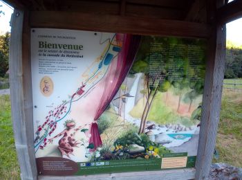
• Départ : Coordonnées décimales Latitude:48,00188 Longitude:6,97638

Randonnée Marche Wildenstein - Du Col de Bramont au Drumont - Photo
Marche 17.315
Km

Marche

Très facile
Wildenstein, Grand Est, Haut-Rhin, France
17,3 km | 29 km-effort
5h 49min
888 m
721 m
Non
oscar1

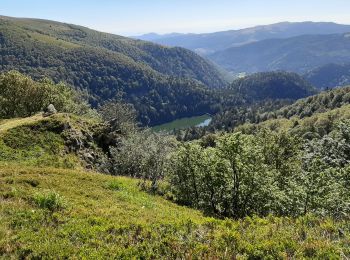
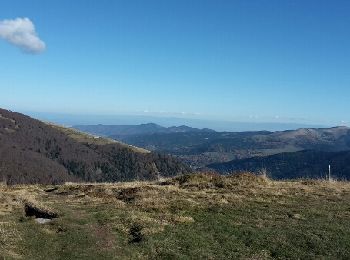
• Randonnée avec de beaux panoramas, du Ventron au Drumont. Néanmoins du Col d'Oderen au Drumont, la montée est très ra...

Randonnée Marche Wildenstein - Blanchemer - Photo
Marche 15.736
Km

Marche

Très facile
Wildenstein, Grand Est, Haut-Rhin, France
15,7 km | 24 km-effort
4h 6min
605 m
603 m
Oui
olivier5960

• Blanchemer

Randonnée Raquettes à neige Wildenstein - Wildenstein - Vieille Montagne - Bramont en raquettes - Photo
Raquettes à neige 10.531
Km

Raquettes à neige

Difficile
Wildenstein, Grand Est, Haut-Rhin, France
10,5 km | 18,8 km-effort
4h 0min
621 m
624 m
Oui
tracegps

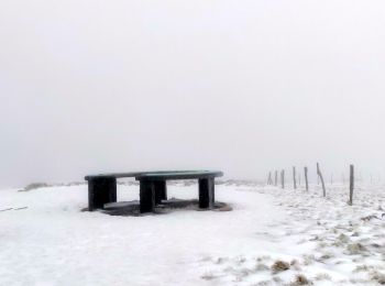
• Cette agréable randonnée en boucle qui rejoint la Vieille Montagne et le Col du Bramont depuis Wildenstein offre quel...

Randonnée Marche Wildenstein - le grand Ventron depuis Wildenstein - Photo
Marche 15.514
Km

Marche

Difficile
Wildenstein, Grand Est, Haut-Rhin, France
15,5 km | 28 km-effort
3h 57min
919 m
920 m
Oui
margotte

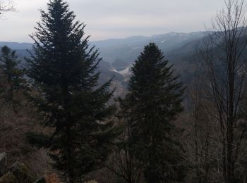
• un bon dénivelé sur des sentiers de montagne. cascades, ruisseaux, forêts envoûtantes, chaumes et points de vues...to...

Randonnée Marche Wildenstein - Vosges 2020 : col de Bramont - Rainkopf (2020-12-20).ori - Photo
Marche 13.278
Km

Marche

Très facile
Wildenstein, Grand Est, Haut-Rhin, France
13,3 km | 23 km-effort
4h 3min
752 m
747 m
Oui
PatDev

• Partie du trajet hors des sentiers

Randonnée Vélo électrique Wildenstein - La Bresse - Photo
Vélo électrique 41.166
Km

Vélo électrique

Wildenstein, Grand Est, Haut-Rhin, France
41 km | 60 km-effort
3h 27min
1385 m
1385 m
Oui
Derrendinger

Randonnée Marche Wildenstein - Wildenstein - Steinwasen  (20/8/2020) - Photo
Marche 17.804
Km

Marche

Moyen
Wildenstein, Grand Est, Haut-Rhin, France
17,8 km | 30 km-effort
5h 26min
899 m
894 m
Oui
Richard68500

• direction Wildenstein au fond de la vallée de Thann à l'assaut..... - du col du Bramont (Le col de Bramont est un col...

Randonnée Marche Wildenstein - rotenbach  - Photo
Marche 5.779
Km

Marche

Wildenstein, Grand Est, Haut-Rhin, France
5,8 km | 8,7 km-effort
2h 25min
224 m
198 m
Oui
christine 57

Randonnée Marche Wildenstein - le Rothenbackopf depuis le col  du Bramont - Photo
Marche 13.72
Km

Marche

Moyen
Wildenstein, Grand Est, Haut-Rhin, France
13,7 km | 22 km-effort
3h 20min
614 m
619 m
Oui
margotte

Randonnée Marche Wildenstein - Étang de Machais et Lac de Blanchemer  - Photo
Marche 12.666
Km

Marche

Facile
Wildenstein, Grand Est, Haut-Rhin, France
12,7 km | 22 km-effort
3h 50min
663 m
662 m
Oui
egodard

• attention aux pentes rudes dinon pas de difficultés majeures

Randonnée V.T.T. Wildenstein - Wildenstein - Col du Bramont - Photo
V.T.T. 10.602
Km

V.T.T.

Moyen
Wildenstein, Grand Est, Haut-Rhin, France
10,6 km | 17,9 km-effort
45min
551 m
551 m
Oui
tracegps

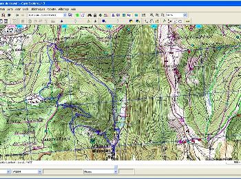
• D'autres informations et une carte détaillée sont visibles ICI

Randonnée Marche Wildenstein - thierry -Huss- dimache 07/01/23- copains - Photo
Marche 19.311
Km

Marche

Wildenstein, Grand Est, Haut-Rhin, France
19,3 km | 26 km-effort
6h 24min
418 m
838 m
Non
chantalwaltzer

• Avc Christian

Randonnée Marche Wildenstein - Wildenstein- Thann- Christian - Photo
Marche 17.875
Km

Marche

Wildenstein, Grand Est, Haut-Rhin, France
17,9 km | 29 km-effort
7h 3min
804 m
805 m
Oui
chantalwaltzer

• Facile

Randonnée Marche Wildenstein - Wildenstein- Rothenbach- Gasser/ Christian-01/07 - Photo
Marche 14.127
Km

Marche

Wildenstein, Grand Est, Haut-Rhin, France
14,1 km | 24 km-effort
6h 3min
768 m
764 m
Oui
chantalwaltzer

• 01/07/23 Montée très raide- eau parcours

Randonnée Marche Wildenstein - Wildenstein-05/04- Sylviane mercredi - Photo
Marche 17.508
Km

Marche

Moyen
Wildenstein, Grand Est, Haut-Rhin, France
17,5 km | 28 km-effort
5h 35min
773 m
776 m
Oui
chantalwaltzer

• superbe

Randonnée Marche Wildenstein - eef - Photo
Marche 26.253
Km

Marche

Très difficile
Wildenstein, Grand Est, Haut-Rhin, France
26 km | 35 km-effort
3h 53min
556 m
822 m
Non
Jack 68

20 randonnées affichées sur 67

Application GPS de randonnée GRATUITE

Logo SityTrail SityTrail

IGN / Instituts géographiques

Télécharger SityTrail sur l'App Store Télécharger SityTrail sur Google Play

Logo SityTrail SityTrail World

Le monde est à vous

Télécharger SityTrail sur l'App Store Télécharger SityTrail sur Google Play Télécharger SityTrail sur Huawei AppGallery

Activités

Fermer
Mes abonnements