Randonnée Course à pied Villenouvelle - Villenouvelle à Bazièges - Photo

Villenouvelle à Bazièges

 tracegps
tracegps

Utilisateur

© OpenStreetMap contributors
Longueur
Longueur
19,2 km
Altitude max
Altitude max
236 m
Dénivelé positif
Dénivelé positif
187 m
Km-Effort
Km-Effort  
22 km
Altitude min
Altitude min
155 m
Dénivelé négatif
Dénivelé négatif
188 m
Boucle
Boucle
Oui
Date de création :
2014-12-10 00:00:00.0
Dernière modification :
2014-12-10 00:00:00.0

(0 Avis)

Course à pied
Course à pied
2h00
Difficulté : Difficile

Scannez ce code QR pour ouvrir la randonnée dans l'application SityTrail

Application GPS de randonnée GRATUITE

Logo SityTrail SityTrail

IGN / Instituts géographiques

Télécharger SityTrail sur l'App Store Télécharger SityTrail sur Google Play

Logo SityTrail SityTrail World

Le monde est à vous

Télécharger SityTrail sur l'App Store Télécharger SityTrail sur Google Play Télécharger SityTrail sur Huawei AppGallery

À propos

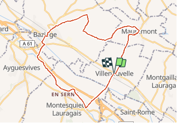
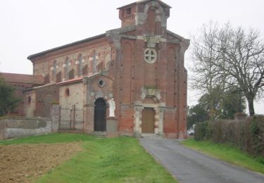
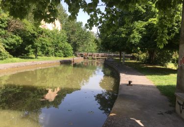
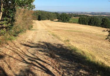
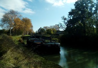
Randonnée Course à pied de 19,2 km à découvrir à Occitanie, Haute-Garonne, Villenouvelle. Cette randonnée est proposée par tracegps.

Description

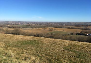
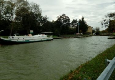
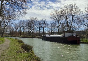
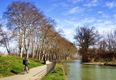
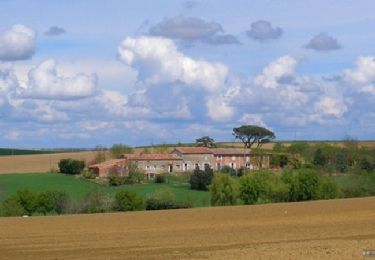
On part à l'assaut des coteaux avant de suivre le cours tranquille du Canal du Midi.

Profil altimétrique

Photos

Localisation

Pays :
France
Région :
Occitanie
Département/Province :
Haute-Garonne
Commune :
Villenouvelle
Localité :
Unknown
Départ:(Dec)
Départ:(UTM)
391680 ; 4810015 (31T) N.

Randonnées à proximité

Randonnée Marche Gardouch - Canal du Midi - Photo
Marche
richardsimopons

Marche

Difficile
Gardouch, Occitanie, Haute-Garonne, France
10,5 km | 12,7 km-effort
2h 32min
Oui
Randonnée Marche Montesquieu-Lauragais - mardi 20 octobre  - Photo
Marche
arnoultjf

Marche

Très facile
Montesquieu-Lauragais, Occitanie, Haute-Garonne, France
12 km | 13,7 km-effort
2h 40min
Oui
Randonnée Course à pied Mauremont - Running à Mauremont - Photo
Course à pied
tracegps

Course à pied

Difficile
Mauremont, Occitanie, Haute-Garonne, France
14,4 km | 17,6 km-effort
1h 10min
Oui
Randonnée Marche Gardouch - Le canal du Midi - Photo
Marche
richardsimopons

Marche

Difficile
Gardouch, Occitanie, Haute-Garonne, France
11,2 km | 12,1 km-effort
2h 34min
Non
Randonnée Marche Gardouch - Les Collines du Lauragais  - Photo
Marche
richardsimopons

Marche

Gardouch, Occitanie, Haute-Garonne, France
8,3 km | 10,1 km-effort
2h 21min
Oui
Randonnée Marche Vieillevigne - lamarasse2h15 - Photo
Marche
arnoultjf

Marche

Très facile
Vieillevigne, Occitanie, Haute-Garonne, France
10,1 km | 10,9 km-effort
2h 9min
Non
Randonnée Marche Gardouch - Canal du Midi - Ecluse de Laval - En Cassan - Photo
Marche
tracegps

Marche

Facile
Gardouch, Occitanie, Haute-Garonne, France
8,4 km | 8,9 km-effort
1h 40min
Non
Randonnée Marche Ayguesvives - Canal du Midi - Ecluse du Sanglier - Ecluse de Laval - Photo
Marche
tracegps

Marche

Facile
Ayguesvives, Occitanie, Haute-Garonne, France
7,9 km | 8,6 km-effort
1h 30min
Non
Randonnée Marche Villefranche-de-Lauragais - Tour du Télégraphe à Villefranche de Lauragais - Photo
Marche
tracegps

Marche

Moyen
Villefranche-de-Lauragais, Occitanie, Haute-Garonne, France
12,6 km | 15,3 km-effort
3h 10min
Oui


Fermer
Mes abonnements