Randonnée Cheval Grandvelle-et-le-Perrenot - grandvelle-vy les rupt - Photo
 toledo
toledo

Utilisateur

© OpenStreetMap contributors
Longueur
Longueur
30 km
Altitude max
Altitude max
276 m
Dénivelé positif
Dénivelé positif
345 m
Km-Effort
Km-Effort  
35 km
Altitude min
Altitude min
197 m
Dénivelé négatif
Dénivelé négatif
378 m
Boucle
Boucle
Non
Date de création :
2019-01-15 13:36:51.532
Dernière modification :
2019-08-18 06:22:25.419

(0 Avis)

Cheval
Cheval
--
Difficulté : Facile

Scannez ce code QR pour ouvrir la randonnée dans l'application SityTrail

Application GPS de randonnée GRATUITE

Logo SityTrail SityTrail

IGN / Instituts géographiques

Télécharger SityTrail sur l'App Store Télécharger SityTrail sur Google Play

Logo SityTrail SityTrail World

Le monde est à vous

Télécharger SityTrail sur l'App Store Télécharger SityTrail sur Google Play Télécharger SityTrail sur Huawei AppGallery

À propos

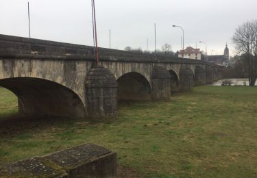
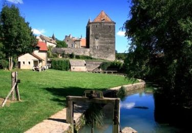
Randonnée Cheval de 30 km à découvrir à Bourgogne-Franche-Comté, Haute-Saône, Grandvelle-et-le-Perrenot. Cette randonnée est proposée par toledo.

Profil altimétrique

Points d'intérêt

Point d'intérêt Noidans-le-Ferroux - Pique-nique - Photo
toledo
NOIDANS-LE-FERROUX 
Point d'intérêt Noidans-le-Ferroux - Point d'eau - Photo
toledo
NOIDANS-LE-FERROUX 
Point d'intérêt Neuvelle-lès-la-Charité - Point d'eau - Photo
toledo
NEUVELLE-LÈS-LA-CHARITÉ 

Localisation

Pays :
France
Région :
Bourgogne-Franche-Comté
Département/Province :
Haute-Saône
Commune :
Grandvelle-et-le-Perrenot
Localité :
Unknown
Départ:(UTM)
725328 ; 5266213 (31T) N.

Randonnées à proximité

Randonnée Marche Fretigney-et-Velloreille - i)Etapa 9 - Photo
Marche
RafaTuareg

Marche

Moyen
Fretigney-et-Velloreille, Bourgogne-Franche-Comté, Haute-Saône, France
35 km | 40 km-effort
4h 7min
Non
Randonnée Marche Mailley-et-Chazelot - Grand tour - Photo
Marche
Emmanuel Joly

Marche

Moyen
Mailley-et-Chazelot, Bourgogne-Franche-Comté, Haute-Saône, France
14,4 km | 19,7 km-effort
4h 8min
Oui
Randonnée Marche Fondremand - Fondremand, petite cité comtoise de caractère - Photo
Marche
tracegps

Marche

Facile
Fondremand, Bourgogne-Franche-Comté, Haute-Saône, France
2,5 km | 3,7 km-effort
1h 0min
Oui
Randonnée V.T.T. Fondremand - Fondremand Ouest - Photo
V.T.T.
tracegps

V.T.T.

Difficile
(1)
Fondremand, Bourgogne-Franche-Comté, Haute-Saône, France
21 km | 27 km-effort
2h 15min
Oui
Randonnée Marche Maizières - Maizière-Gy - Photo
Marche
dagobert5612

Marche

Facile
Maizières, Bourgogne-Franche-Comté, Haute-Saône, France
25 km | 32 km-effort
6h 39min
Non
Randonnée Marche Mailley-et-Chazelot - Bois noroy  - Photo
Marche
nicolasdresse

Marche

Moyen
Mailley-et-Chazelot, Bourgogne-Franche-Comté, Haute-Saône, France
5,5 km | 7 km-effort
2h 1min
Oui
Randonnée A pied Fondremand - fondremand - Photo
A pied
henribranget25

A pied

Facile
(1)
Fondremand, Bourgogne-Franche-Comté, Haute-Saône, France
5,1 km | 7,3 km-effort
1h 39min
Oui
Randonnée Marche nordique Fondremand - fondremand - Photo
Marche nordique
sergelopez

Marche nordique

Très facile
Fondremand, Bourgogne-Franche-Comté, Haute-Saône, France
12 km | 15,8 km-effort
3h 24min
Oui
Randonnée Marche Fretigney-et-Velloreille - Les gorges de la loue - Photo
Marche
calou123

Marche

Fretigney-et-Velloreille, Bourgogne-Franche-Comté, Haute-Saône, France
122 km | 159 km-effort
6h 41min
Non


Fermer
Mes abonnements