Le pic de Parières par l'arête est
tracegps
Utilisateur
Longueur
8 km
Altitude max
3037 m
Dénivelé positif
1699 m
Km-Effort
25 km
Altitude min
1339 m
Dénivelé négatif
15 m
Boucle
Non
Date de création :
2014-12-10 00:00:00.0
Dernière modification :
2014-12-10 00:00:00.0
10h00
Difficulté : Très difficile
Application GPS de randonnée GRATUITE
À propos
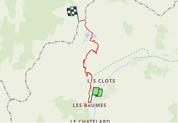
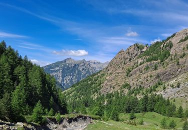
Randonnée Marche de 8 km à découvrir à Provence-Alpes-Côte d'Azur, Hautes-Alpes, Champoléon. Cette randonnée est proposée par tracegps.
Description
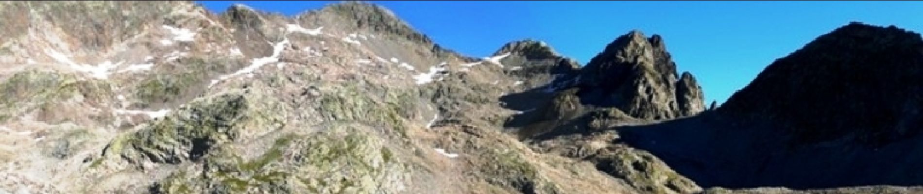
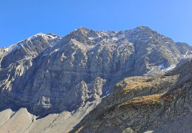
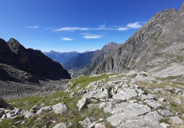
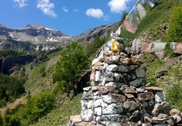
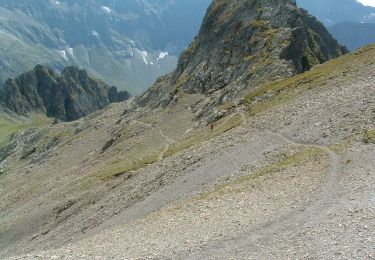
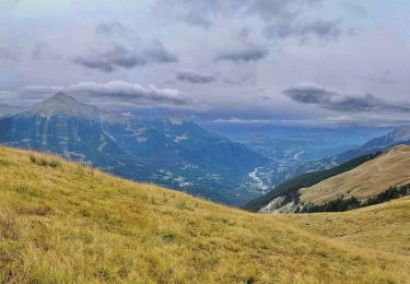
Superbe randonnée alpine donnant un panorama sublime sur toute les faces sud des Ecrins. ( auteur Zézette) La suite est sur Montagne-Cool
Localisation
Pays :
France
Région :
Provence-Alpes-Côte d'Azur
Département/Province :
Hautes-Alpes
Commune :
Champoléon
Localité :
Unknown
Départ:(Dec)
Départ:(UTM)
282148 ; 4957630 (32T) N.
Commentaires
Randonnées à proximité
Balade Vallée Champoléon
Marche
Facile
Champoléon,
Provence-Alpes-Côte d'Azur,
Hautes-Alpes,
France
9,5 km | 12,2 km-effort
2h 40min
Oui
Refuge Tourond par Fermonds et Borels
Marche
Difficile
Champoléon,
Provence-Alpes-Côte d'Azur,
Hautes-Alpes,
France
9,8 km | 16,8 km-effort
3h 22min
Non
Lac de Prelles-Col du Cheval de bois
Marche
Très difficile
Champoléon,
Provence-Alpes-Côte d'Azur,
Hautes-Alpes,
France
16,3 km | 30 km-effort
6h 50min
Oui
PARC NATIONAL DES ECRINS: LACS DE CRUPILOUSE
Marche
Très difficile
Champoléon,
Provence-Alpes-Côte d'Azur,
Hautes-Alpes,
France
17,4 km | 37 km-effort
7h 24min
Oui
Refuge du Tourond
A pied
Facile
Champoléon,
Provence-Alpes-Côte d'Azur,
Hautes-Alpes,
France
8,4 km | 14,2 km-effort
3h 14min
Oui
Méollion
Marche
Moyen
Champoléon,
Provence-Alpes-Côte d'Azur,
Hautes-Alpes,
France
7,5 km | 13,7 km-effort
2h 59min
Oui
Boucle Isora
Marche
Très difficile
Champoléon,
Provence-Alpes-Côte d'Azur,
Hautes-Alpes,
France
17,8 km | 38 km-effort
8h 39min
Oui
05 - MEOLLION Champsaur
Marche
Moyen
Champoléon,
Provence-Alpes-Côte d'Azur,
Hautes-Alpes,
France
8,3 km | 14,9 km-effort
2h 46min
Oui
Roc d’Alibrandes
Marche
Difficile
Orcières,
Provence-Alpes-Côte d'Azur,
Hautes-Alpes,
France
8,7 km | 16,9 km-effort
4h 42min
Oui