Randonnée V.T.T. Malansac - Rando VTT Malansac 2010 - Photo

Rando VTT Malansac 2010

 tracegps
tracegps

Utilisateur

© OpenStreetMap contributors
Longueur
Longueur
34 km
Altitude max
Altitude max
95 m
Dénivelé positif
Dénivelé positif
472 m
Km-Effort
Km-Effort  
40 km
Altitude min
Altitude min
26 m
Dénivelé négatif
Dénivelé négatif
472 m
Boucle
Boucle
Oui
Date de création :
2014-12-10 00:00:00.0
Dernière modification :
2014-12-10 00:00:00.0

(1 Avis)

V.T.T.
V.T.T.
3h00
Difficulté : Difficile

Scannez ce code QR pour ouvrir la randonnée dans l'application SityTrail

Application GPS de randonnée GRATUITE

Logo SityTrail SityTrail

IGN / Instituts géographiques

Télécharger SityTrail sur l'App Store Télécharger SityTrail sur Google Play

Logo SityTrail SityTrail World

Le monde est à vous

Télécharger SityTrail sur l'App Store Télécharger SityTrail sur Google Play Télécharger SityTrail sur Huawei AppGallery

À propos

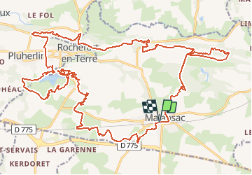
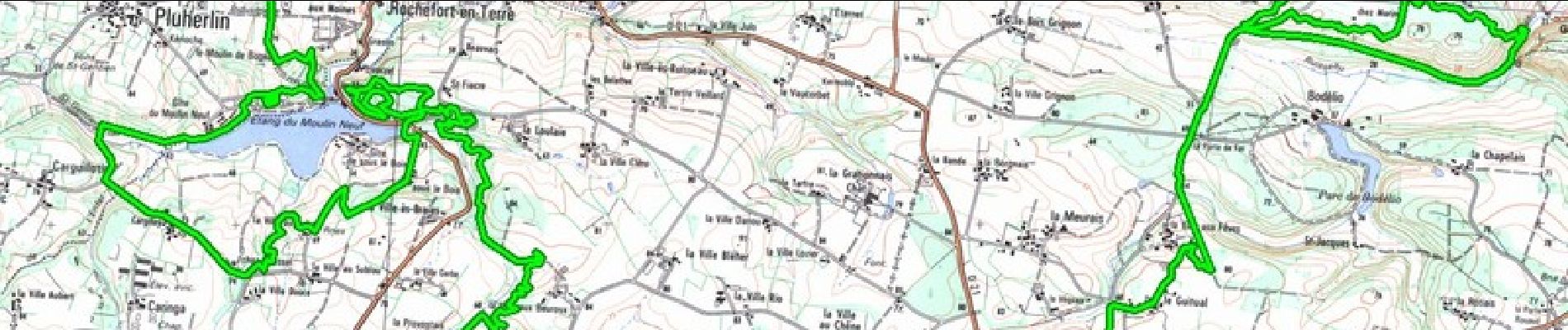
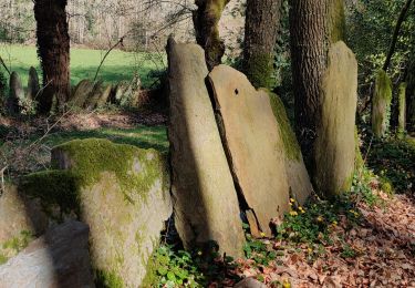
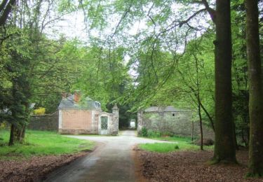
Randonnée V.T.T. de 34 km à découvrir à Bretagne, Morbihan, Malansac. Cette randonnée est proposée par tracegps.

Description

Circuit de 37 kilomètres malansac 2010 envoyé par alanri. - Découvrez les dernières vidéos de sport. Plus d'info sur www.alanric-vtt.com

Profil altimétrique

Photos

Localisation

Pays :
France
Région :
Bretagne
Département/Province :
Morbihan
Commune :
Malansac
Localité :
Unknown
Départ:(Dec)
Départ:(UTM)
552717 ; 5280528 (30T) N.

Commentaires

Veuillez vous connecter pour laisser un commentaire ou une note


Excellente application, tant sur ses fonctions que sa facilité d’utilisation. Comme toute application utilisant le gps elle est gourmande en batterie.


Randonnées à proximité

Randonnée A pied Rochefort-en-Terre - Circuit de Rochefort - Photo
A pied
PRO

A pied

Facile
Rochefort-en-Terre, Bretagne, Morbihan, France
7,5 km | 9,1 km-effort
2h 3min
Oui
Randonnée Marche Rochefort-en-Terre - Rochefort en terre - Photo
Marche
zeuhlio

Marche

Facile
(1)
Rochefort-en-Terre, Bretagne, Morbihan, France
3,3 km | 4,1 km-effort
1h 25min
Oui
Randonnée Marche Rochefort-en-Terre - Rochefort en terre - Photo
Marche
gentyann

Marche

Facile
(1)
Rochefort-en-Terre, Bretagne, Morbihan, France
14,2 km | 17,7 km-effort
3h 46min
Oui
Randonnée Marche Limerzel - PR_56_Limerzel_AA_01_Circuit1b_Vallee-Du-Trevelo_20231215 - Photo
Marche
patrickdanilo

Marche

Difficile
Limerzel, Bretagne, Morbihan, France
11,9 km | 14 km-effort
3h 10min
Oui
Randonnée Marche Limerzel - GRP_Lanvaux_AI_09_Limerzel_Berric_20210528 - Photo
Marche
patrickdanilo

Marche

Facile
Limerzel, Bretagne, Morbihan, France
21 km | 25 km-effort
5h 18min
Non
Randonnée Marche Pluherlin - GRP_Lanvaux_AH_08_Rochefort-Terre_Limerzel_20210515 - Photo
Marche
patrickdanilo

Marche

Facile
Pluherlin, Bretagne, Morbihan, France
13,5 km | 16,3 km-effort
3h 28min
Non
Randonnée Marche Pluherlin - Rochefort en terre - Photo
Marche
nolsim

Marche

Moyen
Pluherlin, Bretagne, Morbihan, France
17,5 km | 21 km-effort
4h 1min
Oui
Randonnée sport Rochefort-en-Terre - 9322323-BACVTT - ASCENSION - REDON - Photo
sport
godmer

sport

Très facile
(1)
Rochefort-en-Terre, Bretagne, Morbihan, France
69 km | 81 km-effort
Inconnu
Oui
Randonnée Marche Malansac - PR_56_Malansac_AA_01_Circuit1b_Des-Ardoisieres_20160619 - Photo
Marche
patrickdanilo

Marche

Facile
Malansac, Bretagne, Morbihan, France
20 km | 23 km-effort
5h 4min
Oui


Fermer
Mes abonnements