Randonnée Marche Plestin-les-Grèves - Circuit de la chapelle St Roch - Plestin-les-Grèves - Photo

Circuit de la chapelle St Roch - Plestin-les-Grèves

 tracegps
tracegps

Utilisateur

© OpenStreetMap contributors
Longueur
Longueur
5,8 km
Altitude max
Altitude max
116 m
Dénivelé positif
Dénivelé positif
107 m
Km-Effort
Km-Effort  
7,2 km
Altitude min
Altitude min
29 m
Dénivelé négatif
Dénivelé négatif
103 m
Boucle
Boucle
Oui
Date de création :
2014-12-10 00:00:00.0
Dernière modification :
2014-12-10 00:00:00.0

(0 Avis)

Marche
Marche
1h30
Difficulté : Facile

Scannez ce code QR pour ouvrir la randonnée dans l'application SityTrail

Application GPS de randonnée GRATUITE

Logo SityTrail SityTrail

IGN / Instituts géographiques

Télécharger SityTrail sur l'App Store Télécharger SityTrail sur Google Play

Logo SityTrail SityTrail World

Le monde est à vous

Télécharger SityTrail sur l'App Store Télécharger SityTrail sur Google Play Télécharger SityTrail sur Huawei AppGallery

À propos

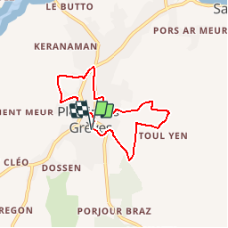
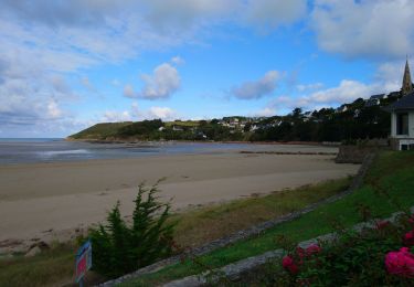
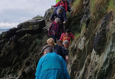
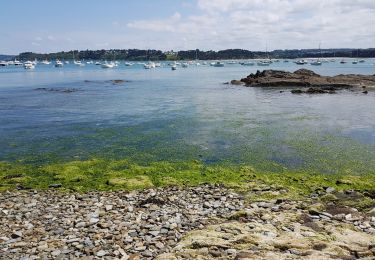
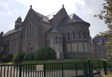
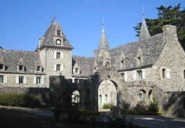
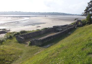
Randonnée Marche de 5,8 km à découvrir à Bretagne, Côtes-d'Armor, Plestin-les-Grèves. Cette randonnée est proposée par tracegps.

Description

Circuit proposé par l'Office Culturel Municipal de Plestin-les-Grèves. Départ face au Ti an Holl (rue des écoles). Retrouvez la fiche du circuit sur le site de l’Office de Tourisme de la Lieue de Grève.

Profil altimétrique

Photos

Localisation

Pays :
France
Région :
Bretagne
Département/Province :
Côtes-d'Armor
Commune :
Plestin-les-Grèves
Localité :
Unknown
Départ:(Dec)
Départ:(UTM)
453502 ; 5389121 (30U) N.

Randonnées à proximité

Randonnée V.T.T. Plestin-les-Grèves - Circuit des chapelles, coté terre - Plestin-les-Grèves - Photo
V.T.T.
tracegps

V.T.T.

Moyen
(1)
Plestin-les-Grèves, Bretagne, Côtes-d'Armor, France
17,1 km | 20 km-effort
2h 0min
Oui
Randonnée Marche Saint-Michel-en-Grève - Saint-Michel-en-Grève - GR34 le Grand Rocher - 12km 300m 4h05 - 2023 09 13 - Photo
Marche
Orcal37

Marche

Difficile
Saint-Michel-en-Grève, Bretagne, Côtes-d'Armor, France
12,1 km | 16 km-effort
4h 5min
Oui
Randonnée Marche Saint-Michel-en-Grève - Saint-Michel-en-Grève - GR34 Beg ar Forn Église - 7.7km 200m 2h15 (50mn) - 2023 09 13 - Photo
Marche
Orcal37

Marche

Moyen
Saint-Michel-en-Grève, Bretagne, Côtes-d'Armor, France
7,7 km | 10,4 km-effort
2h 15min
Oui
Randonnée Marche Saint-Michel-en-Grève - Bretagne nord J6pm : St Michel en Grève - Locquémau - Photo
Marche
chessyca

Marche

Très facile
Saint-Michel-en-Grève, Bretagne, Côtes-d'Armor, France
8,2 km | 10,3 km-effort
2h 19min
Non
Randonnée Marche Plestin-les-Grèves - Locquirec 07-06-19 - Photo
Marche
nolsim

Marche

Moyen
Plestin-les-Grèves, Bretagne, Côtes-d'Armor, France
12,4 km | 14,7 km-effort
3h 38min
Non
Randonnée Marche Locquirec - Petit tour de Loquirec - Photo
Marche

Marche

Très facile
Locquirec, Bretagne, Finistère, France
4,6 km | 5,7 km-effort
1h 12min
Oui
Randonnée Marche Plestin-les-Grèves - Plestin les grèves - Photo
Marche
Marie-Claire-mcp

Marche

Moyen
Plestin-les-Grèves, Bretagne, Côtes-d'Armor, France
11,9 km | 14,7 km-effort
3h 10min
Oui
Randonnée Marche Plestin-les-Grèves - Embouchure du Douron - Plestin Les Grèves - Photo
Marche
tracegps

Marche

Moyen
Plestin-les-Grèves, Bretagne, Côtes-d'Armor, France
10,7 km | 12,9 km-effort
3h 0min
Oui
Randonnée Marche Plestin-les-Grèves - De Plestin Les Grèves à Saint Efflam - Photo
Marche
tracegps

Marche

Moyen
(1)
Plestin-les-Grèves, Bretagne, Côtes-d'Armor, France
10,7 km | 13,4 km-effort
4h 0min
Oui


Fermer
Mes abonnements