Randonnée Marche Saint-Laurent-en-Beaumont - Saint-Laurent-en-Beaumont - Canal de Beaumont - 6.8km 130m 1h35 - 2014 06 04 - Photo

Saint-Laurent-en-Beaumont - Canal de Beaumont - 6.8km 130m 1h35 - 2014 06 04

 Orcal37
Orcal37

Utilisateur

© OpenStreetMap contributors
Longueur
Longueur
6,8 km
Altitude max
Altitude max
977 m
Dénivelé positif
Dénivelé positif
132 m
Km-Effort
Km-Effort  
8,6 km
Altitude min
Altitude min
919 m
Dénivelé négatif
Dénivelé négatif
133 m
Boucle
Boucle
Oui
Date de création :
2019-05-07 01:56:00.968
Dernière modification :
2021-09-07 15:12:10.601

(0 Avis)

Marche
Marche
1h35
Difficulté : Facile

Scannez ce code QR pour ouvrir la randonnée dans l'application SityTrail

Application GPS de randonnée GRATUITE

Logo SityTrail SityTrail

IGN / Instituts géographiques

Télécharger SityTrail sur l'App Store Télécharger SityTrail sur Google Play

Logo SityTrail SityTrail World

Le monde est à vous

Télécharger SityTrail sur l'App Store Télécharger SityTrail sur Google Play Télécharger SityTrail sur Huawei AppGallery

À propos

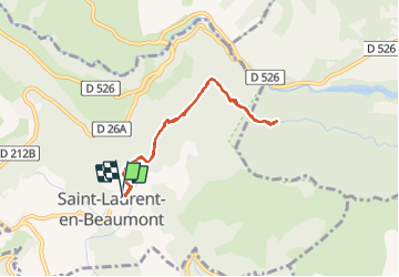
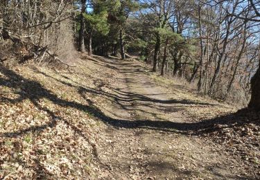
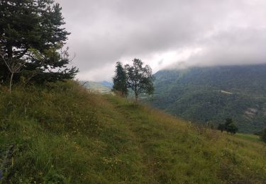
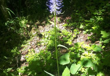
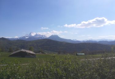
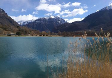
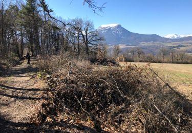
Randonnée Marche de 6,8 km à découvrir à Auvergne-Rhône-Alpes, Isère, Saint-Laurent-en-Beaumont. Cette randonnée est proposée par Orcal37.

Description

Saint-Laurent-en-Beaumont - Canal de Beaumont - 6.8km 130m 1h35 - 2014 06 04

Profil altimétrique

Photos

Localisation

Pays :
France
Région :
Auvergne-Rhône-Alpes
Département/Province :
Isère
Commune :
Saint-Laurent-en-Beaumont
Localité :
Unknown
Départ:(Dec)
Départ:(UTM)
725180 ; 4973494 (31T) N.

Randonnées à proximité

Randonnée Marche Sainte-Luce - Côte Rouge  - Photo
Marche
GuyVachet

Marche

Très difficile
Sainte-Luce, Auvergne-Rhône-Alpes, Isère, France
10,7 km | 21 km-effort
6h 59min
Oui
Randonnée Marche Saint-Laurent-en-Beaumont - Croix de la Roche et Signal St-Michel - Photo
Marche
GuyVachet

Marche

Très difficile
Saint-Laurent-en-Beaumont, Auvergne-Rhône-Alpes, Isère, France
14,2 km | 24 km-effort
5h 54min
Oui
Randonnée Marche Valbonnais - le canal du Beaumont  ,les verneys - Photo
Marche
bailleulherve

Marche

Moyen
Valbonnais, Auvergne-Rhône-Alpes, Isère, France
14 km | 22 km-effort
3h 25min
Oui
Randonnée Vélo électrique Saint-Laurent-en-Beaumont - plafin oris la valette retour pont roizon sievoz - Photo
Vélo électrique
ricoshox

Vélo électrique

Moyen
Saint-Laurent-en-Beaumont, Auvergne-Rhône-Alpes, Isère, France
25 km | 38 km-effort
1h 44min
Oui
Randonnée V.T.T. Sainte-Luce - St luce canal beaumont - Photo
V.T.T.
ricoshox

V.T.T.

Moyen
Sainte-Luce, Auvergne-Rhône-Alpes, Isère, France
22 km | 30 km-effort
1h 55min
Non
Randonnée Marche Valbonnais - Tour de Belle Roche - Photo
Marche
Emelle

Marche

Moyen
Valbonnais, Auvergne-Rhône-Alpes, Isère, France
15 km | 30 km-effort
6h 20min
Oui
Randonnée Marche Siévoz - foison 2019 - Photo
Marche
goizet

Marche

Facile
Siévoz, Auvergne-Rhône-Alpes, Isère, France
5,7 km | 10,7 km-effort
4h 18min
Non
Randonnée Marche Valbonnais - Plan d'eau de Valbonnais - Les Angelas - Photo
Marche
maupassant38

Marche

Facile
Valbonnais, Auvergne-Rhône-Alpes, Isère, France
8,3 km | 9,8 km-effort
1h 55min
Oui
Randonnée Marche Saint-Laurent-en-Beaumont - Tour du canal de Beaumont  - Photo
Marche
RD78-38

Marche

Très facile
Saint-Laurent-en-Beaumont, Auvergne-Rhône-Alpes, Isère, France
17,8 km | 25 km-effort
5h 33min
Oui


Fermer
Mes abonnements