


Le Hohrupf1

patrickbeyrath
Utilisateur
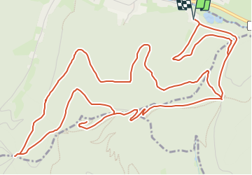

Longueur
9,8 km

Altitude max
791 m

Dénivelé positif
474 m
Km-Effort
16,1 km

Altitude min
392 m

Dénivelé négatif
474 m
Boucle
Oui
Date de création :
2018-10-13 05:53:50.375
Dernière modification :
2018-10-13 05:53:50.387
--
Difficulté : Moyen

Application GPS de randonnée GRATUITE
 SityTrail
IGN / Instituts géographiques
SityTrail Plus
Le monde est à vous
À propos
Randonnée Marche de 9,8 km à découvrir à Grand Est, Haut-Rhin, Lautenbachzell. Cette randonnée est proposée par patrickbeyrath.
Description
Lautenbach-Col de Schramberg-Le Hohrupf-Tour du Hohrupf-Col du Wolfsgrübe-Col de Schrangen et retour Lautenbach
Localisation
Pays :
France
Région :
Grand Est
Département/Province :
Haut-Rhin
Commune :
Lautenbachzell
Localité :
Unknown
Départ:(Dec)
Départ:(UTM)
362804 ; 5311027 (32T) N.
Commentaires