


saint jean frapotel

gilbertdu60
Utilisateur
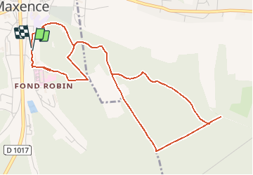

Longueur
5,7 km

Altitude max
135 m

Dénivelé positif
151 m
Km-Effort
7,8 km

Altitude min
41 m

Dénivelé négatif
152 m
Boucle
Oui
Date de création :
2014-12-10 00:00:00.0
Dernière modification :
2014-12-10 00:00:00.0
--
Difficulté : Facile

Application GPS de randonnée GRATUITE
 SityTrail
IGN / Instituts géographiques
SityTrail Plus
Le monde est à vous
À propos
Randonnée Marche de 5,7 km à découvrir à Hauts-de-France, Oise, Pont-Sainte-Maxence. Cette randonnée est proposée par gilbertdu60.
Description
rue saint jean, croix frapotel
Localisation
Pays :
France
Région :
Hauts-de-France
Département/Province :
Oise
Commune :
Pont-Sainte-Maxence
Localité :
Unknown
Départ:(Dec)
Départ:(UTM)
471353 ; 5460546 (31U) N.
Commentaires