Randonnée Course à pied Séranon - Trail des Mont d'Azur  - Photo
 chrisrando
chrisrando

Utilisateur

© OpenStreetMap contributors
Longueur
Longueur
18,8 km
Altitude max
Altitude max
1589 m
Dénivelé positif
Dénivelé positif
1149 m
Km-Effort
Km-Effort  
34 km
Altitude min
Altitude min
1043 m
Dénivelé négatif
Dénivelé négatif
1147 m
Boucle
Boucle
Oui
Date de création :
2014-12-10 00:00:00.0
Dernière modification :
2014-12-10 00:00:00.0

(0 Avis)

Course à pied
Course à pied
2h51
Difficulté : Difficile

Scannez ce code QR pour ouvrir la randonnée dans l'application SityTrail

Application GPS de randonnée GRATUITE

Logo SityTrail SityTrail

IGN / Instituts géographiques

Télécharger SityTrail sur l'App Store Télécharger SityTrail sur Google Play

Logo SityTrail SityTrail World

Le monde est à vous

Télécharger SityTrail sur l'App Store Télécharger SityTrail sur Google Play Télécharger SityTrail sur Huawei AppGallery

À propos

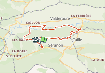
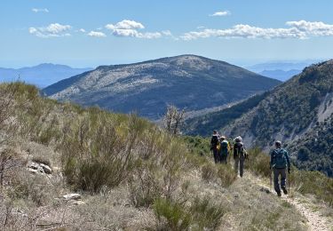
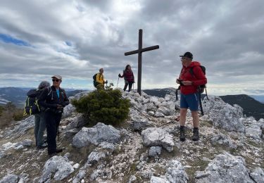
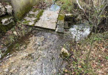
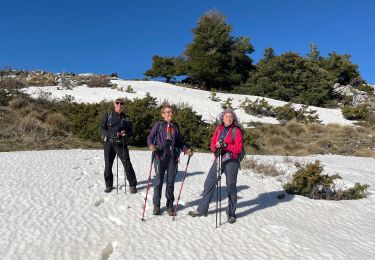
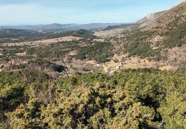
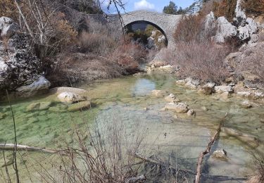
Randonnée Course à pied de 18,8 km à découvrir à Provence-Alpes-Côte d'Azur, Alpes-Maritimes, Séranon. Cette randonnée est proposée par chrisrando.

Profil altimétrique

Localisation

Pays :
France
Région :
Provence-Alpes-Côte d'Azur
Département/Province :
Alpes-Maritimes
Commune :
Séranon
Localité :
Unknown
Départ:(Dec)
Départ:(UTM)
313740 ; 4849289 (32T) N.

Randonnées à proximité

Randonnée Marche Mons - tour du Mt Lachens - Photo
Marche
pascalspr

Marche

Moyen
(3)
Mons, Provence-Alpes-Côte d'Azur, Var, France
20 km | 32 km-effort
6h 53min
Oui
Randonnée A pied Caille - Grand tour du haut Estéron - Etape 5 - Photo
A pied
PRO

A pied

Difficile
Caille, Provence-Alpes-Côte d'Azur, Alpes-Maritimes, France
19,3 km | 32 km-effort
7h 13min
Non
Randonnée A pied Séranon - Crêtes du Bauroux - Photo
A pied
PRO

A pied

Facile
Séranon, Provence-Alpes-Côte d'Azur, Alpes-Maritimes, France
11,8 km | 19,3 km-effort
4h 23min
Oui
Randonnée Marche Séranon - Seranon <-> Caille - Photo
Marche
ETMU5496

Marche

Difficile
Séranon, Provence-Alpes-Côte d'Azur, Alpes-Maritimes, France
23 km | 37 km-effort
8h 21min
Oui
Randonnée Marche Séranon - Seranon Sommet du Bauroux Caille La Mouliere La clue trace réelle - Photo
Marche
jouans

Marche

Très difficile
Séranon, Provence-Alpes-Côte d'Azur, Alpes-Maritimes, France
23 km | 37 km-effort
8h 22min
Oui
Randonnée Marche La Bastide - Le Lachens 2024 - Photo
Marche
ETMU5496

Marche

Difficile
La Bastide, Provence-Alpes-Côte d'Azur, Var, France
18,8 km | 35 km-effort
7h 56min
Oui
Randonnée Marche La Bastide - Lachens le tour trace réelle - Photo
Marche
jouans

Marche

Très difficile
La Bastide, Provence-Alpes-Côte d'Azur, Var, France
18,7 km | 35 km-effort
7h 55min
Oui
Randonnée Marche La Bastide - Le Lachens-la Bastide-20-03-23 - Photo
Marche
Christiancordin

Marche

Difficile
La Bastide, Provence-Alpes-Côte d'Azur, Var, France
19 km | 33 km-effort
5h 15min
Oui
Randonnée Marche La Bastide - 2023-03-03 Col de Clavel - Pont de Madame - Photo
Marche
GUIDE
Kargil

Marche

Moyen
La Bastide, Provence-Alpes-Côte d'Azur, Var, France
15,8 km | 22 km-effort
4h 33min
Oui


Fermer
Mes abonnements