Randonnée Marche Sausset-les-Pins - Corniche Sausset-les-Pins - Photo
 clotioneb
clotioneb

Utilisateur

© OpenStreetMap contributors
Longueur
Longueur
4,8 km
Altitude max
Altitude max
18 m
Dénivelé positif
Dénivelé positif
45 m
Km-Effort
Km-Effort  
5,4 km
Altitude min
Altitude min
0 m
Dénivelé négatif
Dénivelé négatif
51 m
Boucle
Boucle
Oui
Date de création :
2014-12-10 00:00:00.0
Dernière modification :
2014-12-10 00:00:00.0

(0 Avis)

Marche
Marche
1h27
Difficulté : Inconnu

Scannez ce code QR pour ouvrir la randonnée dans l'application SityTrail

Application GPS de randonnée GRATUITE

Logo SityTrail SityTrail

IGN / Instituts géographiques

Télécharger SityTrail sur l'App Store Télécharger SityTrail sur Google Play

Logo SityTrail SityTrail World

Le monde est à vous

Télécharger SityTrail sur l'App Store Télécharger SityTrail sur Google Play Télécharger SityTrail sur Huawei AppGallery

À propos

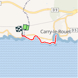
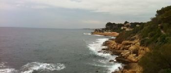
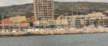
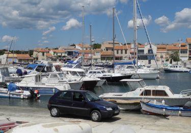
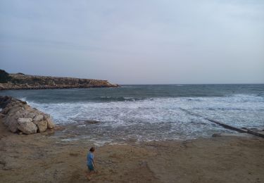
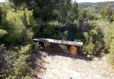
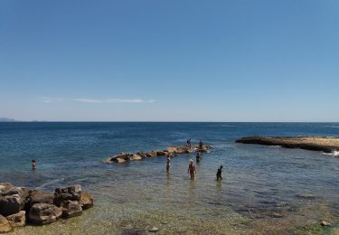
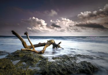
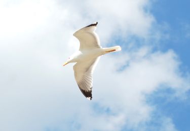
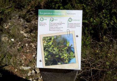
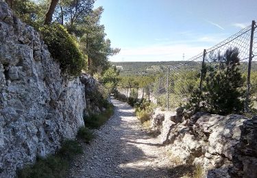
Randonnée Marche de 4,8 km à découvrir à Provence-Alpes-Côte d'Azur, Bouches-du-Rhône, Sausset-les-Pins. Cette randonnée est proposée par clotioneb.

Profil altimétrique

Photos

Points d'intérêt

Point d'intérêt Carry-le-Rouet - Vue vers Sausset - Photo
clotioneb
CARRY-LE-ROUET 
Point d'intérêt Carry-le-Rouet - Carry-le-Rouet - Photo
clotioneb
CARRY-LE-ROUET 
Point d'intérêt Carry-le-Rouet - Planier - Photo
clotioneb
CARRY-LE-ROUET 

Localisation

Pays :
France
Région :
Provence-Alpes-Côte d'Azur
Département/Province :
Bouches-du-Rhône
Commune :
Sausset-les-Pins
Localité :
Unknown
Départ:(Dec)
Départ:(UTM)
672936 ; 4799713 (31T) N.

Randonnées à proximité

Randonnée Marche Martigues - PF-Martigues - La Côte bleue - Cap Couronne - Photo
Marche
MicDul

Marche

Très facile
(2)
Martigues, Provence-Alpes-Côte d'Azur, Bouches-du-Rhône, France
21 km | 24 km-effort
5h 18min
Oui
Randonnée Marche Martigues - Cap couronne  - Photo
Marche
GUIDE
nadinebondoux

Marche

Moyen
Martigues, Provence-Alpes-Côte d'Azur, Bouches-du-Rhône, France
21 km | 25 km-effort
5h 17min
Oui
Randonnée A pied Martigues - Boucle de Boumandariel - Photo
A pied
PRO

A pied

Facile
Martigues, Provence-Alpes-Côte d'Azur, Bouches-du-Rhône, France
5,8 km | 6,6 km-effort
1h 30min
Oui
Randonnée A pied Sausset-les-Pins - Mer et Pinéde Valapoux - Photo
A pied
PRO

A pied

Facile
Sausset-les-Pins, Provence-Alpes-Côte d'Azur, Bouches-du-Rhône, France
6,6 km | 7,9 km-effort
1h 47min
Oui
Randonnée A pied Carry-le-Rouet - Le Vallon de Jaume par les Grottes - Photo
A pied
PRO

A pied

Facile
Carry-le-Rouet, Provence-Alpes-Côte d'Azur, Bouches-du-Rhône, France
7,5 km | 10,2 km-effort
2h 19min
Non
Randonnée A pied Carry-le-Rouet - Le Tour du Romaron - Photo
A pied
PRO

A pied

Facile
Carry-le-Rouet, Provence-Alpes-Côte d'Azur, Bouches-du-Rhône, France
7,3 km | 10 km-effort
2h 15min
Non
Randonnée A pied Carry-le-Rouet - Entre calanques et collines - Photo
A pied
PRO

A pied

Facile
Carry-le-Rouet, Provence-Alpes-Côte d'Azur, Bouches-du-Rhône, France
11,8 km | 14,6 km-effort
3h 19min
Non
Randonnée A pied Sausset-les-Pins - Grand Vallat - Littoral - Photo
A pied
PRO

A pied

Facile
Sausset-les-Pins, Provence-Alpes-Côte d'Azur, Bouches-du-Rhône, France
4,9 km | 5,9 km-effort
1h 20min
Oui
Randonnée A pied Martigues - Mer et colline Valestéloué - Photo
A pied
PRO

A pied

Facile
Martigues, Provence-Alpes-Côte d'Azur, Bouches-du-Rhône, France
14,5 km | 17,8 km-effort
4h 2min
Oui


Fermer
Mes abonnements