


croix de Bramafan

flux99
Utilisateur

Longueur
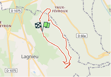
7,1 km

Altitude max
596 m

Dénivelé positif
310 m
Km-Effort
11,3 km

Altitude min
330 m

Dénivelé négatif
310 m
Boucle
Oui
Date de création :
2014-12-10 00:00:00.0
Dernière modification :
2014-12-10 00:00:00.0
3h00
Difficulté : Facile

Application GPS de randonnée GRATUITE
 SityTrail
IGN / Instituts géographiques
SityTrail Plus
Le monde est à vous
À propos
Randonnée Marche de 7,1 km à découvrir à Auvergne-Rhône-Alpes, Ain, Lagnieu. Cette randonnée est proposée par flux99.
Localisation
Pays :
France
Région :
Auvergne-Rhône-Alpes
Département/Province :
Ain
Commune :
Lagnieu
Localité :
Unknown
Départ:(Dec)
Départ:(UTM)
682642 ; 5087088 (31T) N.
Commentaires