Randonnée Marche Bellencombre - De Bellencombre à la forêt d'Eawy - Photo

De Bellencombre à la forêt d'Eawy

 tracegps
tracegps

Utilisateur

© OpenStreetMap contributors
Longueur
Longueur
12,9 km
Altitude max
Altitude max
202 m
Dénivelé positif
Dénivelé positif
271 m
Km-Effort
Km-Effort  
16,5 km
Altitude min
Altitude min
70 m
Dénivelé négatif
Dénivelé négatif
276 m
Boucle
Boucle
Oui
Date de création :
2014-12-10 00:00:00.0
Dernière modification :
2014-12-10 00:00:00.0

(0 Avis)

Marche
Marche
2h30
Difficulté : Facile

Scannez ce code QR pour ouvrir la randonnée dans l'application SityTrail

Application GPS de randonnée GRATUITE

Logo SityTrail SityTrail

IGN / Instituts géographiques

Télécharger SityTrail sur l'App Store Télécharger SityTrail sur Google Play

Logo SityTrail SityTrail World

Le monde est à vous

Télécharger SityTrail sur l'App Store Télécharger SityTrail sur Google Play Télécharger SityTrail sur Huawei AppGallery

À propos

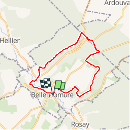
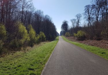
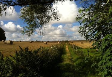
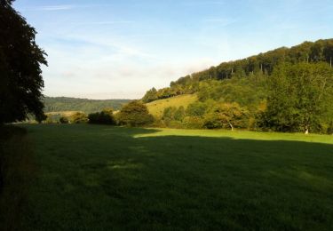
Randonnée Marche de 12,9 km à découvrir à Normandie, Seine-Maritime, Bellencombre. Cette randonnée est proposée par tracegps.

Description

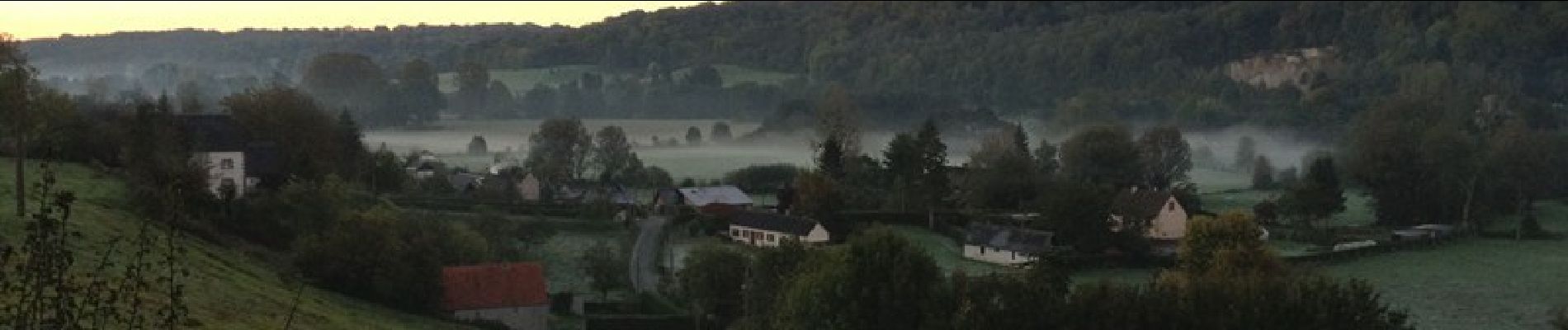
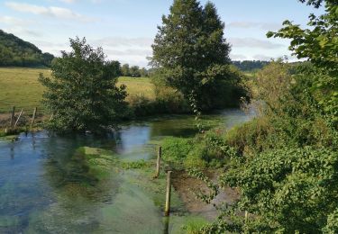
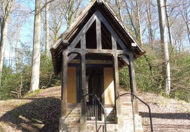
Nous partons de Bellencombre, commune de la vallée de la Varenne et montons en forêt domaniale d'Eawy. Nous passons devant le château du Mont-Roty et celui de la Grande Heuze. Nous suivons le chemin St Martin, traversons la Varenne pour revenir à Bellencombre. Une petite balade très agréable et sans difficulté. Une balade à retrouver sur ICI .

Profil altimétrique

Photos

Localisation

Pays :
France
Région :
Normandie
Département/Province :
Seine-Maritime
Commune :
Bellencombre
Localité :
Unknown
Départ:(Dec)
Départ:(UTM)
372104 ; 5507559 (31U) N.

Randonnées à proximité

Randonnée Marche Bellencombre - Bellencombre forêt d'eawy - Photo
Marche
Papy Diouf

Marche

Difficile
(1)
Bellencombre, Normandie, Seine-Maritime, France
12,4 km | 16 km-effort
3h 37min
Oui
Randonnée Marche Saint-Saëns - 20190404-St Saens - Photo
Marche
doudet

Marche

Moyen
Saint-Saëns, Normandie, Seine-Maritime, France
24 km | 29 km-effort
Inconnu
Oui
Randonnée Marche Saint-Saëns - 20190404 st saens - Photo
Marche
doudet

Marche

Moyen
Saint-Saëns, Normandie, Seine-Maritime, France
23 km | 28 km-effort
5h 31min
Oui
Randonnée Marche Saint-Saëns - 20190404 st saens - Photo
Marche
doudet

Marche

Moyen
Saint-Saëns, Normandie, Seine-Maritime, France
23 km | 28 km-effort
5h 31min
Oui
Randonnée Marche Saint-Saëns - 20190404 st saens - Photo
Marche
doudet

Marche

Moyen
Saint-Saëns, Normandie, Seine-Maritime, France
23 km | 28 km-effort
5h 31min
Oui
Randonnée Marche Saint-Saëns - 20190404 st saens - Photo
Marche
doudet

Marche

Moyen
Saint-Saëns, Normandie, Seine-Maritime, France
23 km | 28 km-effort
5h 31min
Oui
Randonnée Marche Saint-Saëns - 20160428-St Saens - Photo
Marche
doudet

Marche

Moyen
Saint-Saëns, Normandie, Seine-Maritime, France
24 km | 29 km-effort
6h 17min
Oui
Randonnée Marche Rosay - Randonnée à Rosay - Photo
Marche
tracegps

Marche

Moyen
Rosay, Normandie, Seine-Maritime, France
17,3 km | 22 km-effort
3h 40min
Oui
Randonnée Marche Saint-Hellier - Balade à Saint Hellier - Photo
Marche
tracegps

Marche

Facile
Saint-Hellier, Normandie, Seine-Maritime, France
12,4 km | 15,3 km-effort
2h 40min
Oui


Fermer
Mes abonnements